
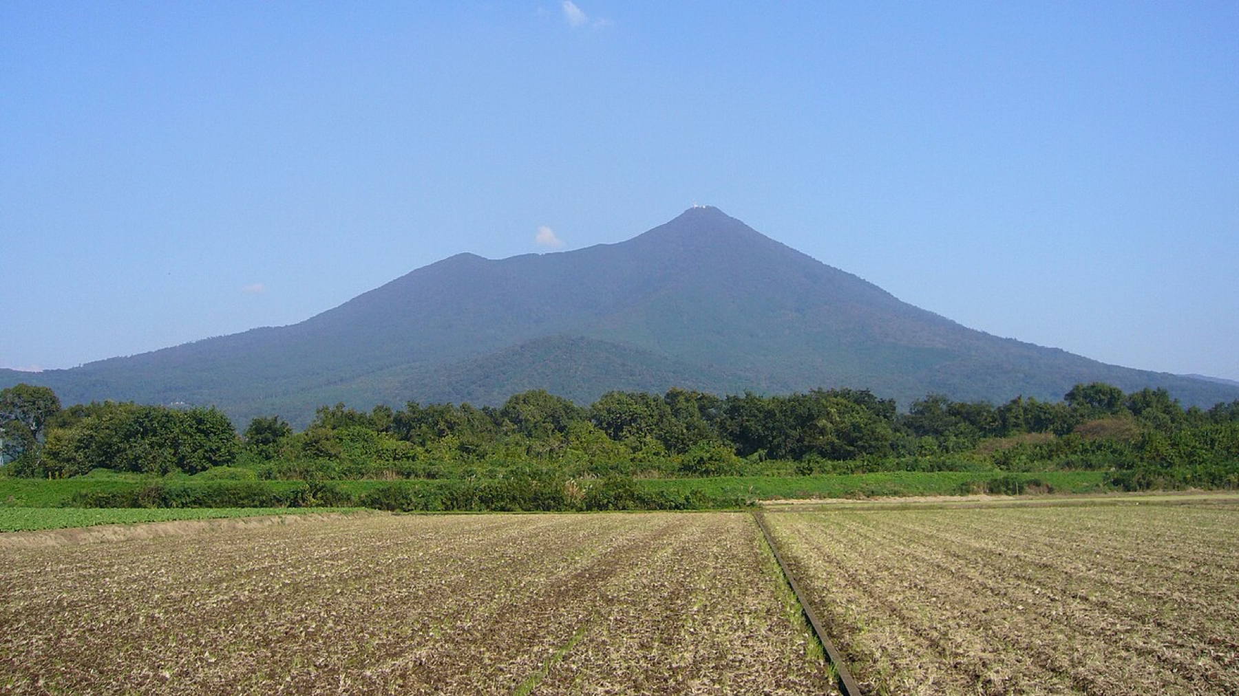
Photo: RESPITE, Wikimedia Commons (Public domain)

22 of Japan's 100 Famous Mountains You Can Day-Hike from Tokyo: Difficulty and Access
The 22 Hyakumeizan (Japan's 100 Famous Mountains) that can be climbed as day trips from Tokyo and the Kanto region, with elevation, difficulty, and how to get there. Includes picks for beginners, longer challenges, cooler summer hikes, and volcano and access notes.
What This List Covers
Of the Nihon Hyakumeizan (Japan's 100 Famous Mountains), 22 can be climbed as a day trip from Tokyo and the Kanto region. They range from Mt. Tsukuba, which you can reach by train and bus and climb with help from a cable car, to serious mountains such as Mt. Tanigawa and Mt. Hiuchi.
- Prefectures: Ibaraki, Tochigi, Gunma, Saitama, Tokyo, Kanagawa, Yamanashi, and part of Niigata
- Elevation: 877 m (Mt. Tsukuba) to 2,599 m (Mt. Kinpu)
- Travel time: roughly 1 to 3 hours one way from Tokyo Station to the trailhead
- Access: some are easy by public transport; others are much easier by car
Difficulty and Access Key
| Difficulty | What it means |
|---|---|
| ★☆☆☆ | Beginner. Small elevation gain; a ropeway or bus can help |
| ★★☆☆ | Beginner to intermediate. Doable as a day hike; fitness matters more than technique |
| ★★★☆ | Intermediate. Needs fitness, proper gear, and map reading. Start early and plan your timing |
| ★★★★ | Advanced. Long days, rocky sections or chains. Needs experience and gear |
Access: 🚃 = train and bus only / 🚗 = car recommended (public transport possible but inconvenient) / 🚃🚗 = either works
The 22 Mountains
| Mountain | Elevation | Difficulty | Access | Nearest station / trailhead |
|---|---|---|---|---|
| Mt. Tsukuba (Ibaraki) | 877 m | ★☆☆☆ | 🚃 | Tsukuba Station (Tsukuba Express), then bus |
| Mt. Nasu (Tochigi/Fukushima) | 1,915 m | ★★☆☆ | 🚃🚗 | JR Nasushiobara Station, then bus |
| Mt. Nantai (Tochigi) | 2,486 m | ★★★☆ | 🚃🚗 | Tobu-Nikko Station, then bus |
| Mt. Nikko-Shirane (Tochigi/Gunma) | 2,578 m | ★★★☆ | 🚃🚗 | Tobu-Nikko Station, then bus, or Marunuma Kogen Ropeway |
| Mt. Sukai (Tochigi/Gunma) | 2,144 m | ★★★★ | 🚗 | Kajikaso (end of a forest road; check road conditions) |
| Mt. Akagi (Gunma) | 1,828 m | ★☆☆☆ | 🚃🚗 | JR Maebashi Station, then bus |
| Mt. Tanigawa (Gunma/Niigata) | 1,977 m | ★★★☆ | 🚃🚗 | JR Doai Station, or Jomo-Kogen Station then bus |
| Mt. Hotaka (Gunma) | 2,158 m | ★★★☆ | 🚗 | Kawaba Ski Resort (lift in summer only) |
| Mt. Kusatsu-Shirane (Gunma) | 2,160 m | ★★☆☆ | 🚗 | From Kusatsu Onsen (Motoshirane side) |
| Mt. Azumaya (Nagano/Gunma) | 2,354 m | ★★☆☆ | 🚗 | Sugadaira Kogen (Torii Pass) |
| Mt. Asama (Nagano/Gunma) | 2,568 m | ★★★☆ | 🚗 | Takamine Kogen Visitor Center (Kurumazaka Pass) |
| Mt. Shibutsu (Gunma) | 2,228 m | ★★★☆ | 🚃🚗 | Oze-Tokura bus stop (Oze shuttle) |
| Mt. Hiuchi (Fukushima) | 2,356 m | ★★★☆ | 🚃🚗 | Aizukogen-Ozeguchi Station, then bus (Oze shuttle) |
| Mt. Ryokami (Saitama) | 1,723 m | ★★★☆ | 🚃🚗 | Seibu-Chichibu Station, then bus |
| Mt. Kumotori (Tokyo/Saitama/Yamanashi) | 2,017 m | ★★★☆ | 🚃🚗 | Okutama Station, then bus to Kamosawa |
| Mt. Tanzawa (Kanagawa) | 1,567 m | ★★★☆ | 🚃 | Shibusawa Station (Odakyu), then bus to Okura |
| Mt. Daibosatsu (Yamanashi) | 2,057 m | ★★☆☆ | 🚃🚗 | JR Kai-Yamato Station, then bus to Kamihikawa Pass |
| Mt. Mizugaki (Yamanashi) | 2,230 m | ★★★☆ | 🚃🚗 | JR Nirasaki Station, then bus to Mizugaki Sanso |
| Mt. Kinpu (Yamanashi/Nagano) | 2,599 m | ★★★☆ | 🚃🚗 | JR Nirasaki Station, then bus to Mizugaki Sanso |
| Mt. Kobushi (Nagano/Saitama/Yamanashi) | 2,475 m | ★★★☆ | 🚃🚗 | JR Shinano-Kawakami Station, then bus to Kekidaira, or Nishizawa Valley |
| Mt. Makihata (Niigata/Gunma) | 1,967 m | ★★★☆ | 🚗 | Shimizu (Sakurazaka parking) |
| Mt. Echigo-Komagatake (Niigata) | 2,003 m | ★★★☆ | 🚗 | Shiori Pass |
Check Before You Go
Mt. Kusatsu-Shirane (Motoshirane)
Kusatsu-Shirane is an active volcano, and entry can be restricted depending on volcanic activity. Always check the Japan Meteorological Agency's volcano information and the restrictions published by Gunma Prefecture and Kusatsu Town before you go. See also Kusatsu-Shirane Yugama reopening 2026.
Mt. Asama
The true summit of Mt. Asama (Kamayama) is next to the crater and has no public trail. Hikers go as far as Maekakeyama (2,524 m), and only when the alert level allows. As of October 23, 2026, the JMA keeps Mt. Asama at Volcanic Alert Level 1, but notes that volcanic earthquakes have increased slightly since late September. Check the JMA's Mt. Asama page right before you go. Details are in our Mt. Asama hiking guide.
Mt. Hiuchi and Mt. Shibutsu (Oze)
Private cars cannot drive all the way into Oze; you switch to a shuttle bus or shared taxi. Access changes by season, so check the Oze Preservation Foundation for the latest. On Mt. Shibutsu, all trails close every spring during the snowmelt season to protect the vegetation, and the east-face trail is uphill only: you may not descend from the summit toward Yamanohana that way.
Best Three for Beginners
1. Mt. Tsukuba (877 m) ★☆☆☆
The lowest of the 100 Famous Mountains. A cable car and a ropeway take you close to the summits, and the walking trails take about 2 to 3 hours. It is one of the few Hyakumeizan you can reach entirely by public transport, via the Tsukuba Express and a shuttle bus. See our Mt. Tsukuba day trip guide.
2. Mt. Akagi (1,828 m) ★☆☆☆
A caldera lake, Onuma, sits near the top, with visitor facilities around it. The round trip to the highest peak, Kurobi-san, from the lakeshore takes 3 to 4 hours, which makes it an easy Hyakumeizan to start with.
3. Mt. Daibosatsu (2,057 m) ★★☆☆
A popular, easy-walking round trip of 3 to 4 hours from the Kamihikawa Pass trailhead, with views of Mt. Fuji along the ridge. A local bus runs from JR Kai-Yamato Station on the Chuo Line. See our Mt. Daibosatsu day hike guide.
Harder Day Trips for Fit Hikers
Mt. Tanigawa (1,977 m) ★★★☆
Known for its many accidents, but the standard Tenjin Ridge route is doable in a day if you are fit. The ropeway gives you a head start in altitude, and the ridge views are among the best in Kanto.
Mt. Kumotori (2,017 m) ★★★☆
The highest peak in Tokyo and the only 2,000 m peak in the metropolis. The Kamosawa route is reachable by bus from Okutama Station, and many people do it as a day hike, but the round trip takes 9 to 10 hours. Start early.
Mt. Hiuchi (2,356 m) ★★★☆
The highest peak in the Tohoku region, looking down on the Ozegahara marsh and Lake Ozenuma. For a day hike, the round trip from the Miike trailhead is the usual choice, but with travel from Kanto it makes for a very long day. Consider staying at a mountain hut.
Cooler Summer Day Hikes


From late July through August, alpine flowers bloom and mountains around 2,000 m are pleasant to walk. For summer day trips from Kanto, look for mountains that are:
- Around 2,000 m, so cooler than the lowlands
- Served by a ropeway, lift, or bus that lets you start high
- Rich in summer scenery: alpine flowers, marshes, crater lakes, or rocky ridges
- Doable in a day if you leave early in the morning
First summer Hyakumeizan: Mt. Nasu, Kirigamine, Mt. Akagi. On Mt. Nasu, a ropeway takes you to 1,684 m, and the round trip to Chausudake is easy to plan. There is little shelter from the wind, so do not push on when it is strong (see our Nasudake guide). Kirigamine (Kurumayama) in Nagano, not in the 22 above, has wide-open highland views, and a lift lets you shorten the walk. Mt. Akagi is a little lower, so in midsummer walk it in the cool of the morning.
Cool air and big views: Mt. Nikko-Shirane, Mt. Shibutsu, Mt. Tanigawa. Nikko-Shirane is the highest peak in Kanto; the Marunuma Kogen Ropeway lets you start at about 2,000 m, with the Goshikinuma pond and volcanic scenery. Mt. Shibutsu offers views over the Ozegahara marsh and alpine flowers. Cars cannot drive to the Hatomachi Pass trailhead, so take the shared bus or taxi from Oze-Tokura, and follow the seasonal closure and the uphill-only rule above. Mt. Tanigawa via the ropeway and Tenjin Ridge is the classic day hike, but it has rocky sections, steep climbs, and fast-changing weather, so it suits groups with an experienced hiker rather than beginners alone.
For a solid workout: Mt. Nantai, Mt. Hotaka. Mt. Nantai is a steep climb from Futarasan Shrine Chugushi on Lake Chuzenji. You go up and down the same trail, so the route is easy to follow, but the elevation gain is large. Mt. Hotaka in Gunma mixes forest and ridge walking. Lift operations depend on the route and season, so check them on the day.
Long-day challenges: Mt. Hiuchi, Mt. Kumotori. Even in summer, Mt. Hiuchi as a day hike is a very long day; switch to a hut stay if you are short on time or energy. On Mt. Kumotori, the low first half gets hot in midsummer. Start around sunrise, carry plenty of water, and know that the day trip is for strong hikers; most people are more comfortable staying at a hut.
Four Rules for Summer Day Hikes
- Start early to avoid afternoon thunderstorms. Thunderclouds tend to build in the afternoon, and above the treeline there is nowhere to hide. Aim to reach the summit in the morning and be off the mountain by about 1 to 2 p.m., working backward from the course time. If you hear thunder, give up the summit and leave the ridge at once. The Oze Preservation Foundation also asks hikers to start by 9 a.m. in summer, because fog and lightning are common in the afternoon.
- Carry plenty of water and salt. How much you need depends on the temperature, your size, and how hard you work. On routes without water sources, carry extra, and replace salt on sweaty days. Do not count on vending machines or huts being open.
- Never skip warm layers and rain gear. Even on a hot day in the city, summits turn cold fast in wind and rain. Bring a two-piece rain jacket and pants, a light fleece or insulating layer, and gloves.
- Check timetables and last departures the day before. Ropeways and mountain buses can stop or run late due to wind, lightning, or crowds. Check not only the way up but the last departure after your hike and a backup plan, and check operators' and local governments' latest notices right before you leave.
Summary
- 22 of the 100 Famous Mountains can be day-hiked from Kanto
- For beginners: Mt. Tsukuba, Mt. Akagi, Mt. Daibosatsu
- For intermediate hikers: Mt. Tanigawa, Mt. Nasu, Mt. Nantai
- For experienced hikers: Mt. Kumotori, Mt. Hiuchi, Mt. Ryokami, Mt. Sukai
- In summer, start with Mt. Nasu, Kirigamine, Mt. Akagi, then try Mt. Nikko-Shirane, Mt. Shibutsu, Mt. Tanigawa for cool air and views
- Always check volcano and entry restrictions before you go
Start with the easier mountains and pick ones that suit the season. When the weather, your fitness, or transport do not line up, switching to a hut stay or a different mountain is the safe way to enjoy them.
Related guides
- Japan hiking rules: the basics
- Bear safety while hiking in Japan
- Mt. Takao day trip from Tokyo
- Mt. Oyama day trip from Tokyo
A Japanese version of this list with a filterable table: 関東から日帰りできる百名山まとめ.