

Photo: RESPITE, Wikimedia Commons (public domain). The twin-peaked silhouette of Mount Tsukuba seen from the west-southwest, October 10, 2006.

Mount Tsukuba Day Trip from Tokyo: Nantaisan or Nyotaisan, Ropeway, Shuttle Bus, and the 2026 Cable Car Suspension
A practical English guide to Mount Tsukuba (筑波山, 877 m) in Ibaraki, written around the twin-peak choice between Nantaisan and Nyotaisan. Covers the Tsukuba Express from Akihabara, the Tsukubasan shuttle bus to the shrine or Tsutsujigaoka, ropeway fares and hours, the summit connector, official hiking courses, and the cable car suspension in effect since September 25, 2026.
This guide is based on official pages from the operator Tsukuba Kanko Railway (mt-tsukuba.com) — including its access page, ropeway fares and timetable, cable car fares and timetable, hiking course pages, and its notice on operations from September 25 — plus JNTO’s Mt. Tsukuba hiking page, JNTO’s cable car & ropeway page, the Ibaraki Guide feature on Mt. Tsukuba, and the Tsukuba Tourism and Convention Association shuttle bus page (all information as of October 2026). Fares, timetables, and especially the cable car status can change. Confirm the linked pages on the morning you travel.
Mount Tsukuba (筑波山, Tsukubasan) is the mountain Japanese people pair with Fuji in the old saying “Fuji in the west, Tsukuba in the east.” JNTO describes it as a twin-peaked mountain in central Ibaraki made up of Mt. Nantai (男体山) and Mt. Nyotai (女体山), rising to 877 m, and notes that it is climbable year-round and makes a great day trip from Tokyo. The Ibaraki Guide adds that it is one of Japan’s One Hundred Famous Mountains, selected despite its modest height because of its shape on the Kanto Plain, its role as the sacred body of Tsukubasan Shrine, and its long history.
Unlike most day-trip mountains, the first thing to decide at Tsukuba is not which trail but which peak you want to reach first — because each peak has its own lift, its own bus stop, and its own walking routes. This guide starts there.
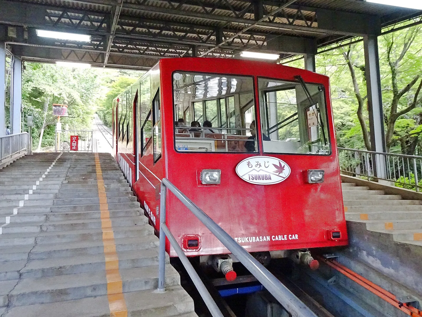
Important for autumn 2026: The operator posted on September 24, 2026 that the Mt. Tsukuba Cable Car (筑波山ケーブルカー) is suspended for the time being for safety checks from Friday, September 25, and that it will announce when service resumes. The Mt. Tsukuba Ropeway (筑波山ロープウェイ) runs as normal. On October 12, 2026 the operator’s top page still showed the cable car as suspended (運転休止中). See mt-tsukuba.com notices.
First decision: Nantaisan side or Nyotaisan side?
| Nantaisan side (男体山) | Nyotaisan side (女体山) | |
|---|---|---|
| Peak height | 871 m (operator) | 877 m, the highest point (operator) |
| Bus stop | Tsukubasan-jinja Iriguchi (筑波山神社入口) | Tsutsujigaoka (つつじヶ丘) |
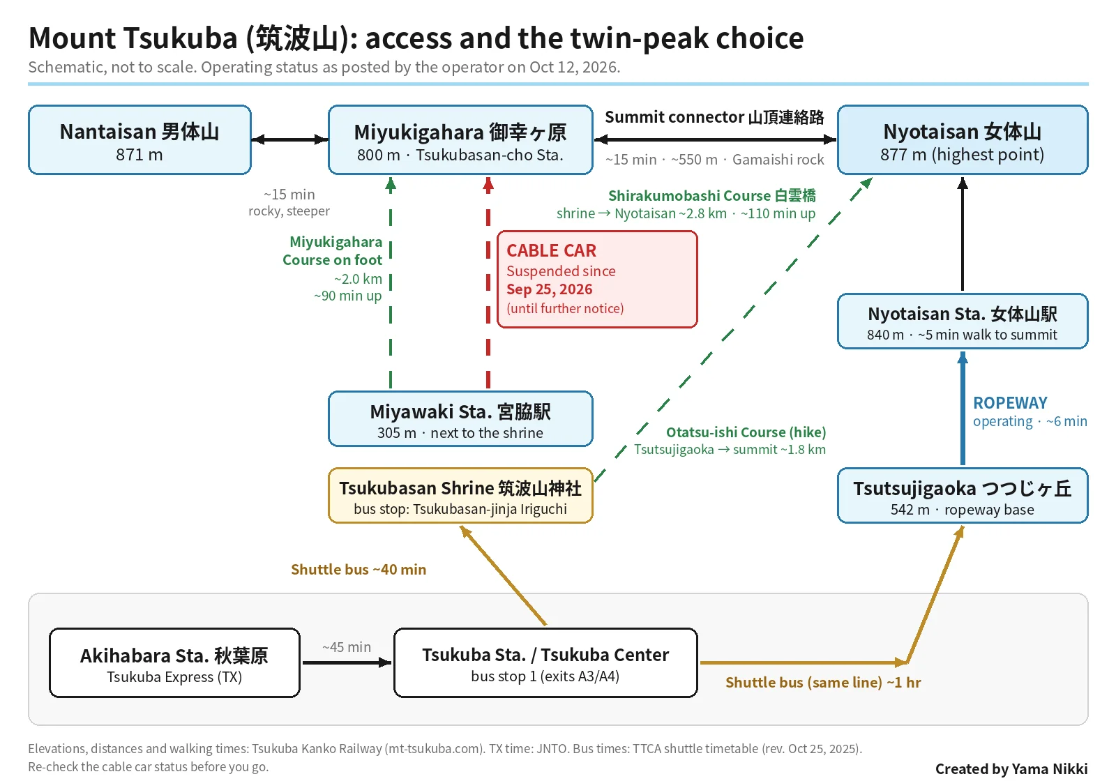
| Lift | Cable car: Miyawaki Sta. (宮脇駅, 305 m) → Tsukubasan-cho Sta. (筑波山頂駅, 800 m) at Miyukigahara, about 8 minutes — suspended since Sep 25, 2026 | Ropeway: Tsutsujigaoka Sta. (542 m) → Nyotaisan Sta. (女体山駅, 840 m), about 6 minutes — operating |
| From the top station | About 15 minutes up a rocky, fairly steep path to Nantaisan summit | About 5 minutes to Nyotaisan summit |
| Main hiking route | Miyukigahara Course: shrine → Miyukigahara, about 2.0 km | Shirakumobashi Course from the shrine (about 2.8 km), or Otatsu-ishi Course from Tsutsujigaoka (about 1.8 km) |
| Highlights | Tsukubasan Shrine at the base, the old cedar forest, Nature Research Trail around the peak | 360° view from the summit rocks, the rock formations along the Shirakumobashi Course |
All figures in this table come from the operator’s cable car, ropeway, and hiking pages.
The two peaks are joined by the summit connector (山頂連絡路) through Miyukigahara (御幸ヶ原), a saddle at about 800 m with shops and restaurants. The operator lists each half — Miyukigahara to Nantaisan, and Miyukigahara to Nyotaisan — as about 15 minutes. So whichever side you arrive on, you can visit both summits in one outing.
What the suspension means in practice: until the cable car resumes, the only lift onto the mountain is the ropeway from Tsutsujigaoka. If you want a lift-assisted visit, ride the shuttle bus all the way to Tsutsujigaoka rather than getting off at the shrine. If you start at the shrine, you will be walking up (and you can still ride the ropeway down on the far side).
Quick answers
| Question | Short answer (verify on official pages) |
|---|---|
| How high is it? | 877 m at Nyotaisan; Nantaisan is 871 m (operator, Ibaraki Guide) |
| How do I get there by train? | Tsukuba Express (TX) from Akihabara to Tsukuba Station (about 45 minutes, JNTO), then the Tsukubasan shuttle bus from Tsukuba Center bus stop 1 |
| Is the cable car running? | No — suspended since Sep 25, 2026 until further notice (operator notice) |
| Ropeway hours (Mar–Nov) | First car 9:20, last car 17:00, every 20 minutes; Dec–Feb 9:20–16:40 (ropeway timetable) |
| Adult ropeway fare (revised Oct 1, 2026) | 930 yen one way / 1,860 yen return; child 400 / 800 yen (ropeway fares) |
| Shuttle bus fare from Tsukuba Center | Adult 770 yen to Tsukubasan-jinja Iriguchi, 930 yen to Tsutsujigaoka (one way, TTCA) |
| Full hike? | JNTO’s circular route from Tsukubasan Shrine: about 4.5 hours, 6.9 km, 663 m of elevation gain |
| Who is it for? | First-time hikers in Japan, families, shrine visitors, and anyone wanting a big Kanto Plain view without an overnight trip |
Getting there: Tsukuba Express + shuttle bus
1. Akihabara → Tsukuba Station (TX)
JNTO’s cable car & ropeway page gives the standard route: take the Tsukuba Express from Akihabara Station (about 45 minutes) to Tsukuba Station, then the shuttle bus. TX also stops at stations such as Kita-Senju and Asakusa on the way out of Tokyo; check the Tsukuba Express site for times and fares.
JNTO’s hiking page also mentions an alternative: an express bus from Tokyo Station to Tsukuba Center Bus Terminal in about 90 minutes.
2. Tsukuba Center → the mountain (Tsukubasan shuttle bus)
The operator’s access page says the direct Tsukubasan shuttle bus (直行筑波山シャトルバス) runs every day from bus stop 1 at Tsukuba Center, the bus terminal outside TX Tsukuba Station exits A3 or A4. Look for the sign for buses bound for Tsukubasan-jinja Iriguchi / Tsutsujigaoka (筑波山神社入口・つつじヶ丘行).
The same line serves both sides of the mountain in sequence: Tsukuba Center → Numata (沼田) → Tsukubasan-jinja Iriguchi → Tsutsujigaoka, and back in the reverse order. In the current timetable PDF posted by the Tsukuba Tourism and Convention Association (revised October 25, 2025), buses are scheduled to take roughly 38 minutes to the shrine stop and about 1 hour to Tsutsujigaoka. JNTO and the Ibaraki Guide give similar shrine-stop estimates (about 40 and 36 minutes). Traffic on autumn weekends can make it longer.
A few practical points from the TTCA page and timetable:
- Pay when you get off, into the fare box. One-way adult fares from Tsukuba Center are 770 yen to Numata or Tsukubasan-jinja Iriguchi and 930 yen to Tsutsujigaoka. Between the shrine stop and Tsutsujigaoka it is 360 yen.
- There are separate weekday and weekend/holiday timetables, and the weekday one has an extra-frequent version for April, May, October, and November. Weekends and holidays have more buses.
- In the October 2025 timetable, the last listed departures down the mountain are around 17:00 from Tsutsujigaoka on weekdays and 17:15 on weekends and holidays (about 15 minutes later from the shrine stop). Some early and late buses do not run in winter. Check the PDF and plan to be at the stop well before the last bus.
- If a bus is full, you may be asked to wait for the next one.
Because one bus line links both stops, one-way traverses work well: for example, ride up to Tsutsujigaoka, cross the summits, walk down to the shrine, and catch the bus back from Tsukubasan-jinja Iriguchi.
Discount tickets
The operator and TTCA list combined tickets: the Tsukubasan Kippu (筑波山きっぷ), which bundles the TX, the bus, and the cable car and ropeway; the Tsukubasan Aru-Kippu (筑波山あるキップ) for TX + bus; and a Tokyo Station express-bus package sold by JR Bus Kanto. Details are on the TX discount ticket page. While the cable car is suspended, check whether a ticket that includes it still makes sense for your plan before you buy.
By car
The operator’s access page asks drivers to search for “筑波山神社” for the cable car side or “筑波山京成ホテル” for the ropeway side, and warns that some navigation systems send drivers coming from the north (Yasato / Ishioka) onto the very narrow Prefectural Road 42. Most parking is paid; the operator lists the city lot on the cable car side at 500 yen per day for ordinary cars and the prefectural Tsutsujigaoka lot on the ropeway side at 700 yen per entry. Lots fill on autumn weekends.
Tsukubasan Shrine (筑波山神社)
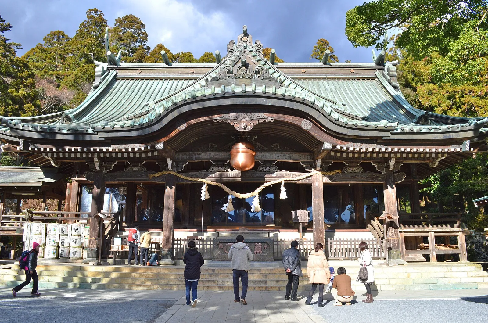

Even if you ride the ropeway, the shrine at the foot of the Nantaisan side is worth the detour. According to the Ibaraki Guide:
- The two peaks embody the deity couple Izanagi (Nantaisan) and Izanami (Nyotaisan), and Tsukubasan Shrine enshrines both. The whole mountain is treated as the shrine’s sacred body, and there are small main shrines (honden) on each summit.
- Most structures in the precincts date from 1633, donated by the shogun Tokugawa Iemitsu. The Zuishinmon gate reflects the blending of Shinto and Buddhist architecture.
- It is customary to pay your respects at the shrine before heading up the mountain.
From the Tsukubasan-jinja Iriguchi bus stop, walk uphill to the main hall. Miyawaki Station of the cable car is right beside the shrine — the operator explains the name as “beside the shrine” (お宮の脇). The Miyukigahara Course trailhead is the torii on the way from the shrine to Miyawaki Station.
The ropeway and Nyotaisan (女体山)
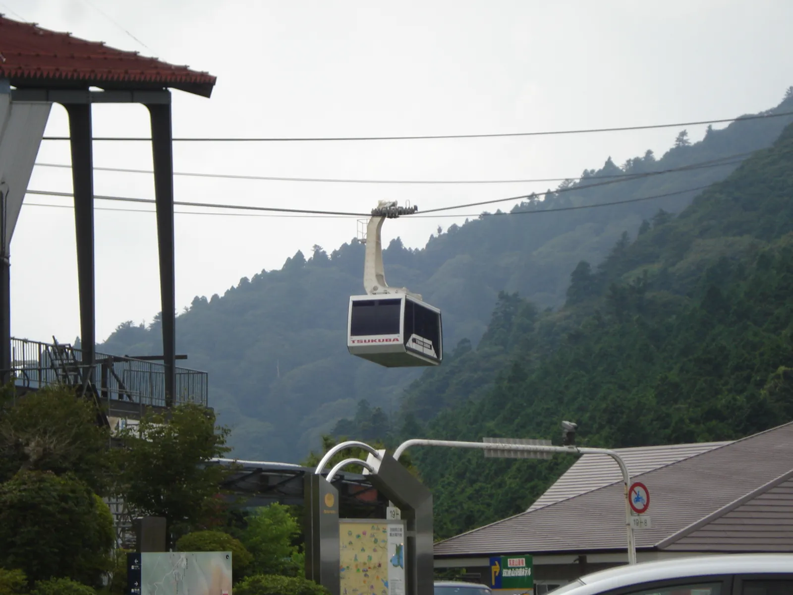

The ropeway page gives the basics: Tsutsujigaoka Station (542 m) to Nyotaisan Station (840 m), 1,296 m long, about 6 minutes, with two cars shuttling up and down. Cars leave both stations at the same time, every 20 minutes, with extra runs when it is busy. The operator says the ropeway is barrier-free, so wheelchair users can board as they are.
From Nyotaisan Station it is about 5 minutes to the summit rocks at 877 m, the highest point of Mount Tsukuba, with a 360° view. On clear days the operator mentions views across Lake Kasumigaura, central Tokyo, Tokyo Skytree, and Mt. Fuji. The summit is rocky and exposed; hold small children’s hands and watch your footing.
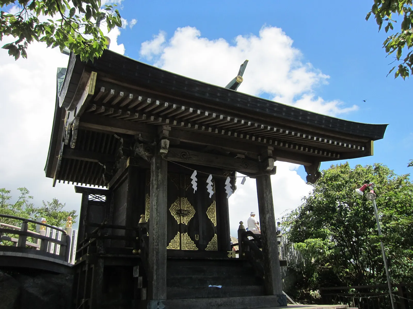

Across the top: the summit connector, Miyukigahara, and Nantaisan
The operator’s summit connector page describes the route Nantaisan summit – Miyukigahara – Nyotaisan summit:
- Miyukigahara ↔ Nyotaisan: about 550 m, about 15 minutes. Rocky in places but relatively gentle. You pass Gamaishi (ガマ石), a toad-shaped rock; local lore says tossing a pebble into its “mouth” brings money luck.
- Miyukigahara ↔ Nantaisan: about 300 m, about 15 minutes, but steeper and rockier.
- About one minute from Miyukigahara is the source of the Minanogawa (男女川), the stream in a well-known poem from the Hyakunin Isshu anthology, next to the large cedar Shiho-sugi (紫峰杉).
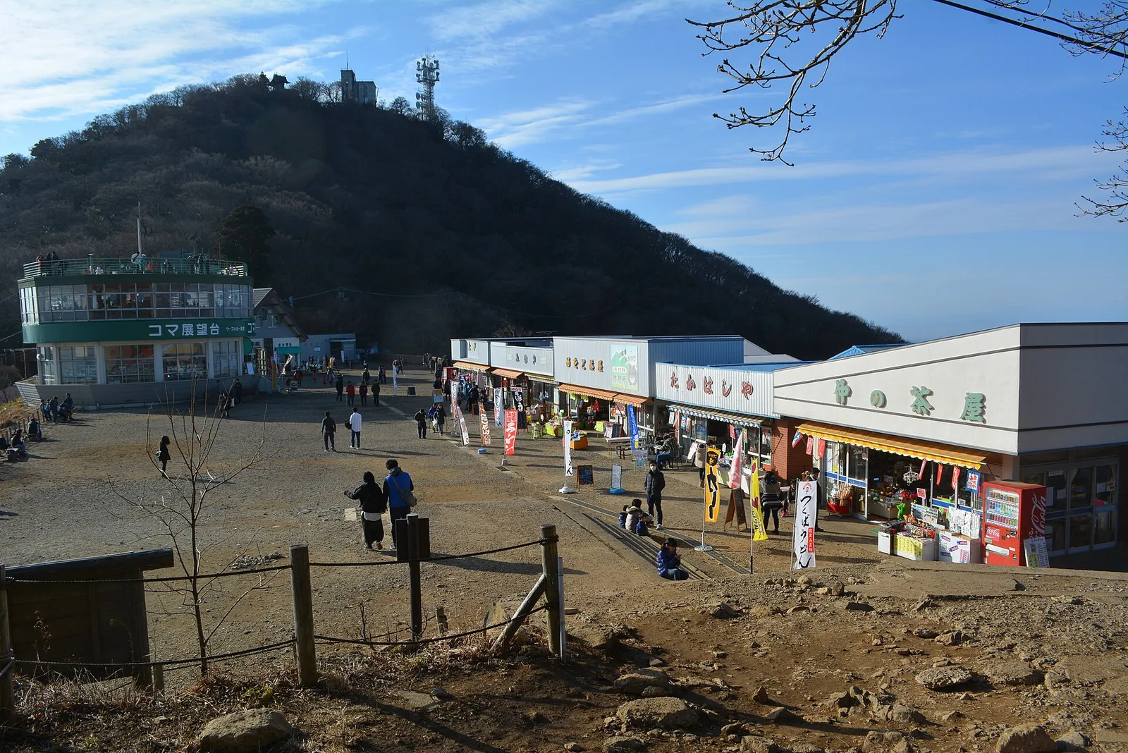

Miyukigahara is the social hub of the summit area: shops, restaurants, and the cable car’s top station. The Ibaraki Guide mentions the free Koma Observatory (コマ展望台) near the station, with a shop, a restaurant, and a rooftop viewing deck.
If you have extra time, the Nature Research Trail (自然研究路) loops around Nantaisan at about 750–800 m: about 1.5 km, about 60 minutes, through beech forest protected as a special zone of the quasi-national park (operator page). Note the operator’s warning: at the far end the path branches toward the Yakuo-in Course to Makabe, which does not return to Miyukigahara.
Hiking up instead: the official courses
The operator lists the main walking routes as follows. Times are the operator’s estimates for an average hiker.
| Course | Start → finish | Distance | Elevation difference | Time (up / down) |
|---|---|---|---|---|
| Miyukigahara Course (御幸ヶ原コース) | Tsukubasan Shrine → Miyukigahara | about 2.0 km | about 610 m | 90 / 70 min |
| Shirakumobashi Course (白雲橋コース) | Tsukubasan Shrine → Nyotaisan summit | about 2.8 km | about 610 m | 110 / 95 min |
| Otatsu-ishi Course (おたつ石コース) | Tsutsujigaoka → Nyotaisan summit (via Benkei Chaya site) | about 1.8 km | see operator page | 80 / 70 min |
| Summit connector (山頂連絡路) | Nantaisan – Miyukigahara – Nyotaisan | about 300 m + 550 m | about 71 m / 77 m | about 15 min each way |
- The Miyukigahara Course climbs roughly alongside the cable car through forest of tall cedars, finishing on long log steps. The operator calls it relatively steep.
- The Shirakumobashi Course has the most famous rock formations near the top — Benkei Nanamodori (弁慶七戻り), Takamagahara (高天原), and Haha no Tainai-kuguri (母の胎内くぐり) — on steep, rocky ground.
- The Otatsu-ishi Course is the shortest way up from the ropeway base. It joins the Shirakumobashi Course at the Benkei Chaya site (弁慶茶屋跡).
JNTO’s reference route, the circular route from Tsukubasan Shrine, is listed at about 4.5 hours, 6.9 km, and 663 m of elevation gain, with a high point of 877 m.
Three ways to plan the day while the cable car is suspended
These are ways to combine the routes above, not official itineraries. Always leave a margin before the last ropeway and the last bus.
- Easiest: ropeway up and down. Bus to Tsutsujigaoka → ropeway to Nyotaisan Station → Nyotaisan summit → (optional) summit connector to Miyukigahara and Nantaisan and back → ropeway down → bus from Tsutsujigaoka. Minimal climbing, both summits possible.
- Half lift, half hike: ropeway up, walk down to the shrine. Bus to Tsutsujigaoka → ropeway up → Nyotaisan → summit connector → Miyukigahara (and Nantaisan) → walk down the Miyukigahara Course (about 70 minutes, operator estimate) → Tsukubasan Shrine → bus from Tsukubasan-jinja Iriguchi. This gives you the summits, the shrine, and the cedar forest, but the descent is long and stepped.
- Hike up, ride down. Bus to Tsukubasan-jinja Iriguchi → shrine → Shirakumobashi Course to Nyotaisan (about 110 minutes) → summit connector if you like → ropeway down to Tsutsujigaoka → bus. You climb about 610 m, and the ropeway saves your knees on the way down.
Before the suspension, many visitors simply rode the cable car to Miyukigahara. Once the operator announces a restart, that becomes the easiest option for the Nantaisan side again. The operator separately announced that a new cable car vehicle is planned for February 2027.

Autumn notes (October–December)
- Foliage: The Ibaraki Guide says November is one of the most popular times to visit, with maples around Miyawaki Station, ginkgo at the shrine, and colorful foliage around Miyukigahara and the Nature Research Trail. It puts the usual peak around the third week of November. That varies by year, so treat it as a guide.
- Night operations: The operator holds night operations in autumn and winter, when the last car runs at 20:00. Events can be cancelled or end early in bad weather, and dates change each year. Check the operator’s site for 2026 dates and whether they include the cable car this year.
- Short days: The operator’s gear list recommends carrying a headlamp in autumn and winter because it gets dark early. Remember that the last buses down leave around 17:00–17:15 (October 2025 timetable).
- Fare change: The operator revised its ropeway and cable car fares from October 1, 2026 and ended its cable car & ropeway round-trip discount coupons on September 30. Older blog posts may show outdated prices.
Practical notes
- Footwear and gear: The operator says many people climb in sneakers, but recommends hiking shoes (high-cut for hiking), rain gear, gloves for rocky sections, and about 2 liters of water for a day hike. There are shops at the summit. The Ibaraki Guide also recommends trekking shoes over sneakers because trails get slippery after rain.
- Stay on the trail: Mount Tsukuba is shrine land within a quasi-national park and part of the Mt. Tsukuba Area Geopark. Going off marked trails and collecting plants, animals, insects, or rocks is prohibited. Carry out your trash (operator; Ibaraki Guide).
- Climbing notification: The operator asks hikers in Ibaraki to submit a climbing notification (登山届) through the Ibaraki Prefectural Police website.
- Weather and lifts: Lifts may stop temporarily in strong wind, heavy snow, or lightning, and close for about a week of inspection in winter (operator FAQ).
- Pets: Pets can ride in a carrier for an extra fare (operator fare pages).
For general trail etiquette and wildlife awareness in Japan:
How Tsukuba compares with other Tokyo day trips
- Mt. Takao day trip from Tokyo — the closest and busiest, reached directly by train from Shinjuku.
- Mt. Mitake day trip from Tokyo — a cable car, a shrine village, and a mossy stream walk in western Tokyo.
- Mt. Daibosatsu day hike from Tokyo — a longer approach and a higher ridge, better for experienced hikers.
Tsukuba stands out as the only one of these with two separate summits and two lifts, and the only one reached by the Tsukuba Express from Akihabara, heading northeast out of Tokyo. Wherever you stay, plan for a shuttle bus ride of 40 minutes to an hour on top of the train.
A Japanese-language Tsukuba guide on this site (useful for kanji place names and course details): GWの筑波山登山ガイド.
References
- Tsukuba Kanko Railway — Mt. Tsukuba Cable Car & Ropeway (top page)
- Tsukuba Kanko Railway — Notices (cable car suspension from Sep 25, 2026; fare revisions from Oct 1, 2026; new cable car vehicle, Feb 2027)
- Tsukuba Kanko Railway — Access (shuttle bus stop, parking, Tsukubasan Kippu)
- Tsukuba Kanko Railway — Ropeway fares / Ropeway timetable / About the ropeway
- Tsukuba Kanko Railway — Cable car fares / Cable car timetable / About the cable car
- Tsukuba Kanko Railway — Hiking courses (Miyukigahara, Shirakumobashi, Otatsu-ishi, Nature Research Trail, Summit connector)
- JNTO — Mt. Tsukuba (hiking course)
- JNTO — Mt. Tsukuba Cablecar and Ropeway
- Ibaraki Guide — Hiking Near Tokyo! Mt. Tsukuba
- Tsukuba Tourism and Convention Association — Tsukubasan shuttle bus (fares, tickets) / Timetable PDF (rev. Oct 25, 2025)
- Tsukuba Express — discount tickets