

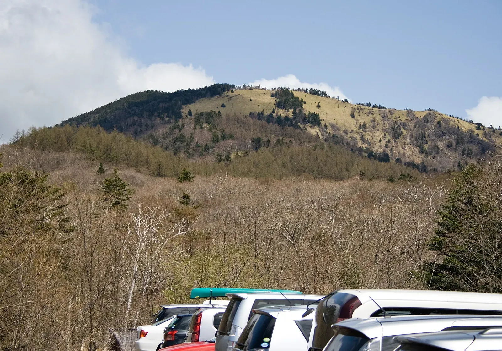
Photo: Ans, Wikimedia Commons (CC BY-SA 3.0). The Daibosatsu range.

Mt. Daibosatsu Day Hike from Tokyo: Bus from Kai-Yamato, Parking, the Kamihikawa Pass Loop, and 2026 Winter Closures
How to hike Mt. Daibosatsu (Daibosatsurei, 2,057 m) in Yamanashi as a day trip from Tokyo. Covers the 2026 weekend bus from Kai-Yamato Station with times and fare, parking at Kamihikawa Pass and the 300-space Lot 4, the classic loop past Kaminari-iwa and Daibosatsu Pass, mountain huts, winter road closures, and climbing plans, based on Koshu City, the bus operator and the huts.
This guide is based on Koshu City, the bus operator Eiwa Kotsu and the mountain huts' own pages (information as of October 2026). Bus days, road closures and prices change, so check the official pages before you go.
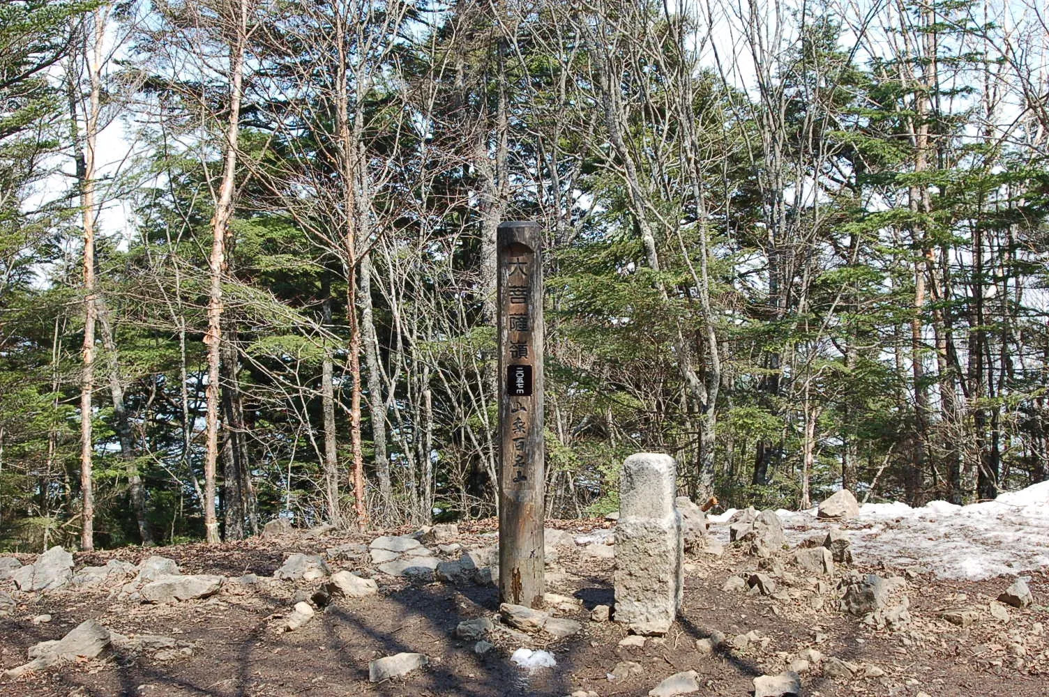
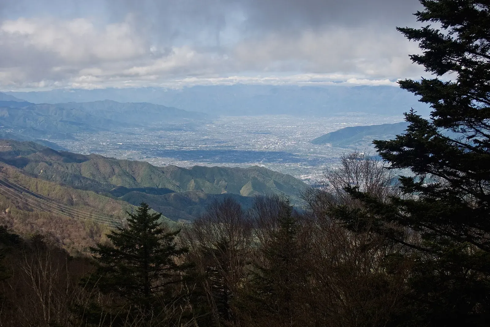
Mt. Daibosatsu (大菩薩嶺, Daibosatsu-rei, 2,057 m) in Yamanashi Prefecture is one of Japan's "100 Famous Mountains" and a classic day trip from Tokyo. Koshu City describes the ridge as gentle, with wide views, popular with beginners, and with routes for everyone from families to experienced hikers. The summit itself is in the trees, but the ridge gives views of Mt. Fuji, the Southern Alps and the Kofu Basin.
The easiest way to start is from Kamihikawa Pass (上日川峠, Kamihikawa-toge, about 1,600 m), which you can reach by bus or car. Koshu City gives about 4 hours 30 minutes of walking from the pass, and about 8 hours from the trailhead on Route 411 that starts lower down.
The classic loop
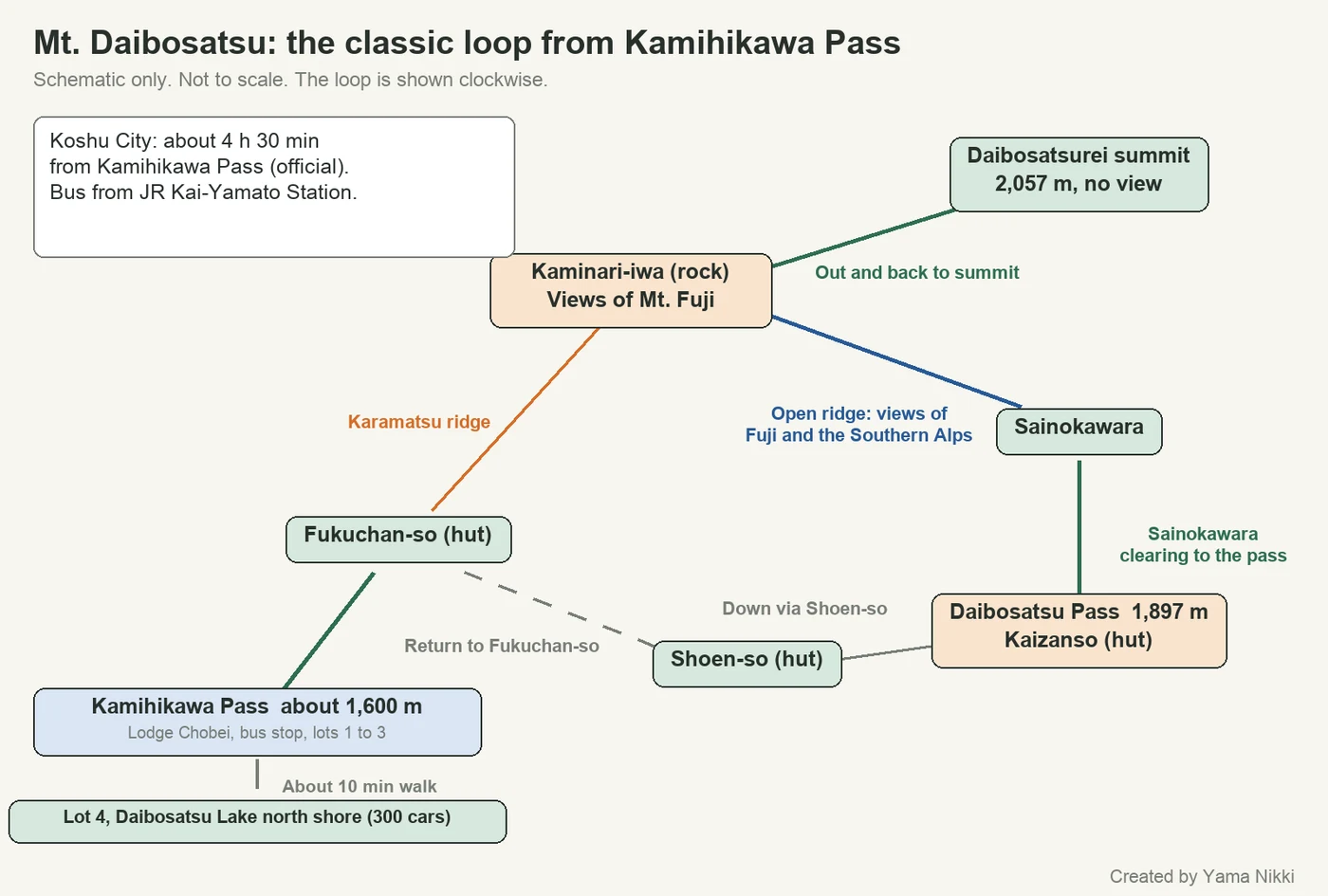
The standard route is a loop from Kamihikawa Pass: Fukuchan-so hut, up the Karamatsu ridge to Kaminari-iwa (the viewpoint rock), out and back to the summit, then along the ridge via Sainokawara to Daibosatsu Pass (大菩薩峠, about 1,897 m), and back via Shoen-so and Fukuchan-so to the pass. The height difference between the pass and the summit is about 450 m (1,600 m to 2,057 m).

I could not find an official time for each section of the loop. Use Koshu City's total of about 4 hours 30 minutes from Kamihikawa Pass as the planning figure, and add time for breaks.


Getting there without a car
From Tokyo, take the JR Chuo Line to Kai-Yamato Station (甲斐大和駅). I did not confirm the train time from Tokyo on an official page, so check it with a route planner. From the station, the Eiwa Kotsu Daibosatsu Kamihikawa-toge line runs to Kamihikawa Pass in about 40 minutes.
2026 bus calendar
- Season: April 18 to December 13, 2026, on Saturdays, Sundays and holidays (third Saturday of April to second Sunday of December), plus some weekdays shown on the timetable's calendar.
- Fare (one way): 1,020 yen for an adult and 510 yen for a child from Kai-Yamato Station to Kamihikawa Pass, according to the fare table on Eiwa Kotsu's site (tax included). The table itself is still dated October 1, 2019, and Eiwa Kotsu's 2026 service announcement points to the same site for fares. The table lists no round-trip ticket, so confirm the current fare with the operator.
- Groups of 15 or more: contact Eiwa Kotsu in advance.
Timetable (2026 PDF, read from the published image)
| Kai-Yamato Station to Kamihikawa Pass | Kamihikawa Pass to Kai-Yamato Station | |
|---|---|---|
| Saturdays, Sundays, holidays | Departs 8:10, 9:20, 9:50, 13:50, 14:50. Arrives 8:51, 10:01, 10:31, 14:31, 15:31 | Departs 9:00, 13:00, 14:00, 15:00, 15:45. Last arrival at Kai-Yamato 16:30 |
| Listed weekdays | Departs 8:10, 9:50, 14:50 | Departs 9:00, 14:00, 15:45 |
The last bus down leaves the pass at 15:45. Decide where you will turn back before you start. The timetable is a scanned image and may be updated, so check the Eiwa Kotsu bus page (Japanese) for the current PDF. By taxi, Koshu City says it is about 30 minutes from JR Enzan Station (about 5,500 yen).
Driving and parking
Koshu City says it takes about 40 minutes from Katsunuma IC to Kamihikawa Pass (via Prefectural Route 201 or 218).
- Kamihikawa Pass lots (Nos. 1 to 3): limited spaces and very busy on weekends and holidays. Lodge Chobei also notes there is no free parking beyond the pass toward Daibosatsu Pass.
- Lot 4 (Daibosatsu Lake north shore): 300 cars. About 10 minutes on foot to Kamihikawa Pass by trail and promenade. Koshu City urges hikers to use this lot, and notes it is also a Mt. Fuji viewpoint.
Winter road closures
Koshu City says the roads to the pass close in winter:
- From Enzan side (Route 201, Sakeishi to the pass): mid-December to mid-April.
- From Yamato side (Route 218, Ichinotaira forest road junction to the pass): early January to mid-April.
Roads can also close after heavy rain or typhoons. The contact for the closures is the Kyoto (eastern Yamanashi) Construction Office, +81-553-20-2734 (Japanese).
Mountain huts
Huts are along the loop and at the pass. Prices and opening days can change, so contact them before you go.
| Hut | Location | Official notes |
|---|---|---|
| Lodge Chobei (ロッヂ長兵衛) | Kamihikawa Pass, 1,600 m | Open year-round (by reservation only from December to mid-April). Capacity 23. Private rooms. Cash only. Public toilets at the pass |
| Kaizanso (介山荘) | Daibosatsu Pass, 1,897 m | Open year-round, with irregular weekday closures. Per Koshu City's listing: 8,500 yen with two meals, 6,000 yen without meals (page last updated in 2022) |
Bring cash, in small bills and coins, for drinks and meals at the huts. Lodge Chobei says it takes payment in cash only.
Climbing plan
Lodge Chobei recommends filing your climbing plan on the Compass site, where this area is submitted online to the Yamanashi Prefectural Police. For Compass, it recommends submitting by the day before you go. See Japan hiking basics.
Planning notes
- Where to get views: Koshu City says the summit itself has few views, while the ridge gives the wide views of Mt. Fuji, the Southern Alps and the Kofu Basin. Plan your photo stops along the ridge.
- Last bus: the last bus down leaves the pass at 15:45, so start early and decide your turn-back point in advance.
- Weather and bears: I did not find a dedicated official warning for this route. At about 2,000 m, check the forecast and read our bear safety guide before you go.
FAQ
Can I do this as a day trip from Tokyo by public transport? On weekends and holidays, yes, using the Chuo Line to Kai-Yamato and the 8:10 or 9:20 bus. The last bus down leaves the pass at 15:45.
Is a car easier? Parking at the pass is limited, so Koshu City recommends Lot 4 (300 cars) and a 10-minute walk.
Is the summit worth it for the view? The summit has little view. The views are from the ridge.
References
- Koshu City tourism: Mt. Daibosatsurei (Japanese)
- Koshu City tourism: Daibosatsu trekking courses (Japanese)
- Koshu City tourism: Parking for Daibosatsu hikers (Lot 4) (Japanese)
- Koshu City: Winter closure of prefectural roads to Daibosatsu (Japanese)
- Eiwa Kotsu: Bus timetable and fare table, Daibosatsu Kamihikawa-toge line (Japanese)
- Lodge Chobei (official site) (Japanese)
- Koshu City tourism: Kaizanso (Japanese)
Pages marked Japanese are the official sources. Last checked October 10, 2026.
Related articles
- Mt. Takao Day Trip from Tokyo: Getting There from Shinjuku, Cable Car Prices, Trails, and the 2026 Autumn Rules
- Japan Hiking Basics for Visitors: Climbing Plans, Emergency Numbers, Rescue Costs, Toilets and Trash
- Bear Safety for Hikers in Japan: Season, Where to Check Sightings, Bells, Spray, and What to Do If You Meet One
- Mt. Nasu (Chausudake) Hiking Guide: With or Without the Ropeway, Asahidake, and Autumn Traffic in 2026
- Mt. Fuji Mountain Huts: How to Book, What They Cost, and the 2026 Rules to Plan Your 2027 Climb