
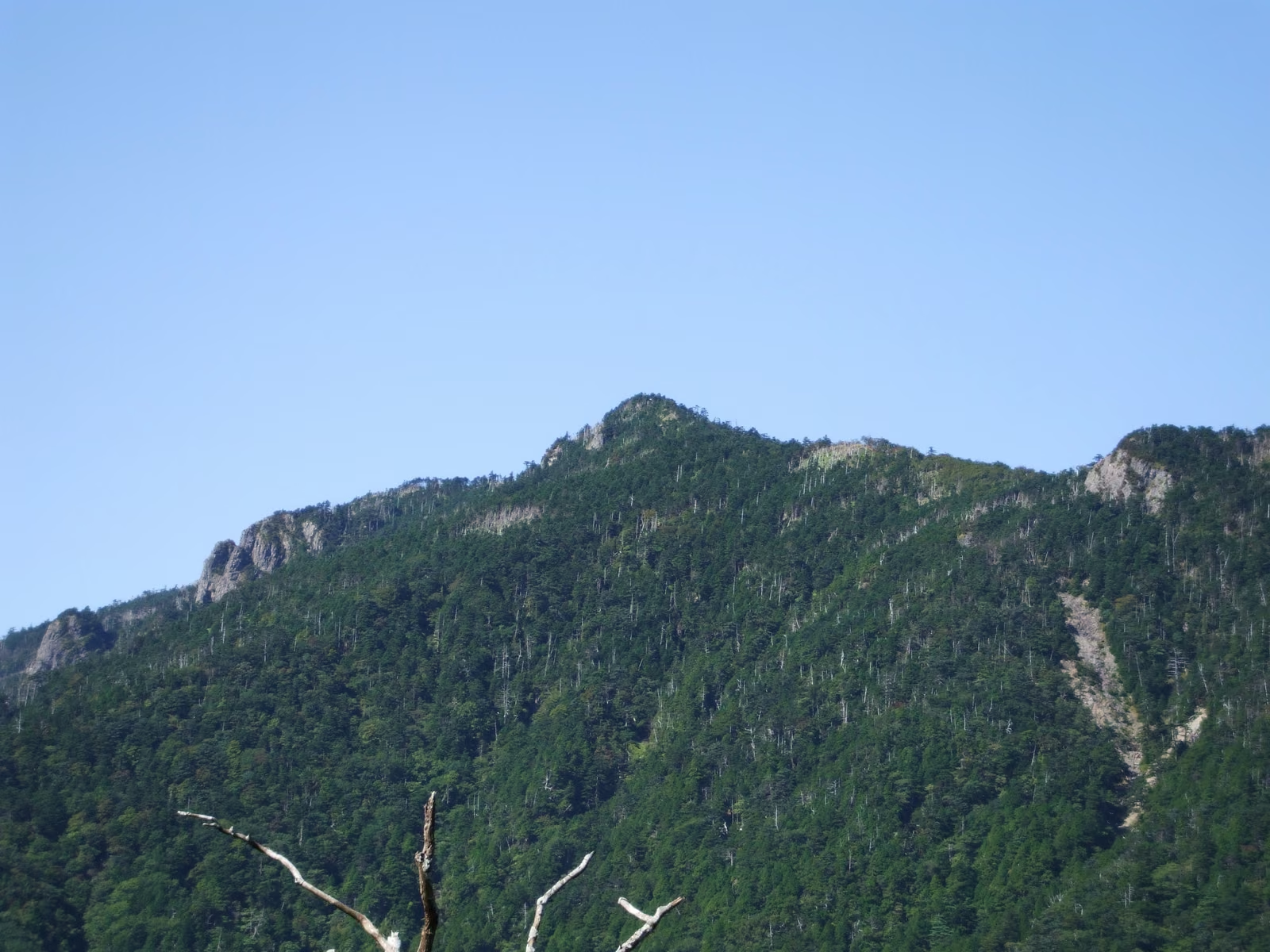
Photo: Mt. Hakkyogatake (highest peak of the Omine range). Mass Ave 975, Wikimedia Commons (CC BY-SA 3.0)

16 of Japan's 100 Famous Mountains You Can Day-Hike from Osaka, Kyoto, and Kobe: Difficulty, Access, and Late-Autumn Closures
A guide to 16 Nihon Hyakumeizan (Japan's 100 Famous Mountains) reachable as day hikes from Osaka, Kyoto, and Kobe, with elevations, difficulty ratings, access notes, and late-autumn 2026 bus, lift, and road closure dates.
Information checked October 24, 2026. Seasonal bus schedules, ropeways, toll roads, and trail access regulations are based on official announcements from each municipality and transport operator. Because snowfall or severe weather can cause earlier closures in late autumn, always verify current operating status before departure.
16 Hyakumeizan Reachable on a Day Trip from Kansai
Starting early in the morning from Osaka, Kyoto, or Kobe, 16 peaks from Kyuya Fukada's Nihon Hyakumeizan (100 Famous Mountains of Japan) can be climbed and returned from within a single day. As a practical benchmark, this list selects mountains where the trailhead is roughly 2 to 4 hours away by car (or reachable via express train and bus/ropeway) and has a standard route that fits into a one-day schedule.
Three points are essential when planning from the Kansai region:
- Only 3 of the 100 Famous Mountains lie within the Kinki region (including Mie): Mt. Ibuki, Mt. Odaigahara, and Mt. Omine (Mt. Hakkyogatake). The remaining 13 require travelling to Hokuriku, Chugoku (Tottori), Shikoku (Tokushima), or the Chubu mountains of Nagano and Gifu.
- Mountains with high-elevation road, bus, or lift access (Mt. Ibuki, Mt. Odaigahara, Mt. Tsurugi, Mt. Norikura, Kirigamine, Utsukushigahara, and Mt. Kisokoma) keep actual walking time short enough to balance a longer highway drive.
- Mid-October through November is the season of autumn cutoffs. Alpine buses, chairlifts, and toll driveways end their 2026 seasons one after another, followed by winter road closures.
1. 2026 Autumn Cutoffs: Lifts, Buses, and Roads
In autumn, checking how long buses, lifts, and access roads remain open is just as important as checking trail conditions. Below is the official 2026 autumn schedule for the main facilities on this list:
| Mountain | Facility / Regulation | 2026 Schedule |
|---|---|---|
| Mt. Ontake | Kengamine summit entry relaxation (Kurosawaguchi & Otakiguchi) | Ended October 14, 2026 at 12:00 noon (entry above Nyonindo / Tanohara Shrine is now closed) |
| Mt. Hakusan | Hakusan Murodo mountain hut operations | Ended October 15, 2026 |
| Mt. Norikura | Tatamidaira shuttle buses (Gifu Hounokidaira & Nagano Norikura Kogen sides) | Operating through October 31, 2026 |
| Kirigamine | Kurumayama Kogen Panorama Lift | Operating through November 3, 2026 (plus November 21–23) |
| Mt. Ontake | Ontake Ropeway | Operating through November 8, 2026 |
| Mt. Ibuki | Ibukiyama Driveway | Operating through November 23, 2026 (winter closure from November 24) |
| Mt. Odaigahara | Direct bus "Sorakaze" (Nara Kotsu, reservation required) | Operating through November 23, 2026 |
| Mt. Tsurugi | Tsurugisan Sightseeing Chairlift | Operating through November 30, 2026 |
| Yatsugatake | Alpico Bus Minoto-guchi Line (from JR Chino Station) | Weekends and holidays only from October 26, 2026 |
Winter Road and Trail Closures (Reference from Previous Season)
Many municipal winter road closure dates are announced shortly before snowfall begins. For reference, recent schedules and official notices include:
- Mt. Yakedake: The Kamikochi-side trail between the trailhead and Yakedake Hut closes for winter when ladders are removed (in the previous season, closure began on October 22, 2025 per Matsumoto City).
- Utsukushigahara & Kirigamine: The Venus Line section between Yashimagahara Wetland and Utsukushigahara closes for winter (from November 19 in the previous season).
- Mt. Odaigahara: The Odaigahara Driveway closes for winter at 15:00 on December 1 through April 20 at 15:00 (parking lots and the Visitor Center also close).
- Mt. Omine: National Route 309 leading to the Gyojagaeri Tunnel West Trailhead has winter closure sections (Tenkawa Village).
- Mt. Ena: The Otani-Kirigahara Forest Road leading to Misaka Pass closes for winter from December.
2. Choosing by Hiking Style
Short Walks with High-Elevation Vehicle or Lift Access
- Mt. Ibuki: About 20 minutes from the Ibukiyama Driveway summit parking lot via the Central Trail (Maibara City).
- Mt. Odaigahara: About 9 km / 4 hours on the Higashi-Odai loop from the parking lot (Kamikitayama Village).
- Mt. Tsurugi: About 15 minutes on the chairlift from Minokoshi to Nishijima Station, then about 1 hour on foot to the summit.
- Mt. Norikura: Shuttle bus to Tatamidaira (2,702 m), then a short round trip to Kengamine (3,026 m).
- Kirigamine & Utsukushigahara: Gently rolling highland plateaus reached via the Venus Line or Kurumayama chairlift.
- Mt. Kisokoma: Shuttle bus and Komagatake Ropeway to Senjojiki Station (2,612 m), then round trip to the 2,956 m summit.


Full-Day Hikes from the Trailhead
- Mt. Arashima: About 3 hr 30 min up / 2 hr 30 min down via the Kadohara route, walkable directly from JR Kadohara Station.
- Daisen (Tottori): Round trip up the Natsuyama Trail from Daisenji to Misen (1,709 m).
- Mt. Omine: Round trip from Gyojagaeri Tunnel West Trailhead to Mt. Hakkyogatake (1,915 m), the highest peak in the Kinki region.
- Mt. Tateshina: Steep, boulder-crowned volcanic peak climbed from the 7th Station trailhead or Ogawara Pass.
- Mt. Ena: Even the shortest Hirogawara route takes about 7 hours 10 minutes round trip (Nakatsugawa City).
Long Drives and Demanding Routes for Experienced Hikers
- Mt. Hakusan: Long approach to Betto Deai and substantial elevation gain to Gozengamine (2,702 m); Hakusan Murodo Hut is already closed for the season after October 15.
- Mt. Ontake: Active volcano (Volcanic Alert Level 1). The 2026 summit relaxation period ended at noon on October 14; hikers can currently climb only as far as Nyonindo (Kurosawaguchi) or Tanohara Shrine (Otakiguchi).
- Mt. Yakedake: Active volcano; climbing is permitted only to the North Peak (2,444 m).
- Yatsugatake (Mt. Akadake): Long day with steep rocky sections and chains.
3. All 16 Hyakumeizan Day-Hikeable from Kansai
- No.: Order in Kyuya Fukada's Nihon Hyakumeizan
- Elevation: Highest point of the mountain (on Daisen and Mt. Yakedake, hikers stop at Misen 1,709 m and the North Peak 2,444 m respectively)
- Difficulty: ★☆☆☆ = short walk with vehicle/lift aid; ★★☆☆ = beginner to intermediate day hike; ★★★☆ = long day or specific access/volcano restrictions; ★★★★ = steep rocky terrain with chains and long total hours
- Access: 🚃🚗 = reachable by train + bus as well as car; 🚗 = car is practical for a day trip
| No. | Mountain | Elev. | Diff. | Region / Pref. | Access | Key Trailhead & Notes |
|---|---|---|---|---|---|---|
| 89 | Mt. Ibuki | 1,377 m | ★☆☆☆ | Kinki (Shiga / Gifu) | 🚗 | Ibukiyama Driveway summit parking (¥3,400 round trip for standard cars; open through Nov 23, 2026). Climbing from the base in Maibara is prohibited; only the summit loop trails from the parking lot are open. |
| 90 | Mt. Odaigahara | 1,695 m | ★☆☆☆ | Kinki (Nara / Mie) | 🚃🚗 | Odaigahara Driveway (~200 spaces) or Nara Kotsu reservation bus "Sorakaze" (through Nov 23, 2026). Higashi-Odai loop is ~9 km / ~4 hr. |
| 91 | Mt. Omine (Hakkyogatake) | 1,915 m | ★★★☆ | Kinki (Nara) | 🚗 | Gyojagaeri Tunnel West on Route 309 (paid parking). Highest peak Hakkyogatake is open to all hikers (women are restricted only inside the Sanjogatake boundary gates). |
| 88 | Mt. Arashima | 1,523 m | ★★☆☆ | Hokuriku (Fukui) | 🚃🚗 | Kadohara Trailhead (walkable from JR Etsumi-Hoku Line Kadohara Station). ~3 hr 30 min up / ~2 hr 30 min down. |
| 87 | Mt. Hakusan | 2,702 m | ★★★☆ | Hokuriku (Ishikawa / Gifu) | 🚗 | Ichinose / Betto Deai (park-and-ride shuttle on peak dates). Hakusan Murodo Hut closed Oct 15, 2026; watch for winter closure of the Hakusan Park Line. |
| 92 | Daisen (Tottori) | 1,729 m | ★★☆☆ | Chugoku (Tottori) | 🚃🚗 | Daisenji Natsuyama Trail (bus from JR Yonago Station). Hikers climb to Misen (1,709 m); the collapsed ridge to Kengamine (1,729 m) is off-limits by prefecture advisory. |
| 93 | Mt. Tsurugi | 1,955 m | ★☆☆☆ | Shikoku (Tokushima) | 🚃🚗 | Minokoshi (15 min chairlift to Nishijima, ¥2,300 adult round trip, open through Nov 30, 2026; ~1 hr walk from Nishijima to summit). |
| 74 | Mt. Kisokoma | 2,956 m | ★★☆☆ | Chubu (Nagano) | 🚃🚗 | Suganodai Bus Center (near Komagane IC / bus from JR Komagane Station) → bus + Komagatake Ropeway to Senjojiki (2,612 m). Prepare for snow/ice from late October. |
| 76 | Mt. Ena | 2,191 m | ★★★☆ | Chubu (Nagano / Gifu) | 🚗 | Hirogawara Trailhead (Achi Village) or Misaka Pass. Hirogawara takes ~7 hr 10 min round trip; Otani-Kirigahara Forest Road closes for winter from December. |
| 61 | Utsukushigahara | 2,034 m | ★☆☆☆ | Chubu (Nagano) | 🚗 | Venus Line (Utsukushigahara Open-Air Museum / Yamamoto Hut side) to Ougatou (2,034 m). Venus Line section closes for winter from mid-November. |
| 62 | Kirigamine | 1,925 m | ★☆☆☆ | Chubu (Nagano) | 🚗 | Kurumayama Kogen (Panorama Lift ~25 min one way; open through Nov 3 and Nov 21–23, 2026) or Yashimagahara Wetland parking. |
| 63 | Mt. Tateshina | 2,531 m | ★★★☆ | Chubu (Nagano) | 🚗 | 7th Station Trailhead or Ogawara Pass by car. Boulder-covered summit; watch for early sunset and icy rocks in autumn. |
| 60 | Mt. Ontake | 3,067 m | ★★★☆ | Chubu (Nagano / Gifu) | 🚗 | Ontake Ropeway (Kurosawaguchi, open through Nov 8, 2026) or Tanohara (Otakiguchi). Active volcano (Level 1); summit entry relaxation ended Oct 14 at noon. |
| 59 | Mt. Norikura | 3,026 m | ★☆☆☆ | Chubu (Nagano / Gifu) | 🚃🚗 | Hounokidaira (Gifu) or Norikura Kogen (Nagano) shuttle bus to Tatamidaira (open through Oct 31, 2026; private cars banned). |
| 58 | Mt. Yakedake | 2,455 m | ★★★☆ | Chubu (Nagano / Gifu) | 🚗 | Shin-Nakanoyu Trailhead or Kamikochi. Active volcano; climbable to North Peak (2,444 m). Kamikochi-side trail closes for winter when ladders are removed. |
| 64 | Yatsugatake (Mt. Akadake) | 2,899 m | ★★★★ | Chubu (Nagano / Yamanashi) | 🚃🚗 | Minoto-guchi (bus from JR Chino Station; weekends/holidays only from Oct 26, 2026). Rocky chains and long hours. |
4. Regional Notes
Kinki's 3 Hyakumeizan: Mt. Ibuki, Mt. Odaigahara, and Mt. Omine


- Mt. Ibuki (1,377 m): Close to Sekigahara IC on the Meishin Expressway, making it easy to reach from Kyoto and Shiga. However, due to slope collapses from heavy rain and ongoing stabilization work, climbing from the base on the Maibara City side is prohibited. Hikers may only use the Ibukiyama Driveway (¥3,400 round trip for standard passenger cars; scheduled to operate through November 23, 2026) to reach the Sky Terrace parking lot and walk the summit loop trails (West, Central, and East trails; the East Trail is descent-only).
- Mt. Odaigahara (Mt. Hidegatake, 1,695 m): The standard Higashi-Odai loop (~9 km, ~4 hours) starts from the Visitor Center parking lot. Because there are no toilets along the Higashi-Odai trail, use the parking lot restrooms before setting out. Entering the Nishi-Odai conservation zone requires advance application, a fee, and a pre-entry briefing. By public transit, Nara Kotsu operates the reservation-only direct bus "Sorakaze" from Kintetsu Yamato-Yagi and Kashiharajingu-mae stations through November 23, 2026.
- Mt. Omine (Mt. Hakkyogatake, 1,915 m): Most hikers aim for Mt. Hakkyogatake (1,915 m), the highest peak in the Kinki region. Note that the traditional religious restriction prohibiting women (nyonin kinsei) applies only to the Mt. Sanjogatake zone inside the four boundary gates (Omine Bridge, Gobanzeki, Amidagamori, and Renge-tsuji); Mt. Hakkyogatake is open to everyone. The shortest route starts from the Gyojagaeri Tunnel West Trailhead along National Route 309, which is narrow and includes the Shirakura Tunnel (vehicle height limit 2.6 m, length limit 7.0 m) as well as winter closure sections (Tenkawa Village).
Hokuriku's 2 Hyakumeizan: Mt. Arashima and Mt. Hakusan
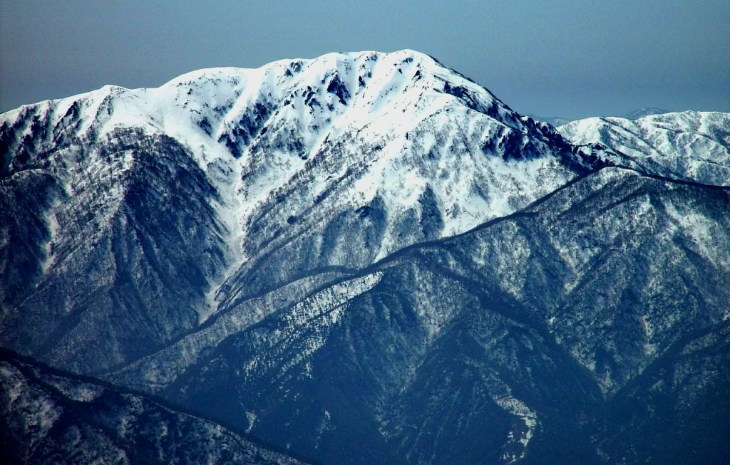

- Mt. Arashima (1,523 m): Fukui Prefecture's only Hyakumeizan. Because the Kadohara trailhead is within walking distance of JR Kadohara Station on the Etsumi-Hoku Line, it can be planned by train as well as car.
- Mt. Hakusan (Gozengamine, 2,702 m): Involves both a long drive and a strenuous climb. On designated peak regulation dates from summer into autumn, private cars are restricted between Ichinose and Betto Deai and hikers transfer to a shuttle bus (Ishikawa Prefecture). Note that Hakusan Murodo Hut closed for the season on October 15, leaving no staffed mountain hut near the summit in late autumn.
Chugoku & Shikoku's 2 Hyakumeizan: Daisen and Mt. Tsurugi


- Daisen (Tottori Prefecture): Distinct from Mt. Oyama in Kanagawa. Although the highest point is Kengamine (1,729 m), the ridge connecting to Kengamine is severely eroded and Tottori Prefecture urges hikers not to enter it; the standard summit for hikers is Misen (1,709 m) via the Natsuyama Trail from Daisenji. By public transit, Nihon Kotsu runs buses from JR Yonago Station to Daisenji.
- Mt. Tsurugi (1,955 m, Tokushima Prefecture): The Tsurugisan Sightseeing Chairlift carries hikers from Minokoshi to Nishijima Station in about 15 minutes (2026 operating season through November 30, adult round-trip fare ¥2,300). From Nishijima, the summit is about a 1-hour walk.
Nagano & Gifu's 9 Hyakumeizan
Reached via the Chuo and Nagano Expressways. Check our individual English guides for detailed routes and access:
- Mt. Norikura: Private cars are barred from Tatamidaira; board shuttle buses from Hounokidaira (Gifu) or Norikura Kogen (Nagano) through October 31, 2026.
- Mt. Ontake: Volcanic Alert Level 1. The 2026 summit relaxation ended at noon on October 14; check Kiso Town and Otaki Village announcements for current entry limits.
- Mt. Ena: Long forest trail from Hirogawara; check forest road status before departure.
- Yatsugatake: Approached from Chino City; check bus timetables and late-autumn frost/snow gear requirements.
5. Late-Autumn Day-Hike Safety Notes
- Plan to finish descending at least 2 hours before sunset: In Osaka, sunset falls around 17:20 in mid-October and around 16:50 by late November. Because long highway drives from Kansai often mean a later trailhead start, set a strict turnaround time and always carry a headlamp.
- Prepare for freezing temperatures and icy trails: From late October onward, peaks above 2,000 m regularly experience frost, rime ice, and snow. Pack warm layers, windproof gloves, and microspikes or light crampons where needed.
- Bear safety: The Kii Peninsula and Chubu mountains are home to Asiatic black bears. Carry a bear bell or make noise in forested sections, and wear bright, high-visibility clothing—especially once the hunting season opens (from November 15 in many prefectures).
- Submit a climbing plan (trail registration): Prefectures such as Nagano and Gifu mandate climbing plan submission in designated mountain areas. Always file your route and share your itinerary with family before leaving.
References
- Maibara City — Mt. Ibuki Special Portal
- Ibukiyama Driveway — Visitor Guide & Fares
- Ministry of the Environment Kinki Regional Office — Overview of Mt. Odaigahara
- Nara Prefecture — Odaigahara Visitor Center
- Nara Kotsu — Odaigahara Direct Bus "Sorakaze"
- Tenkawa Village — Mt. Misen & Mt. Hakkyogatake
- Tenkawa Village — Mt. Sanjogatake
- Ishikawa Prefecture — Mt. Hakusan Peak Season Traffic Regulations
- Hakusan Tourism Association — Hakusan Murodo Facility Guide
- Tottori Prefecture — Daisen Climbing Information
- Tsurugisan Sightseeing Chairlift — Official Site
- Matsumoto City — Mt. Yakedake Trail Winter Closure Notice
- Alpico Group — Minoto-guchi Bus Line
- Japan Meteorological Agency — Volcanic Activity Information for Climbers