
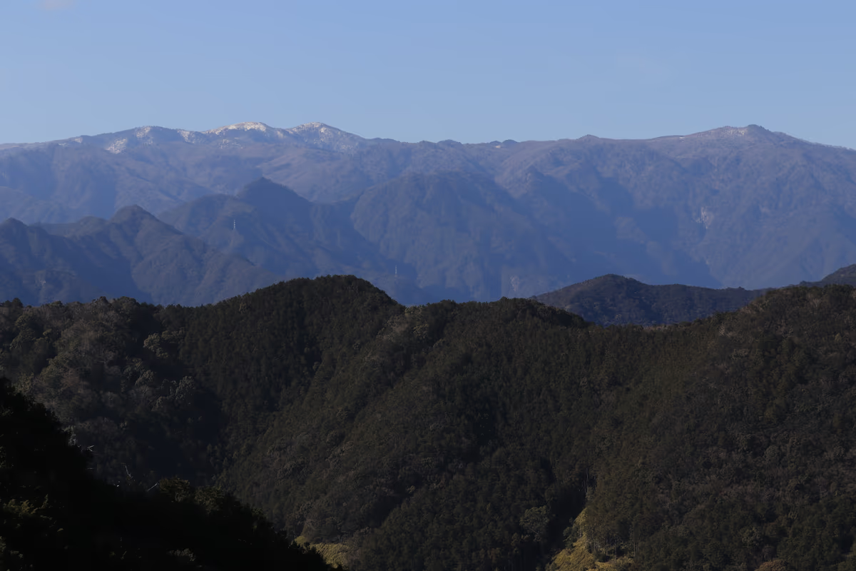
Photo: Alpsdake, Wikimedia Commons (CC BY-SA 4.0)

Mt. Ōdaigahara Hiking Guide: Higashi-Ōdai Loop (Hidegatake & Daijagura), Nishi-Ōdai Permit Rules, Bus & Winter Closure
An official-source guide to Mt. Ōdaigahara (Hidegatake, 1,695 m) on the Nara–Mie border: the 9 km Higashi-Ōdai loop (approx. 4 hours), why there are no toilets inside Higashi-Ōdai, advance application requirements for Nishi-Ōdai, parking (~200 cars), Nara Kotsu bus access, and winter road closure.
This guide is compiled from official information published by the Ministry of the Environment Kinki Regional Environment Office, Nara Prefecture, and Kamikitayama Village (checked October 24, 2026).
Mt. Ōdaigahara sits at the southern end of the Daikō Mountain Range along the border of Nara and Mie Prefectures and is one of Japan's 100 Famous Mountains. Its highest peak is Hidegatake (1,695 m). According to the Ministry of the Environment, the mountain is a rare non-volcanic uplifted peneplain whose southeastern slopes face the Kumano Sea only about 20 km away, drawing up moist ocean air to produce 3,000 to 3,500 mm of annual precipitation—making it one of the wettest places in Japan alongside Yakushima. The plateau is designated as a Special Protection Zone of Yoshino-Kumano National Park and is part of the Mount Odaigahara, Mount Omine and Osugidani UNESCO Eco Park.
The mountain is divided into two distinct zones: Higashi-Ōdai (East Ōdaigahara), which requires no permit and is the standard day-hike area, and Nishi-Ōdai (West Ōdaigahara), a regulated utilization area where advance application, fee payment, and a mandatory pre-entry lecture at the visitor center are required.


Higashi-Ōdai Loop Course (Approx. 9 km / 4 Hours)
Kamikitayama Village lists two main courses in Higashi-Ōdai, both approximately 9 km long and taking about 4 hours:
- Course A (Beginner — Higashi-Ōdai Nakamichi Course, ~9 km / ~4 hours): Visits the highest peak Hidegatake, Masakigahara, Ushiishigahara, and the cliff-edge viewpoint of Daijagura, returning via the Nakamichi trail from Owasetsuji (Owasetsuji to the parking lot via Nakamichi is 2 km, approx. 40 minutes).
- Course B (Intermediate — Full Higashi-Ōdai Loop, ~9 km / ~4 hours): Visits Hidegatake, Masakigahara, Ushiishigahara, and Daijagura, then descends through the rhododendron zone to cross the Shiokaradani suspension bridge before climbing steeply back to the parking lot.
Highlights Along Higashi-Ōdai (Ministry of the Environment)
- Hidegatake (1,695 m): Highest peak of Mt. Ōdaigahara. The summit observation deck looks out over the Ōmine range, the Daikō range, and the Kumano Sea—and on clear days, even Mt. Fuji. Important: The Ministry of the Environment asks hikers to refrain from descending the route toward Ōsugidai due to frequent slip-and-fall accidents.
- Masakitōge & Masakigahara: A broad ridge covered in miyakozasa bamboo grass and weathered standing dead trees, with timber boardwalks and viewing decks looking back toward Hidegatake and the Kumano Sea. Shiroyashio (five-leaf white rhododendron) lines the boardwalk between Hidegatake and Masakitōge.
- Ushiishigahara: An open bamboo-grass plateau along the way from Owasetsuji toward Daijagura, featuring the statue of Emperor Jinmu and Ushi-ishi ("Cow Rock").
- Daijagura: A dramatic rocky outcrop jutting out above an approximately 800 m sheer drop, offering a panoramic view of the Ōmine mountain range and the cliffs of Fudōgaeshi across the gorge.
- Rhododendron Grove to Shiokaradani: A tunnel of pink rhododendron blossoms during flowering season leads down to the Shiokaradani suspension bridge. Note that the climb from the Shiokaradani valley floor back up to the parking lot is steep.


Sources: Ministry of the Environment — Overview of Ōdaigahara, Kamikitayama Village — Mt. Ōdaigahara


Nishi-Ōdai Requires Advance Application
Unlike Higashi-Ōdai, Nishi-Ōdai (West Ōdaigahara) is designated as a Regulated Utilization Area under the Natural Parks Act to protect its beech and conifer forest ecosystem. To enter Nishi-Ōdai, hikers must:
- Submit an advance application and pay the required fee before the hike.
- Attend a mandatory pre-entry orientation lecture at the Ōdaigahara Visitor Center on the day of entry to receive their entry pass.
Daily entry caps apply on both weekdays and weekends/holidays. Check the Ministry of the Environment's Nishi-Ōdai portal for current procedures. Inside Nishi-Ōdai, a portable-toilet booth is installed at Kaitaku-ato (a suggested donation applies).
Toilets, National Park Rules & Bear Safety
- No toilets exist anywhere along the Higashi-Ōdai trails. Once you pass the trailhead, you cannot use a restroom until you return to the parking lot. Always use the public toilets at the Ōdaigahara Visitor Center parking lot before starting your hike.
- National Park rules: Collecting plants, animals, dead branches, or fallen leaves is strictly prohibited. Stay on marked trails and boardwalks, do not bring pets, do not camp or light fires/stoves, carry out all trash, and refrain from smoking while walking.
- Asian black bears: The Kii Mountains are habitat for Asian black bears (Ursus thibetanus). Carry a bear bell or radio to make your presence known, and ring the stationary bear bells installed along the Higashi-Ōdai trail. Never leave food scraps behind.
Weather & Clothing
Because Mt. Ōdaigahara receives 3,000–3,500 mm of rain a year and sits around 1,600 m in elevation, the Ministry of the Environment states that dedicated two-piece rainwear is essential, along with a pack cover and waterproof inner bags. Temperatures on the plateau are typically about 10 °C cooler than on the plains, though summer afternoons can still approach 30 °C—carry plenty of water and salt tablets for heatstroke prevention.
Wet timber boardwalks and tree roots are slippery; wear grippy hiking boots and review Hiking Layering Basics.
Access, Parking & Winter Closure
By Car
- Parking capacity: According to the Ministry of the Environment and Nara Prefecture, the Ōdaigahara parking lot holds approximately 200 cars. During Golden Week, summer vacation, and the autumn foliage season, the lot can fill up early in the morning.
- Driving time: According to Nara Prefecture, driving from Osaka via Koriyama IC, Route 24, and Route 169 onto the Ōdaigahara Driveway (Prefectural Route 40) takes approximately 2 hours 40 minutes (approx. 130 km); from Kyoto it takes approximately 3 hours 30 minutes (approx. 140 km).
- Rainfall road closure threshold: The Ōdaigahara Driveway is closed to traffic when continuous rainfall reaches 110 mm or hourly rainfall reaches 25 mm or more.
- Winter road closure: Prefectural Route 40 (Ōdaigahara Driveway), the parking lot, and the Ōdaigahara Visitor Center close every winter from early December to late April (for the 2025–2026 winter season, closure ran from 3:00 PM on December 1, 2025 to 3:00 PM on April 20, 2026; confirm exact dates for the upcoming winter with the Nara Prefecture Yoshino Civil Engineering Office at 0746-32-4051).
- Ōdaigahara Visitor Center: Open 9:00 AM – 5:00 PM during the open season (Tel: 07468-3-0312).
By Train & Bus (Nara Kotsu Bus)
- Seasonal Nara Kotsu buses to Ōdaigahara operate from AEON Mall Kashihara, Kintetsu Yamato-Yagi Station, and Kintetsu Kashiharajingu-mae Station (approx. 3 hours 25 minutes from AEON Mall Kashihara).
- Important: Since 2022, buses bound for Ōdaigahara no longer stop at Kintetsu Yamato-Kamiichi Station. Be sure to board at Yamato-Yagi or Kashiharajingu-mae Station.
- Check the official Nara Kotsu website for operating days, timetables, and current fares before your trip.
Sources: Nara Prefecture — Ōdaigahara Visitor Center, Ministry of the Environment — Overview of Ōdaigahara, Kamikitayama Village — Mt. Ōdaigahara
Summary
- Higashi-Ōdai loop: Approx. 9 km / 4 hours (Course A returns via the gentler Nakamichi trail from Owasetsuji; Course B crosses the Shiokaradani suspension bridge and climbs steeply back to the parking lot).
- Do not descend from Hidegatake toward Ōsugidai due to frequent slip-and-fall accidents.
- No toilets exist inside Higashi-Ōdai—use the visitor center parking lot restroom before starting.
- Parking (~200 cars) and the Ōdaigahara Driveway close for winter from early December to late April and during heavy rain (110 mm continuous or 25 mm/h).
- Nara Kotsu buses depart from Yamato-Yagi and Kashiharajingu-mae stations (no stop at Yamato-Kamiichi Station since 2022).