
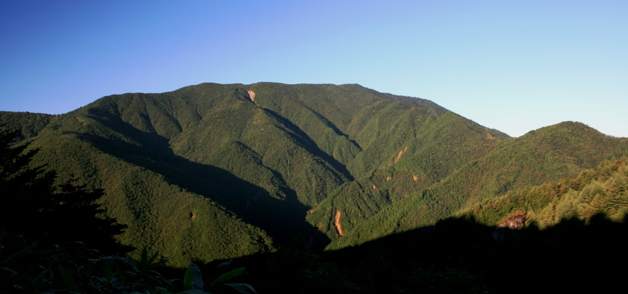
Photo: Alpsdake, Wikimedia Commons (public domain)

Mt. Ena Hiking Guide: Four Routes Compared with Official Course Times, Forest Road Closures and Cautions
Mt. Ena (2,191 m), the southern end of the Central Alps, has four main routes. Nakatsugawa City gives the Hirogawara route about 3 h 50 min up and the Misaka Pass route about 5 h up. Official distances and times, the closed Kuroisawa forest road, the winter closure of the road to Misaka Pass from December 1, and Achi Village's warnings.
This guide is based on information from Nakatsugawa City and Achi Village, checked October 24, 2026. Road conditions change, so check these pages before you go.
Mt. Ena (2,191 m) stands on the border of Achi Village in Nagano and Nakatsugawa City in Gifu, at the southern end of the Central Alps. It is one of Japan's 100 Famous Mountains. Nakatsugawa City lists four main routes: Hirogawara (Nagano side), Kuroisawa, Misaka Pass (Misaka-toge) and Maemiya.


The four routes (official distances and course times)
| Route | Distance | Course time | Official description |
|---|---|---|---|
| Hirogawara (Nagano side) | about 4.1 km | up about 3 h 50 min / down 3 h 20 min | The shortest and relatively easy. Watch for getting lost and for rising river water |
| Kuroisawa | about 6.5 km | up about 4 h 30 min / down about 3 h 30 min | Climbs through forest along a stream, with an emergency hut on the way. Watch for getting lost and rising water. Access road closed (see below) |
| Misaka Pass | about 6.5 km | up about 5 h / down about 4 h 30 min | Follows the ridge with the best views of any route. No hut on the way; watch for lightning and falls |
| Maemiya | about 6.7 km | up about 8 h / down about 5 h 50 min | The longest and steepest route, for experienced hikers. Usually done with a night in the summit emergency hut |
Source: Nakatsugawa City hiking routes (Japanese) (page updated April 2024)
The times exclude breaks. Even the shortest route, Hirogawara, is about 7 hours 10 minutes for the round trip, and Misaka Pass about 9 hours 30 minutes, which is a long day.
Road and trail conditions
Kuroisawa: the forest road is closed
Nakatsugawa City's forest road page (updated October 2, 2026) says City Road Nakatsu 4845 (the "Enasan forest road" toward Kuroisawa) is closed. The city's route page explains that the July 2020 heavy rain caused slope collapses on the road to the Kuroisawa trailhead. No reopening date is given.
The road to Misaka Pass (Rindo Otani-Kirigahara Line)
- The section from Kowashimizu to Bangakuso, the road to Mt. Ena and the Fujimidai Highland (Misaka Pass), reopened after winter on April 2, 2026.
- It closes for winter every year from December 1 until around mid-April (dates can change with snow).
Source: Nakatsugawa City forest roads (Japanese)
Hirogawara route: Achi Village's warnings
Achi Village's page (updated May 21, 2024) says:
- The forest road to the trailhead has falling rocks and is dangerous; take great care.
- The planks across the river at the trailhead are very unstable and can be damaged when rain raises the river, so do not climb after rain.
- Enquiries: Achi Village Commerce and Tourism Section, 0265-43-2220.
The page is not recent, so contact the village for current conditions before you go.
Source: Achi Village: Hirogawara route (Japanese)


Misaka Pass and Bangakuso
Nakatsugawa City describes the Misaka Pass route as following the ridge with the best views on the mountain, with no hut on the way and a risk of lightning and falls.
Note that the short trail from Bangakuso (about 1.8 km, about 40 minutes up and 30 minutes down) that the city recommends for families goes to the top of the Fujimidai Highland, not to Mt. Ena.


The summit hut
The city says the Maemiya route is usually walked with a night in the summit emergency hut. We could not confirm the hut's capacity, water or toilets from official sources; ask the Nakatsugawa City Tourism Section (0573-66-1111) before relying on it.
What to bring
- Quick-drying base layer, a warm layer (fleece or light down) and rain gear; the ridge and summit area are cold and windy.
- Hiking boots with good grip for steep, rooty and wet trails.
- Plenty of water: we could not confirm any water sources from official information.
- Headlamp, a map app and a backup map, and a power bank.
- A bear bell: Nakatsugawa City reports bear sightings on nearby Mt. Kohide, so take care on Mt. Ena too.
- From autumn, warm clothes and gloves; watch for early snow and ice.
Planning
- Even Hirogawara takes about 7 h 10 min of walking. Start early enough to finish well before dark.
- Misaka Pass takes about 9 h 30 min; avoid it if you are not confident of your fitness.
- Check the forest roads, and after rain the Hirogawara trailhead crossing, the day before.
- Avoid the Misaka Pass ridge when thunderstorms or strong winds are forecast.
- We could not confirm access details (the road from Sonohara IC, parking, fees or toilets) from official sources. Check with Achi Village or Nakatsugawa City before you go.