
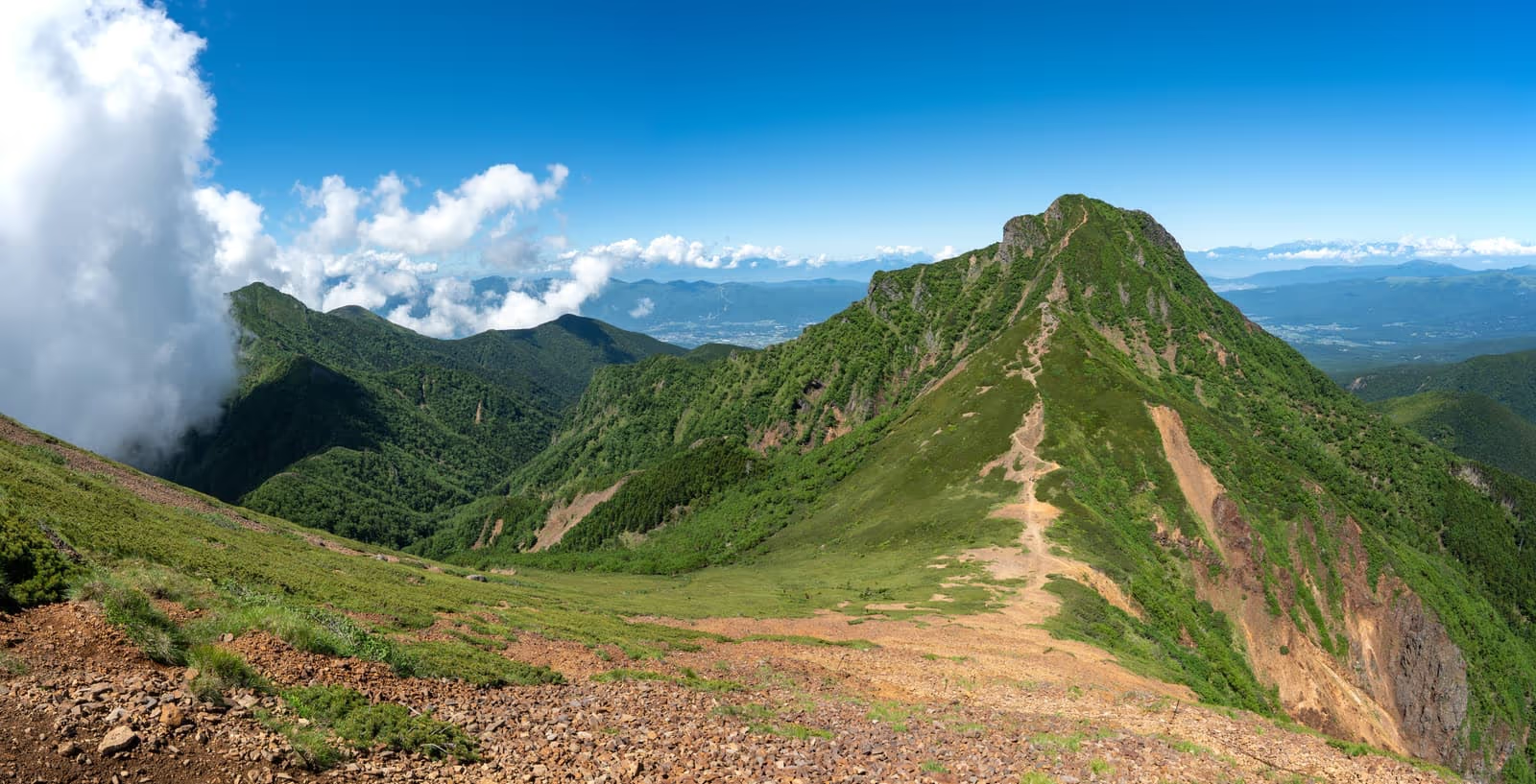
When to Hike Yatsugatake: North vs. South Yatsugatake Routes, Access, and Hut Seasons
How to choose a Yatsugatake route by season—comparing the ropeway-assisted North Yatsugatake (Mt. Kitayokodake and Mt. Tateshina) with the rocky high ridges of South Yatsugatake (Mt. Akadake), plus official access and hut schedules.
Note: Ropeway fares, bus timetables, trail grading figures, and mountain hut operating dates in this guide are based on official notices from Kita-Yatsugatake Ropeway, Alpico Kōtsū, Nagano Prefecture, Yamanashi Prefecture, and Akadake Kōsen / Gyōja-goya checked October 24, 2026.
The Yatsugatake mountain range straddles Nagano and Yamanashi prefectures and is divided at Natsuzawa Pass into two distinct sections with very different terrain and snow conditions:
- North Yatsugatake (Kita-Yatsugatake): Gentle volcanic slopes, mossy subalpine forests, and a ropeway that climbs directly to 2,237 m—making it far more approachable from spring through autumn.
- South Yatsugatake (Minami-Yatsugatake): Steep, rocky alpine peaks approaching 2,900 m (headed by Mt. Akadake, 2,899 m) with chain-assisted scrambles, exposed ridges, and snow and ice that linger well into spring and return early in autumn.
Even during the spring Golden Week holidays or late autumn, while towns at the base enjoy mild weather, the 2,200 m–2,899 m ridges of Yatsugatake frequently experience freezing temperatures, lingering snowpack, or new snowfall. Choosing between North and South Yatsugatake—and matching your footwear and seasonal traction to current conditions—is the key to a safe hike.
1. North Yatsugatake vs. South Yatsugatake at a Glance
According to the Nagano Trail Grading Matrix (published by Nagano Prefecture):
| Area & Peak | Representative Route | Fitness Score | Technical Grade | Round-Trip Time | Distance | Cumulative Ascent |
|---|---|---|---|---|---|---|
| North Yatsugatake: Mt. Kitayokodake (2,480 m) | Ropeway Sanchō Sta. round trip | 1 (Lightest) | A (Easiest) | ~2 hr | 3.6 km | 260 m |
| North Yatsugatake: Mt. Tateshina (2,531 m) | 7th Station trailhead round trip | 2 | B | ~3 hr 30 min | 5.4 km | 625 m |
| North Yatsugatake: Mt. Tateshina (2,531 m) | Ōgawara Pass round trip | 2 | B | ~3 hr 40 min | 5.4 km | 500 m |
| North Yatsugatake: Mt. Tengudake (2,646 m) | Karasawa Kōsen round trip | 3 | B | ~5 hr 30 min | 8.5 km | 800 m |
| South Yatsugatake: Mt. Akadake (2,899 m) | 美濃戸口 (Minotoguchi) round trip | 5 (Day-hike max) | C (Chains & steep rock) | ~9 hr | 16.2 km | 1,340 m |
| South Yatsugatake: Mt. Akadake (2,899 m) | 美濃戸 (Minoto) round trip | 4 | C | ~7 hr | 10.2 km | 1,160 m |
 Kita-Yatsugatake Ropeway climbs to 2,237 m in about 7 minutes (Photo: Wikimedia Commons, CC BY-SA 3.0)
2. North Yatsugatake: Ropeway Access to 2,237 m and Beginner-Friendly Peaks
Mt. Kitayokodake (2,480 m) & Tsuboniwa
The Kita-Yatsugatake Ropeway carries hikers from Sanroku Station (1,771 m) to Tsuboniwa Station (2,237 m) in about 7 minutes.
- Ropeway Fares (Kita-Yatsugatake Ropeway official site):
- Round trip: ¥2,600 (adults) / ¥1,300 (children)
- One way: ¥1,400 (adults) / ¥700 (children)
- Free parking at the base station (600 spaces).
- Scheduled Maintenance Closures:
- 2026 Autumn Closure: November 16 – December 11, 2026
- 2027 Spring Closure: April 5 – April 23, 2027
- Always check the official daily operating schedule before visiting.
From the upper ropeway station, the Tsuboniwa Nature Garden boardwalk loop takes roughly 30–40 minutes through volcanic lava rock and alpine pines. Continuing up the trail through subalpine forest brings you to Kitayokodake Hut and the twin summits of Mt. Kitayokodake (South Peak and North Peak, 2,480 m) in a 3.6 km, ~2-hour round trip (Nagano Trail Grading: Fitness 1 / Grade A).
Note that even on this Grade A trail, compacted snow and ice persist on shaded wooden steps and forest slopes during spring (April–May) and from late autumn onward. Check recent trail reports and carry light traction (such as chain spikes) whenever snow or ice remains.
 Tsuboniwa at 2,237 m just outside the ropeway's upper station (Photo: Wikimedia Commons, CC BY-SA 3.0)
Looking south toward Mt. Akadake and Mt. Amida from the summit of Mt. Kitayokodake (Photo: Wikimedia Commons, CC BY-SA 3.0)
Mt. Tateshina (2,531 m)
At the northern end of the range stands Mt. Tateshina (2,531 m, one of Japan's 100 Famous Mountains), known as Suwa Fuji for its conical silhouette.
- From the 7th Station Trailhead (七合目登山口): Fitness 2 / Grade B, 5.4 km round trip, ~3 hr 30 min, 625 m cumulative ascent.
- From Ōgawara Pass (大河原峠): Fitness 2 / Grade B, 5.4 km round trip, ~3 hr 40 min, 500 m cumulative ascent.
The upper cone and wide summit crater of Mt. Tateshina are covered in large volcanic boulders. Step carefully to avoid twisting an ankle, and wear gloves to protect your hands while balancing on the rocks.
 Mt. Tateshina at the northern end of the Yatsugatake range (Photo: Wikimedia Commons, CC BY-SA 4.0)
3. South Yatsugatake: High Alpine Ridges and Mt. Akadake (2,899 m)
At 2,899 m, Mt. Akadake is the highest peak in the Yatsugatake range. Unlike the gentle boardwalks of North Yatsugatake, climbing Mt. Akadake involves steep valley approaches (Minamisawa or Kitazawa from Minoto) followed by steep rocky scrambles equipped with chains and ladders on the final ascent via Jizō-no-kashira or Monjūsawa (Bunzaburō Ridge).
- From Minotoguchi (美濃戸口, bus stop): Fitness 5 / Grade C, 16.2 km round trip, ~9 hours, 1,340 m cumulative ascent.
- From Minoto (美濃戸, vehicle parking further up the forest track): Fitness 4 / Grade C, 10.2 km round trip, ~7 hours, 1,160 m cumulative ascent.
- From Seisenryō /的美し森 (Utsukushimori, Yamanashi side via Shinshū Pass): Listed on the Yamanashi Prefecture mountain grading matrix as Fitness 6 / Grade C, recommending an overnight stay rather than a day trip.
Mountain Hut Operating Seasons around Mt. Akadake
Staying overnight at Akadake Kōsen or Gyōja-goya breaks the steep climb into two manageable days:
- Akadake Kōsen (赤岳鉱泉): Open year-round (prior reservation required).
- Gyōja-goya (行者小屋): Seasonal operation only. According to the official Akadake Kōsen / Gyōja-goya website, its 2026 operating dates are:
- Spring Golden Week: April 25 (Sat) – May 5 (Tue), 2026
- Summer – Autumn: June 6 (Sat) – November 2 (Mon), 2026
- Outside these periods, Gyōja-goya is closed.
- For other huts across the Yatsugatake range, Nagano Prefecture's Yatsugatake Mountain Hut Directory notes that operating periods and reservation rules vary by hut—always confirm directly with each hut before planning your route.
 The rocky silhouette of Mt. Akadake seen from Mt. Yokodake (Photo: 12019 / Wikimedia Commons, CC0)
4. Public Transit Access from JR Chino Station
The primary rail gateway to Yatsugatake is JR Chino Station (Chūō Line Limited Express Azusa from Shinjuku). Alpico Kōtsū operates seasonal and year-round bus lines from Chino Station:
- For North Yatsugatake (Kita-Yatsugatake Ropeway Line):
- Runs directly from JR Chino Station (West Exit, Bus Stop No. 2) to Kita-Yatsugatake Ropeway.
- Fare: ¥1,550 one way for adults (per the official 2026 timetable PDF).
- For South Yatsugatake (Minotoguchi Line):
- Runs from JR Chino Station to Minotoguchi (美濃戸口), the gateway to Akadake Kōsen, Gyōja-goya, and Mt. Akadake.
- Fare: ¥1,700 one way for adults (per the official 2026 timetable PDF).
- Seasonal Operation: Check the current Alpico Kōtsū timetable PDF for exact operating dates and departure times, as service frequency changes between summer/autumn peak season and winter/spring.
5. Safety and Preparation Checklist
- Match Your Gear to the Elevation (2,200 m–2,899 m): Even when valleys are warm, winds across exposed passes and summits like Kitayokodake, Tateshina, and Akadake require windproof rain shells, warm mid-layers, gloves, and a knit cap. During spring snowmelt (April–May) and from October onward, check whether chain spikes, 10–12-point crampons, an ice axe, and a climbing helmet (essential on rocky South Yatsugatake scrambles) are needed.
- Submit a Climbing Registration Plan (登山届): Both Nagano Prefecture and Yamanashi Prefecture require hikers to submit a climbing plan before entering the mountains. Ensure your itinerary leaves ample buffer before sunset and before the last ropeway or bus departure.
References
- Kita-Yatsugatake Ropeway Official Site (Operating Calendar, Fares & Parking)
- Alpico Kōtsū — Chino Area Local Bus Lines (Kita-Yatsugatake Ropeway & Minotoguchi)
- Alpico Kōtsū — Kita-Yatsugatake Ropeway Line Timetable & Fare PDF (2026)
- Alpico Kōtsū — Minotoguchi Line Timetable & Fare PDF (2026)
- Nagano Prefecture — Nagano Trail Grading
- Nagano Prefecture — 2026 Trail Grading List (PDF)
- Yamanashi Prefecture — Mountain Climbing & Trail Grading Information
- Yamanashi Prefectural Police — Submitting a Climbing Registration Plan
- Akadake Kōsen & Gyōja-goya Official Site (2026 Operating Dates)
- Nagano Prefecture — Yatsugatake Area Mountain Hut Directory