

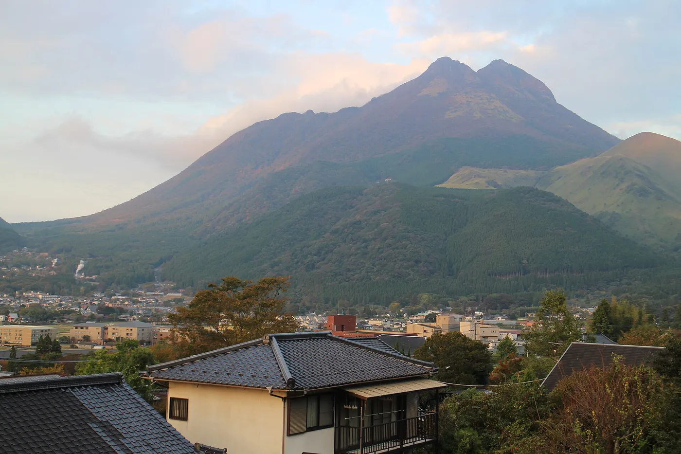
Photo: STA3816, Wikimedia Commons (CC BY-SA 3.0). Mount Yufu from the Sagiridai viewpoint, October 18, 2011.

Mount Yufu (Yufudake) from Yufuin: The Bus to the Main Trailhead, East Peak or West Peak, November Daylight, and an Onsen Finish in Oita
An English guide to hiking Mount Yufu (由布岳, 1,583 m), the twin-peaked volcano behind the hot-spring town of Yufuin in Oita, Kyushu. Covers the Kamenoi Bus from Yufuin or Beppu to the Yufu Tozanguchi stop and the new fares from October 17, 2026, parking and the only toilets, the standard route via Goyagoe and Matae, why most hikers should choose the East Peak over the chained West Peak, the easy Iimorigajo option, volcano status, November daylight and clothing, climbing plans with Oita Prefectural Police, and Yufuin's hot-spring bathing tax.
This guide is based on Yufu City’s Mount Yufu hiking route map, the Yufu City Tourism Bureau, Visit Oita (Oita’s official tourism site), Kamenoi Bus, the Japan Meteorological Agency and Oita Prefectural Police. Bus fares and timetables change, so open the linked pages before you go.
Step off the train at Yufuin Station (由布院駅) and the mountain is already in front of you: two rocky summits above a green basin of hot-spring inns. That is Mount Yufu (由布岳, Yufu-dake), 1,583 m, nicknamed Bungo Fuji (豊後富士) for its shape. Visit Oita calls it one of the most rewarding day hikes in Kyushu, and it fits neatly into a trip that many visitors already make between Beppu and Yufuin: a bus to the trailhead in the morning, a summit around midday, and a hot-spring bath before dinner.
It is also a real mountain. The upper half is steep, rocky and exposed to wind, and the higher of the two summits is reached by chains. This guide is about choosing the right objective and getting the logistics right.
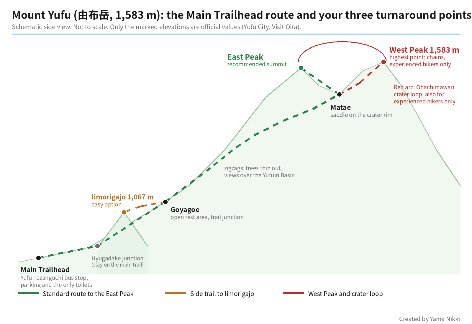
Pick your turnaround point first
On Mount Yufu, the useful question is not “can I reach the top?” but “which top?” Yufu City’s route map and Visit Oita describe three realistic goals from the Main Trailhead (正面登山口, Shōmen tozanguchi):
| Iimorigajo (飯盛ヶ城) | East Peak (東峰, Higashi-mine) | West Peak (西峰, Nishi-mine) | |
|---|---|---|---|
| What it is | A 1,067 m hill reached by a side trail from Goyagoe | The summit most hikers aim for | The highest point, 1,583 m |
| Time from the Main Trailhead | About 75 minutes (Yufu City) | About 2 hours 30 minutes on average to the summit (Yufu City); Visit Oita allows about 2 h 40 min up and 2 h 30 min down | Longer; reached from Matae by chains |
| What it asks of you | Easy walking; Yufu City suggests it for beginners, families and anyone unsure of their fitness | Steady climbing on zigzags, then rocky steps and large boulders near the top | Narrow ledges you cross sideways and chained rock; Visit Oita says beginners should not attempt it |
| The view | The Yufuin Basin below | The Yufuin Basin, Beppu Bay and the Kuju mountains on a clear day | Similar to the East Peak |
There is a fourth option, the Ohachimawari (お鉢まわり) loop around the summit crater between the two peaks, about 90 minutes on Yufu City’s map. The city describes loose rock and very poor footing and recommends it only for experienced hikers, adding that tired legs after the climb make it more dangerous.
Yufu City also warns that trails starting anywhere other than the Main Trailhead are hard to follow, and recommends going with an experienced companion if you use them. Everything below assumes the Main Trailhead.
Getting to the Main Trailhead
By bus: Kamenoi Bus route 36
The trailhead has its own stop, Yufu Tozanguchi (由布登山口), on Kamenoi Bus route 36, the Yufuin Line (湯布院線), which runs between Beppu Station West Exit (別府駅西口) and Yufuin Ekimae Bus Center (由布院駅前バスセンター) next to Yufuin Station. From Yufuin the ride is about 10 to 15 minutes (Visit Oita; Yufu City map).
Kamenoi Bus publishes separate weekday and weekend/holiday timetables for route 36. Check both directions before you start, and note the time of the last few buses back so that you can plan your descent around them.
Fares change on October 17, 2026. The Kamenoi Bus fare table effective that day (Japanese PDF, route 36 page) lists, for adults:
| Between Yufu Tozanguchi and | Fare |
|---|---|
| Yufuin Ekimae Bus Center | 430 yen |
| Beppu Station West Exit | 850 yen |
So you can do the hike from a base in Beppu without a car.
Do not walk from Yufuin. The Yufu City Tourism Bureau specifically advises against walking or cycling to the trailhead: the road has no sidewalk, climbs steeply for a long way and carries fast traffic, and there have been accidents (Yufu City Tourism Bureau). Take the bus, a taxi or a rental car.
By car
Visit Oita gives about 15 minutes from the Yufuin interchange on the Oita Expressway. Yufu City’s map shows a free parking lot of about 30 spaces and a pay lot of about 70 spaces at the Main Trailhead; the pay lot charges 500 yen for a regular car. The Kyushu Regional Development Bureau lists the free lot as open 24 hours (Kyushu “Torupa” parking page, Japanese). Both lots are limited in size.
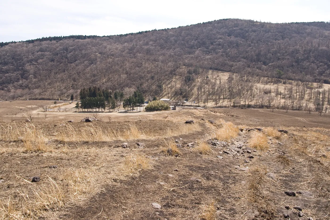

Before you leave the trailhead
- The only toilets are at the Main Trailhead parking lot, and toilet paper is not provided — bring your own (Yufu City Tourism Bureau).
- There are no vending machines or water sources on the trail. Buy drinks and food in Yufuin town before you get on the bus.
- Carry out all of your trash.
The route, landmark by landmark
The standard line, as described by Visit Oita, is: Main Trailhead → Hyugadake junction → Goyagoe → Matae → East Peak.
- Grassland and forest. The trail starts across open grassland, then enters forest with tree roots and volcanic rock underfoot.
- Hyugadake junction (日向岳分岐). About 15 minutes from the trailhead. Visit Oita advises first-time visitors to stay on the main Mount Yufu trail here, because the other path is harder to follow.
- Goyagoe (合野越). An open area used as a rest stop, and the junction for Iimorigajo. If you only want an easy walk, this is where you turn off.
- The zigzags. Above Goyagoe the trail climbs in a long series of switchbacks. The trees get lower and the view over Yufuin opens up behind you.
- Matae (マタエ). The saddle on the crater rim between the two peaks. The trail splits here for the two summits.
- East Peak. The recommended finish. Expect rocky sections and big steps near the top, and take extra care when the rock is wet.
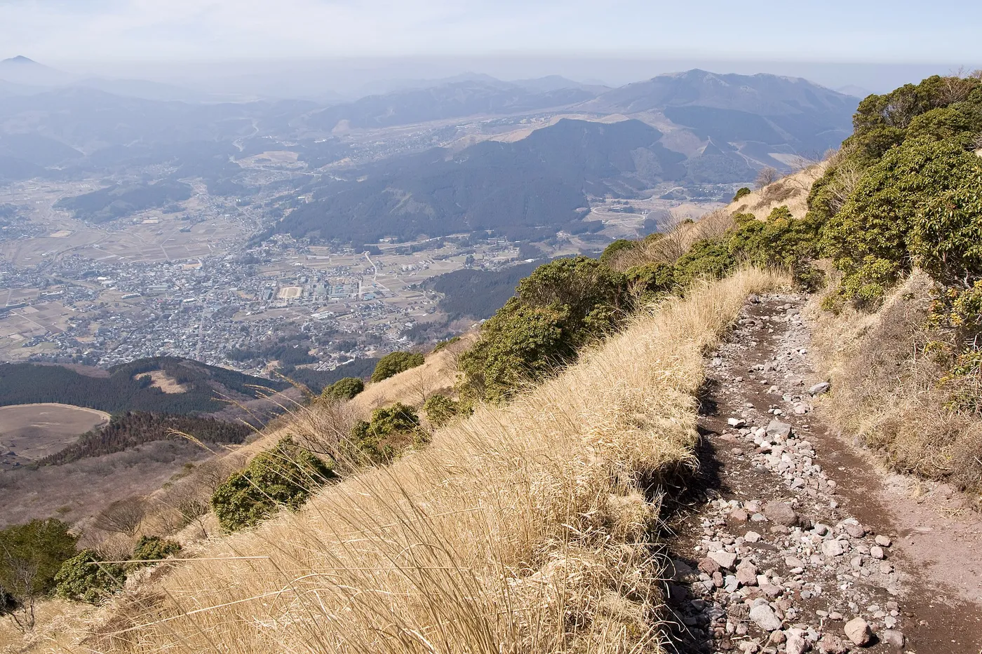

Visit Oita lists a few habits that make the climb safer and smoother on a busy day: give way to hikers coming uphill; when you let someone pass on a narrow section, step to the mountain side, not the drop side; avoid stepping on loose rocks; and be careful not to knock stones onto people below. Saying konnichiwa to passing hikers is normal, and they will often tell you about wind or poor visibility ahead.
East Peak or West Peak?
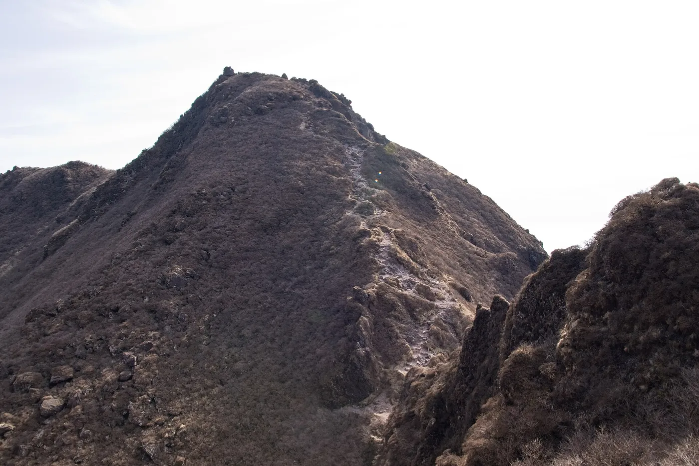

The West Peak is the highest point of the mountain, and it is where the 1,583 m figure comes from. Yufu City’s map describes the way up: hard sections at Shōjido (障子戸), including a sideways traverse along a narrow ledge known as Kani-no-yokobai (カニノヨコバイ, “the crab walk”), and chained rock. Visit Oita notes that slips and falls happen there and that casual hikers should not try it without experience and proper equipment.
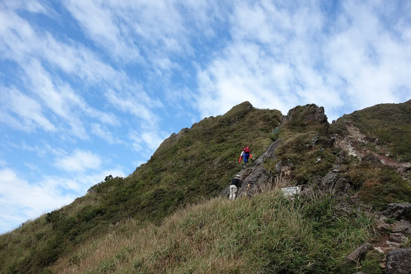

A simple rule for visitors: if you have never used fixed chains on exposed rock, or the rock is wet, or the wind is strong at Matae, choose the East Peak. Its view is just as good.
Is it safe to climb a volcano?
Mount Yufu is one of Japan’s active volcanoes, but it is quiet. The Japan Meteorological Agency (JMA) says that its last major eruptive activity was about 2,200 years ago and that there is no recorded volcanic activity in historical times (JMA, Japanese). JMA’s Fukuoka office lists Mount Yufu among the Kyushu volcanoes that are observed regularly or as needed, rather than under 24-hour monitoring, and it is not one of the volcanoes with a numbered Volcanic Alert Level (JMA Fukuoka, Japanese). You can see the current forecast on JMA’s Mount Yufu activity page.
In practice, the hazards on Mount Yufu are the ordinary mountain ones: wind, cloud, wet rock and darkness.
Late October and November on Mount Yufu
Daylight
Sunrise and sunset for Oita City from the National Astronomical Observatory of Japan (October and November tables):
| Date (2026) | Sunrise | Sunset |
|---|---|---|
| October 16 | 6:18 | 17:40 |
| October 25 | 6:25 | 17:29 |
| November 1 | 6:31 | 17:22 |
| November 10 | 6:39 | 17:15 |
| November 20 | 6:49 | 17:09 |
| November 30 | 6:58 | 17:06 |
Visit Oita allows about six hours for the East Peak with breaks. Count six hours back from sunset, then add the time you need to catch a bus. In November that means a morning start; Visit Oita’s first safety tip is simply “start early”. Carry a headlamp anyway.
Weather and clothing
The Yufu City Tourism Bureau points out two things that catch people out. There is almost no shade near the summit, so sun protection matters even on a cool day, and cloud often sits only on the top of the mountain, cutting visibility in the upper section while the town below stays clear (Yufu City Tourism Bureau). Visit Oita adds that the summit can be windy, cold and misty when the trailhead feels warm, and that you should be ready to turn back.
Yufu City’s route map gives a packing list that works well for late autumn:
- Shoes: trekking shoes with thick soles.
- Hands free: you will hold onto rock in places, so carry everything in a backpack; the map suggests work gloves.
- Layers: quick-drying synthetic base layers rather than cotton, which chills you when wet; a warm mid-layer such as fleece or a light down jacket; and a jacket that blocks wind and rain.
- A warm hat that stays on in wind and covers your ears, and gloves.
- In the pack: water, lunch and emergency food, warm and rain clothing, a change of clothes, and a small first-aid kit.
Visit Oita also recommends trekking poles, a map or offline navigation app, and a charged phone. For the colder months, Yufu City’s map describes hoarfrost in winter, and Visit Oita says winter conditions need more experience and the right equipment. If you are visiting late in the season, check conditions with the Yufu City Tourist Information Center before you go.
Climbing plan and emergencies
Oita Prefectural Police accept climbing plans (登山届, tozan-todoke) and ask hikers to submit one so that rescuers know where to look; filing online or through an app covers every mountain in the prefecture (Oita Prefectural Police, Japanese). You can file it:
- online, including through the apps Compass and YAMAP, both of which have agreements with Oita Prefecture and the prefectural police;
- at major trailheads in the prefecture, where you can fill one in on site; or
- with the police station responsible for the mountain.
The police also remind hikers that phones may not get a signal everywhere in the mountains. In an emergency, dial 110 (police) or 119 (fire and ambulance). For how rescues and insurance work in Japan, see our Japan hiking basics for visitors.
After the hike: Yufuin and its hot springs

The bus drops you back at Yufuin Ekimae Bus Center, in the middle of one of Japan’s best-known onsen towns. According to the Yufu City Tourism Bureau, Yufuin Onsen has about 850 hot-spring sources, heated by the Kuju and Yufu–Tsurumi volcanoes, with water ranging from mild alkaline springs to sodium chloride springs that can turn bluish or milky (Yufu City Tourism Bureau — Onsen, Japanese). Day bathing is offered at a number of facilities in town, and the Yufu City Tourist Information Center can point you to one that is open when you get down.
One small cost to expect: Yufu City charges a bathing tax (入湯税). For day bathing at facilities that charge 400 yen or more (before consumption tax), it is 70 yen per person; children under 12 are exempt.
If you have a car and want something stronger, the same page describes Tsukahara Onsen (塚原温泉), fed by the volcano Mount Garan (伽藍岳): a strongly acidic spring of about pH 1.8.
Fitting Mount Yufu into a Kyushu trip
- Staying in Yufuin: the simplest plan. Take an early route 36 bus up, hike, and bathe in town in the afternoon.
- Staying in Beppu: route 36 starts at Beppu Station West Exit and also stops at Yufu Tozanguchi, so you can hike without changing buses and return to Beppu, or ride on to Yufuin first.
- Coming from Fukuoka: Yufuin Station is on the JR Kyudai Line, and Kamenoi Bus also runs the Yufuin highway bus between Yufuin and Fukuoka (Hakata, Tenjin and Fukuoka Airport). Arriving the evening before and hiking the next morning leaves the most daylight.
Related guides on Yama Nikki
- Japan hiking basics for visitors — climbing plans, emergency numbers, rescue costs and insurance.
- Nasudake and Chausudake hiking guide — another active volcano with a hot-spring town at its foot, in Tochigi.
- Mount Bandai trailheads guide — a volcano in Fukushima with several ways up.
- Mount Rokko to Arima Onsen — a hike that ends in a hot-spring town near Kobe.
References
- Yufu City — Mount Yufu hiking route map (Japanese and English PDFs)
- Yufu City — Mount Yufu hiking map, English (PDF)
- Yufu City — Mount Yufu hiking map, Japanese (PDF)
- Yufu City Tourism Bureau — Mount Yufu Hiking Map and “Before You Hike”
- Yufu City Tourism Bureau — Onsen and bathing tax (Japanese)
- Visit Oita — Hiking Mount Yufu: A Rewarding Day Hike with an Onsen Finish
- Visit Oita — Mt. Yufu
- Tourism Oita — Yufudake (Japanese)
- Kamenoi Bus — Route timetables (Japanese)
- Kamenoi Bus — Fare table effective October 17, 2026 (Japanese PDF)
- Kyushu Regional Development Bureau — Yufudake trailhead parking (Japanese)
- Japan Meteorological Agency — Yufudake (Japanese)
- Japan Meteorological Agency — Yufudake volcanic activity (Japanese)
- Fukuoka Regional Headquarters, JMA — Volcano monitoring in Kyushu and Yamaguchi (Japanese)
- National Astronomical Observatory of Japan — Sunrise and sunset, Oita, October 2026 (Japanese)
- National Astronomical Observatory of Japan — Sunrise and sunset, Oita, November 2026 (Japanese)
- Oita Prefectural Police — Climbing plans (Japanese)
- Oita Prefecture — Using Compass for climbing plans (Japanese)
- Compass — Online climbing plans (Japanese)
- YAMAP