

Photo: KENPEI, Wikimedia Commons (CC BY 3.0). Weathered granite in the Ashiya Rock Garden, October 16, 2010.

Mount Rokko to Arima Onsen: Hiking Over Kobe's Mountain from the Rock Garden to a Hot-Spring Bath, with Ropeway Options and November Tips
An English guide to crossing Mount Rokko (六甲山, 931 m) between Osaka and Kobe and finishing in the hot-spring town of Arima Onsen. Covers the classic route from Hankyu Ashiyagawa Station through Takaza Falls, the Ashiya Rock Garden and Kazafuki-iwa to the highest peak, the Totoyamichi trail down to Arima, the Rokko Cable Car and Rokko-Arima Ropeway if you would rather ride, Kin no Yu and Gin no Yu fees and closing days, November sunsets and autumn leaves, wild boars, and how to get back to Kobe.
This guide draws on Visit Hyogo (Hyogo Prefecture’s official tourism site), Ashiya City’s Rock Garden page, Kobe City’s advice for hikers, the Rokko-Arima Ropeway operator, the Kin no Yu and Gin no Yu official site, and the Arima Onsen Tourism Association. Fares, hours and closing days change, so open the linked pages before you set out.
Most mountains in Japan make you choose between a hike and a hot spring. Mount Rokko (六甲山, Rokkō-san) lets you do both in one line on the map: you start at a suburban train station between Osaka and Kobe, scramble up granite boulders above the city, cross the highest peak at 931 m, and walk down the far side into Arima Onsen (有馬温泉), one of Japan’s oldest hot-spring towns. Visit Hyogo calls the Rock Garden route to the highest peak the most popular of the many trails on the mountain.
And if your legs or the weather say no, a cable car, a mountaintop bus and a ropeway cover the same crossing without a single step of trail.
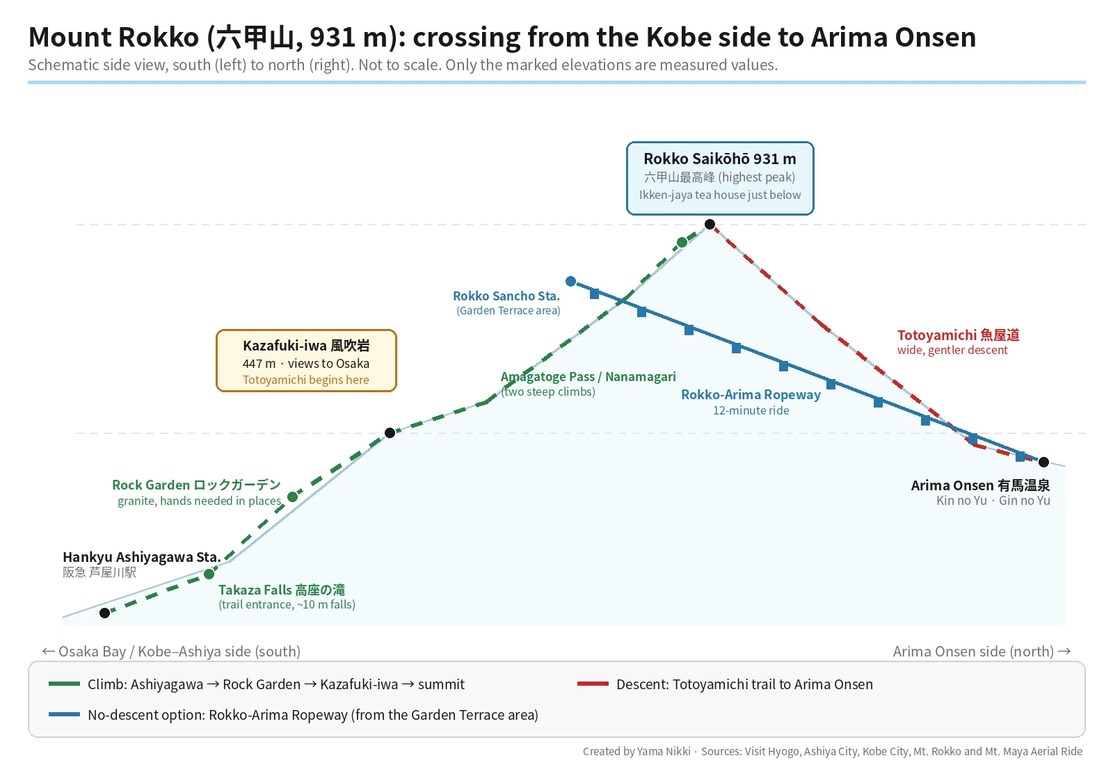
Three ways to cross the mountain
| A. Full crossing on foot | B. Ride up, walk down | C. Ride all the way | |
|---|---|---|---|
| Route | Ashiyagawa Sta. → Takaza Falls → Rock Garden → Kazafuki-iwa → highest peak → Totoyamichi → Arima Onsen | Rokko Cable Car and Rokko Sanjo Bus to the mountaintop, walk to the highest peak, descend the Totoyamichi | Rokko Cable Car → Rokko Sanjo Bus → Rokko-Arima Ropeway (12 minutes) to Arima Onsen |
| What it asks of you | A full hiking day; rocky sections where you use your hands, plus chains and ladders on steep rock | The descent only, on a wide trail | Nothing beyond station stairs |
| Watch out for | Many trail junctions; daylight in November | Ropeway and bus last departures if you change your mind | Wind can stop the ropeway |
| Good for | Fit hikers with proper shoes | Hikers short on time or nervous about rock | Non-hikers, rainy days, families |
For the full crossing, the published figures differ a little: Visit Hyogo gives about five hours of hiking for the Rock Garden route, while Yamakei’s Hikes in Japan lists 12.3 km, about 900 m of elevation gain and four hours of walking from Ashiyagawa to Arima. Plan around the longer figure and add your breaks on top.
Before you start: Ashiyagawa Station
The classic start is Hankyu Ashiyagawa Station (阪急芦屋川駅) on the Hankyu Kobe Line, which runs between Osaka-umeda and Kobe-sannomiya. There is no parking near the Rock Garden, so Ashiya City asks drivers to use coin parking near Hankyu Ashiyagawa or JR Ashiya Station and walk in (Ashiya City FAQ). The city also notes that despite the name, the “garden” is simply the area of exposed, weathered granite along the hiking trails — there are no gardens, gates or facilities.
If you are short on gear, Trail Station Kobe (“Toreko”) inside JR Shin-Kobe Station rents hiking equipment at a flat 550 yen per item, stores baggage, sells maps and has staff who know the local trails. From March to November it opens on Mondays, Thursdays to Sundays and holidays, 8:30–12:00 and 13:00–17:30 (closed Tuesdays and Wednesdays) (Trail Station Kobe).
Bring a printed or offline map. The Rokko Visitor Center publishes a hiking map with 22 numbered courses; course 18 is Ashiyagawa → Rock Garden → highest peak, and course 17 is the Totoyamichi (from Hanshin Fukae Station to Arima).
Stage 1: Takaza Falls and the Rock Garden
From the station’s mountain-side exit, Ashiya City describes the way: follow the Takaza-no-taki-michi (高座の滝道) north along the Ashiya River, with signs reading “高座の滝・ロックガーデン” (Takaza Falls / Rock Garden) at each turn, through a residential area to a tunnel marked “Rock Garden” and on to Takaza Falls (高座の滝), a 10 m waterfall that was once a training site for mountain ascetics (Ashiya City). On the rock face to the left of the falls is a relief of Fujiki Kuzō (藤木九三), a pioneer of modern Japanese climbing who gave the Rock Garden its name (Ashiya City map guide). Hikes in Japan puts this walk at about 30 minutes and mentions two tea houses and a toilet at the falls.
Cross the wooden bridge at the falls and the real trail begins. What to expect, according to Ashiya City:
- Boulders all the way up the central ridge. You pick your footholds one by one; at a large white rock face you can either take the stepped path around it or climb straight up using hand- and footholds.
- Chains and tall ladders on the steepest rock.
- Several junctions. At each one, follow signs for 風吹岩 (Kazafuki-iwa). Ashiya City’s own guide tells hikers to carry a map and compass.
Kobe City’s beginner guidebook for Rokko adds a warning that matters for visitors: if you wander onto paths that the signposts do not show, or simply follow the person in front of you, you can end up on an advanced route without noticing (Kobe City guidebook, Japanese PDF). The same guide says that on ordinary routes there is always an easy place to get up a rocky section — don’t force a climb; look around for it.
Stage 2: Kazafuki-iwa to the highest peak
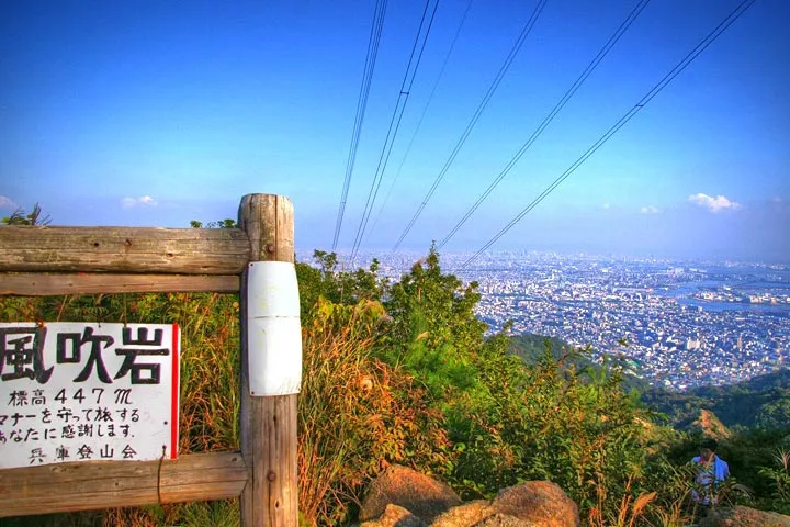

Above the rocks, the trail enters forest and reaches Kazafuki-iwa (風吹岩, “wind-blown rock”), a granite outcrop at 447 m. On clear days the view runs from Kobe across to Osaka (Visit Hyogo). Kobe City’s guidebook mentions that the rock is crowded at lunchtime and suggests the pond a little to the north, Yokoike (横池), as a quieter place to eat.
From here the path to Arima is the Totoyamichi (魚屋道, “fishmongers’ road”). Hikes in Japan explains that it was an Edo-period route for carrying seafood up to Arima about 400 years ago. Heading north, you pass two steep sections, Amagatoge Pass (雨ヶ峠) and Nanamagari (七曲り, “seven bends”), before reaching Ikken-jaya (一軒茶屋), which Hikes in Japan calls the oldest tea house on the mountain. The highest peak is about five minutes up the road from there.
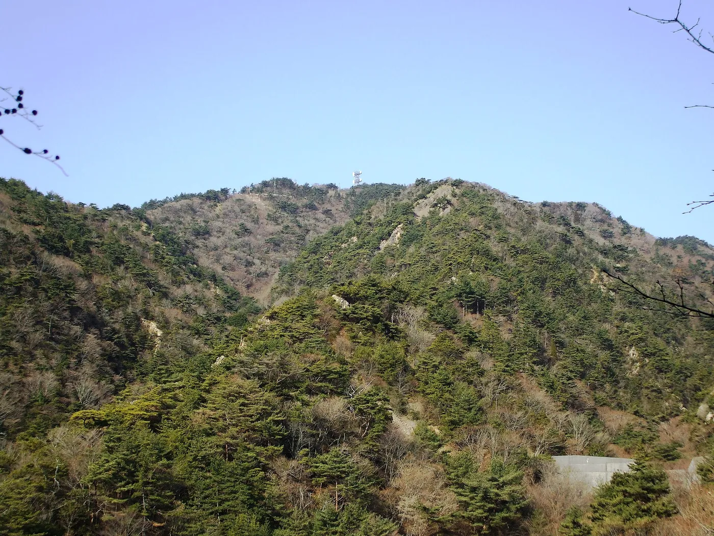

Rokko Saikōhō (六甲山最高峰), the highest peak, stands at 931 m, with views north over Arima (Visit Hyogo). The Access to Mt. Rokko site, linked from Kobe City’s pages, notes that the peak sits about 2 km east of the main tourist area on top of the mountain (kobe-rokko.jp) — useful to know if you are planning to walk over to the ropeway instead of descending on foot.
Stage 3: Down the Totoyamichi to Arima
Go back down to Ikken-jaya and pick up the Totoyamichi heading north. Hikes in Japan describes this side as wide and gentle. It is still a mountain trail, so keep an eye on signposts at junctions — Hikes in Japan’s route notes repeat that Rokko has so many trails that mistakes happen at forks.
The trail ends in Arima Onsen town, where the bathhouses are a short walk away. Rokko has other ways down to Arima, but the Totoyamichi is the one Visit Hyogo, Hikes in Japan and the Rokko Visitor Center map all feature, which makes it the natural choice for a first visit.
Riding instead: Rokko Cable Car, Sanjo Bus and Rokko-Arima Ropeway
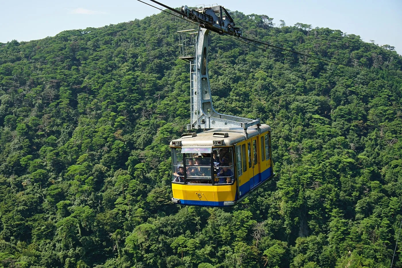

The ropeway connects Rokko Sancho Station (六甲山頂駅, in front of Rokko Garden Terrace) with Arima Onsen Station in a 12-minute ride, normally every 20 minutes, and it can be suspended in strong wind. The operator’s page also lists the cable car up from the Kobe side and the mountaintop bus that links the two.
| Service | Hours in autumn | Adult fare |
|---|---|---|
| Rokko Cable Car (Rokko Cable Shita ↔ Rokko Sanjo) | First 7:10, last 21:10, every 20–30 min | 800 yen one way / 1,550 yen round trip |
| Rokko Sanjo Bus Route 1 (Ropeway Sancho Sta. → Rokko Cable Sanjo Sta.) | First 9:53, last 17:33, every 20–40 min | 370 yen for the full ride |
| Rokko-Arima Ropeway (Rokko Sancho ↔ Arima Onsen) | From 9:30. Sept 1–Nov 30: last departure 17:30 on weekdays, 19:10 on holidays | 1,400 yen one way / 2,520 yen round trip |
All figures are from the operator’s hours and fares page. Two details for late autumn:
- November 2–30, 2026: the last weekday ropeway departure is extended to 18:10.
- From December 1: winter hours begin, with the last departure at 17:10 every day.
Children aged 6 to 11 pay half fare on the ropeway, and seniors aged 70 or over get 20% off with official ID. Kobe’s official tourism site, Feel Kobe, also introduces combination tickets for this crossing, such as the Rokko-Arima one-way ticket (Feel Kobe model course, Japanese).
The ropeway also works as a safety valve for hikers. If you reach the highest peak later than planned, walking west to Rokko Sancho Station and riding down is an option — but only before the last departure.
Arima Onsen: which bath to choose
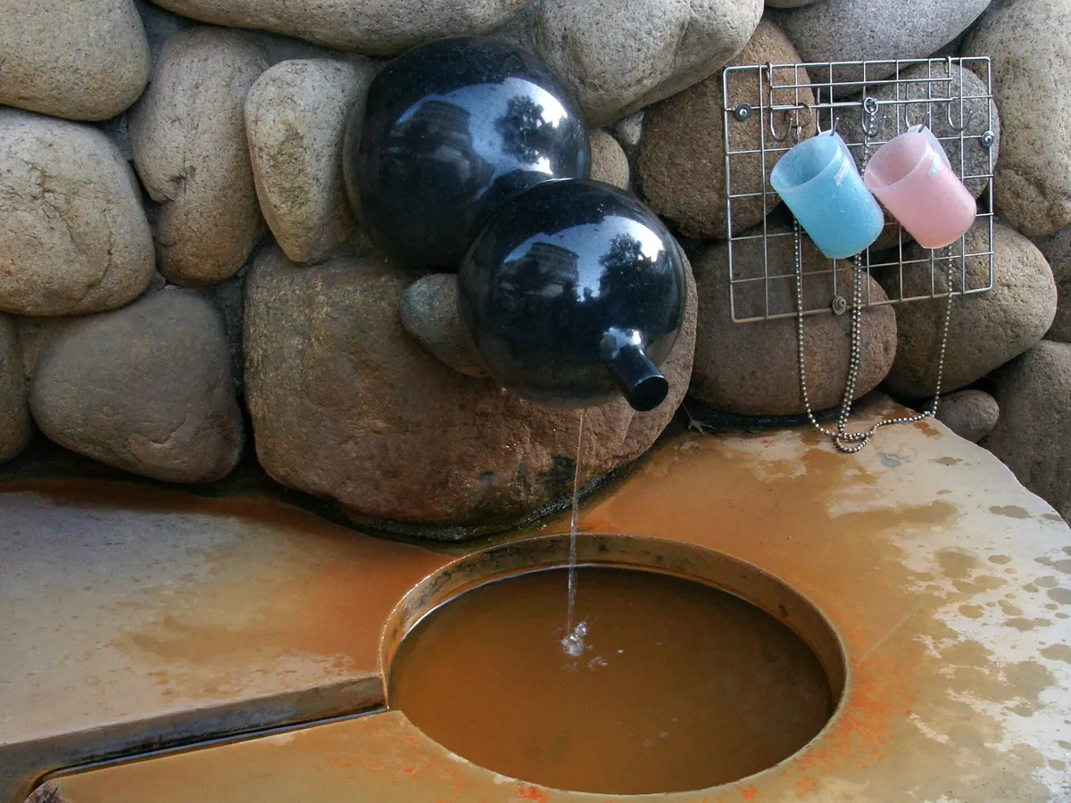

Arima has two kinds of water: the iron-rich, brown kinsen (金泉, “gold water”) and the clear ginsen (銀泉, “silver water”). Two public bathhouses run by the same operator let day visitors try each one (Kin no Yu / Gin no Yu official site).
| Kin no Yu (金の湯) | Gin no Yu (銀の湯) | |
|---|---|---|
| Water | Kinsen (brown) | Ginsen (clear) |
| Adults | 800 yen (650 yen on weekdays) | 700 yen (550 yen on weekdays) |
| Elementary and junior high students | 350 yen | 300 yen |
| Hours | 8:00–22:00, last entry 21:30 | 9:00–21:00, last entry 20:30 |
| Closed | 2nd and 4th Tuesdays, and January 1 | 1st and 3rd Tuesdays, and January 1 |
| Two-bath ticket | 1,200 yen covers both |
Prices and closing days are from the official pages for Kin no Yu and Gin no Yu; hours are from the operator’s notices and the Arima Onsen Tourism Association. If a closing Tuesday is a public holiday, the bath opens and closes the next day instead. Because the two close on different Tuesdays, at least one is usually open. Both may limit entry when crowded, and Kin no Yu has a free footbath outside that follows its opening hours — a good option if you arrive muddy and only have a few minutes.
Late October and November on Rokko
Daylight
The biggest planning change in late autumn is how early it gets dark. Sunrise and sunset times for Kobe from the National Astronomical Observatory of Japan (October and November tables):
| Date (2026) | Sunrise | Sunset |
|---|---|---|
| October 15 | 6:04 | 17:25 |
| November 1 | 6:19 | 17:06 |
| November 15 | 6:33 | 16:55 |
| November 30 | 6:47 | 16:49 |
Under trees and on the north side of the mountain, it gets dark before the official sunset. For the full crossing in November, aim to leave Ashiyagawa in the morning so that you are on the descent by early afternoon, and carry a headlamp either way — Kobe City lists a light among the basic items for every hike (Kobe City).
Autumn leaves at Zuihoji Park
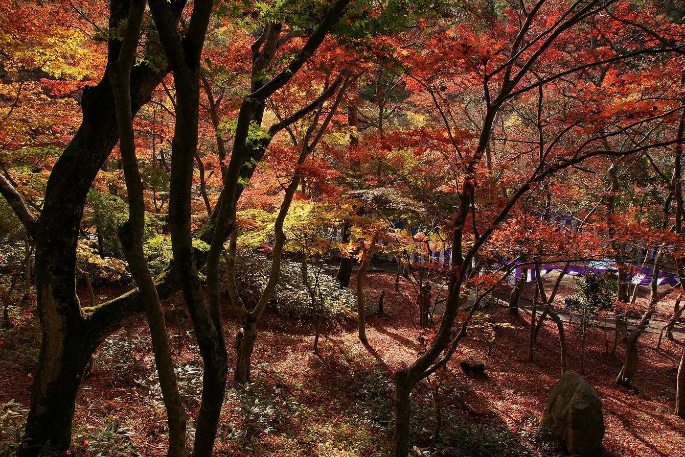

Zuihoji Park (瑞宝寺公園), on the hillside at the east end of Arima, is the town’s best-known autumn-leaf spot — a former temple whose gate, said to have been moved from Fushimi Castle, still stands. The Arima Onsen Tourism Association says that in November a seasonal tea house, Momiji-chaya (もみじ茶屋), opens; that the Arima Grand Tea Ceremony (有馬大茶会) holds an outdoor tea session there on November 2 and 3; and that traffic restrictions apply around the park during November. The park is a 20-minute walk from Kobe Electric Railway’s Arima Onsen Station and has no parking (Arima Onsen Tourism Association).
Clothing
Kobe City recommends long sleeves and long trousers year-round, quick-drying base layers, and warm layers, gloves and rain gear in your pack, because mountain weather changes quickly. It also points out that fallen leaves and branches make the trail slippery — worth remembering on the descent in November.
Wildlife and safety on a city mountain
Rokko feels close to the city, but Kobe City reports around 100 mountain rescues a year, mostly in the Rokko range, many of which preparation could have prevented (Kobe City). Points specific to this mountain:
- Wild boars (イノシシ) are common. Kobe City says meeting one is not unusual; back away slowly. Never feed them: in parts of Higashinada, Nada and Chuo wards, feeding wild boars — or carelessly leaving food or rubbish they could eat — is banned under a city ordinance. If a boar seems to be after your food, keep bags closed and hold them away from your body (Kobe City wild boar page).
- Hornets. Don’t swat at them; if you get close to a nest, crouch low and move away slowly.
- Yellow “119 plates.” These numbered plates along the trails help rescuers find you; read the number to the operator when you call 119.
- Bears. Kobe City posted an alert after a bear was caught on a sensor camera in Dōjō-chō in Kita Ward, in the north of the city. For general bear precautions, see our bear safety guide.
- Climbing plans. Submitting one is not required in Hyogo, but the Hyogo Prefectural Police encourage it and accept plans online through Compass, the system run by the Japan Mountain Guides Association (Hyogo Prefectural Police).
Take your rubbish home, and give way on narrow sections — uphill hikers generally have priority.
Getting back from Arima
- Shinki Bus to Sannomiya: about 25 minutes, 600 yen for adults, from the Arima Onsen (Taiko Bridge) stop to the Shinki Bus Kobe Sannomiya Bus Terminal. There are only about 7 departures a day from Arima, so check the timetable before your bath (Shinki Bus).
- Kobe Electric Railway (Shintetsu): trains also run from Arima Onsen Station toward central Kobe; Zuihoji Park is about 20 minutes on foot from the station.
Related guides on Yama Nikki
- Japan hiking basics for visitors — emergency numbers, rescue costs and insurance.
- Bear safety for hikers in Japan
- Tateyama Kurobe Alpine Route in late autumn 2026 — another crossing by ropeway, in the Northern Alps.
- Mount Oyama day trip from Tokyo — a cable car, a shrine and a summit loop near Tokyo.
Japanese-language guide on this site (useful for kanji names): 関西GW日帰り登山おすすめ10選, which includes Mount Rokko.
References
- Visit Hyogo — Retreat into Nature in Kobe and Awaji Island (Mount Rokko hiking)
- Ashiya City — Ashiya Rock Garden (Japanese)
- Ashiya City — FAQ: Ashiya Rock Garden admission and parking (Japanese)
- Ashiya City — Historic sites map: Takaza Falls and the Fujiki Kuzō relief (Japanese)
- Kobe City — For everyone hiking in Kobe (Japanese)
- Kobe City — Beginner’s guidebook to Mount Rokko (Japanese PDF)
- Kobe City — Wild boar damage prevention (Japanese)
- Access to Mt. Rokko — Mountain hike!
- Access to Mt. Rokko — Trail Station Kobe (Toreko)
- Rokko Visitor Center — Hiking trails (English page)
- Mt. Rokko and Mt. Maya Aerial Ride — Rokko-Arima Ropeway hours and fares
- Feel Kobe — Mount Rokko and Arima Onsen one-day crossing (Japanese)
- Kin no Yu (official, Japanese)
- Gin no Yu (official, Japanese)
- Visit Arima Onsen — Gin no Yu
- Arima Onsen Tourism Association — Zuihoji Park (Japanese)
- National Astronomical Observatory of Japan — Sunrise and sunset, Kobe, October 2026 (Japanese)
- National Astronomical Observatory of Japan — Sunrise and sunset, Kobe, November 2026 (Japanese)
- Hyogo Prefectural Police — Do I need to submit a climbing plan? (Japanese)
- Compass — Online climbing plans (Japanese)
- Shinki Bus — Sannomiya–Arima Onsen
- Hikes in Japan (Yamakei) — From Ashiya Rock Garden to Arima Onsen via the Totoya Trail