
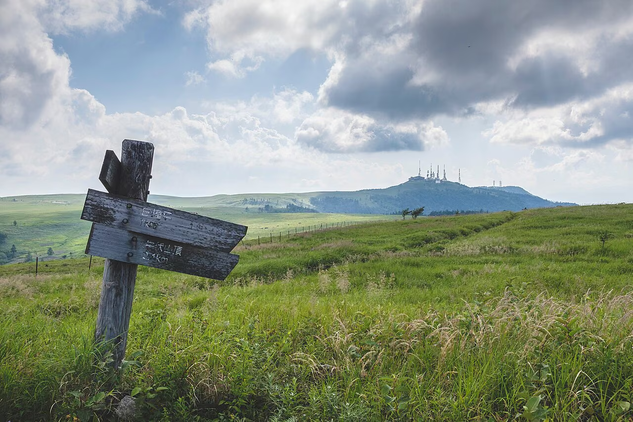
Photo: MitsunoriEgawa, Wikimedia Commons (CC BY 4.0)

Utsukushigahara Highland (Mt. Ogatou, 2,034 m) Hiking Guide: 2,000 m Lava Plateau, Venus Line Access, Trail Courses & 2026 Road Closure Notice
Complete guide to hiking Utsukushigahara Highland (highest point: Ogatou, 2,034 m) in Nagano Prefecture, one of Japan's 100 Famous Mountains. Covers the flat pasture walk from Yamamotogoya, the Utsukushigahara Nature Conservation Center route, the Mijo Pasture climb, the Open-Air Museum, and 2026 road closure notices.
Utsukushigahara Highland (美ヶ原高原) is Japan's broadest high-altitude volcanic lava plateau, spreading across Matsumoto City, Ueda City, and Nagawa Town in central Nagano Prefecture at an elevation of roughly 2,000 meters. Crowned by its highest point, Ogatou (王ヶ頭, 2,034 m), and selected as one of the 100 Famous Mountains of Japan (Nihon Hyakumeizan), Utsukushigahara offers a landscape unlike any other peak on the list: wide alpine cattle pastures, the iconic white bell tower of Utsukushi-no-To (美しの塔), the Utsukushigahara Open-Air Museum, and a 360-degree panorama encompassing roughly 40 of Japan's 100 Famous Mountains—from the Northern, Central, and Southern Alps to Yatsugatake, Mt. Asama, and Mt. Fuji.
Because paved highland roads reach parking areas at roughly 1,900–2,000 m on both sides of the plateau, you can walk to the 2,034 m summit of Ogatou with only ~50–150 meters of elevation gain, or choose a traditional 500-meter forest-to-plateau climb from Mijo Pasture (三城牧場, ~1,500 m).
Important 2026 Road Closure & Access Rule (Checked October 24, 2026 via Matsumoto City & Yamamotogoya Official Notices):
- Private vehicles cannot drive across the summit plateau: The western trailhead (Utsukushigahara Nature Conservation Center / Utsukushi Terrace on the Matsumoto/Misuzuko side) and the eastern trailhead (Roadside Station Utsukushigahara Kogen / Open-Air Museum and Nagawamachi Municipal Parking Lot at Yamamotogoya Furusatokan on the Venus Line side) lie on opposite sides of Ogatou (2,034 m). Only pedestrians can cross between them (~100–120 minutes on foot one way).
- Azalea Line / Yomogikoba Forest Road Closure (Oct 19, 2026 – Spring 2027): According to Matsumoto City's official road closure notice, Yomogikoba Forest Road (Azalea Line, from ~1 km above Mijo Ikoi-no-Hiroba to Tobira Pass) is closed all day from Monday, October 19, 2026 through December 25, 2026 for retaining-wall repair work, and remains closed directly into the winter road closure period until mid-April. During this period, cars from central Matsumoto cannot reach the Venus Line / Yamamotogoya / Open-Air Museum via Mijo and Tobira Pass (you can still drive up to Mijo Ikoi-no-Hiroba for the Mijo trail, or reach the western trailhead at Utsukushigahara Nature Conservation Center via Misuzuko until late November). To reach Yamamotogoya or the Open-Air Museum by car, approach via Chuo Expressway Okaya IC → Route 142 (Shin-Wada Tunnel) → Wada-shuku Honjin-iriguchi → Prefectural Route 178 / Venus Line (or via Route 254 Misayama Tunnel from Matsumoto).
Utsukushigahara Basic Information
| Item | Details |
|---|---|
| Highest Peak | Ogatou (王ヶ頭, 2,034 m) (plus Ogahana 2,008 m, Chausuyama, Uribuseyama 1,990 m) |
| Location | Matsumoto City, Ueda City & Nagawa Town, Nagano Prefecture (Yatsugatake Chushin Kogen Quasi-National Park) |
| Difficulty | Beginner (Plateau routes from Yamamotogoya or Nature Conservation Center) to Lower-Intermediate (Mijo Pasture climb) |
| Main Trailhead Parking Lots | 1. Venus Line / Eastern Side: • Nagawamachi Municipal Parking Lot (長和町営駐車場) in front of Yamamotogoya Furusatokan (~2,000 m, free, ~60 cars) • Utsukushigahara Daijo Parking Lot (美ヶ原台上駐車場) at Roadside Station / Open-Air Museum (~2,000 m, free, ~800 cars) 2. Matsumoto / Western Side: • Utsukushigahara Nature Conservation Center Parking Lot (美ヶ原自然保護センター駐車場) (~1,900 m, free, ~150 cars) 3. Foothill Climb: • Mijo Ikoi-no-Hiroba / Mijo Pasture (三城牧場) (~1,500 m, free) |
| Mountain Lodges & Facilities | Ogatou Hotel (summit lodge), Yamamotogoya Furusatokan (lodge/cafe/shop at 2,000 m), Utsukushigahara Kogen Hotel Yamamotogoya, Utsukushi Terrace (at Nature Conservation Center) |
Three Ways to Hike Utsukushigahara
Course 1: Yamamotogoya Furusatokan (Nagawamachi Parking) → Utsukushi-no-To → Ogatou & Ogahana (Most Popular Beginner Walk)
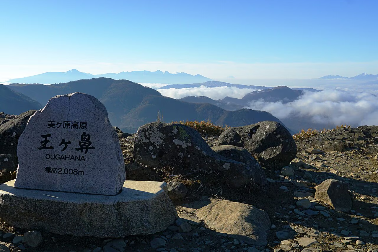
Starting from the Nagawamachi Municipal Parking Lot in front of Yamamotogoya Furusatokan (~2,000 m) on the Venus Line side, you walk along an almost flat gravel pasture road past grazing cattle and the white stone bell tower of Utsukushi-no-To (美しの塔) to the summit of Ogatou (2,034 m) and the cliff-edge viewpoint of Ogahana (王ヶ鼻, 2,008 m).
| Waypoint | Elevation | Segment Time (Approx.) |
|---|---|---|
| Yamamotogoya Furusatokan (Nagawamachi Parking) | ~2,000 m | — |
| Utsukushi-no-To Bell Tower (美しの塔) | ~2,000 m | ~15–20 min |
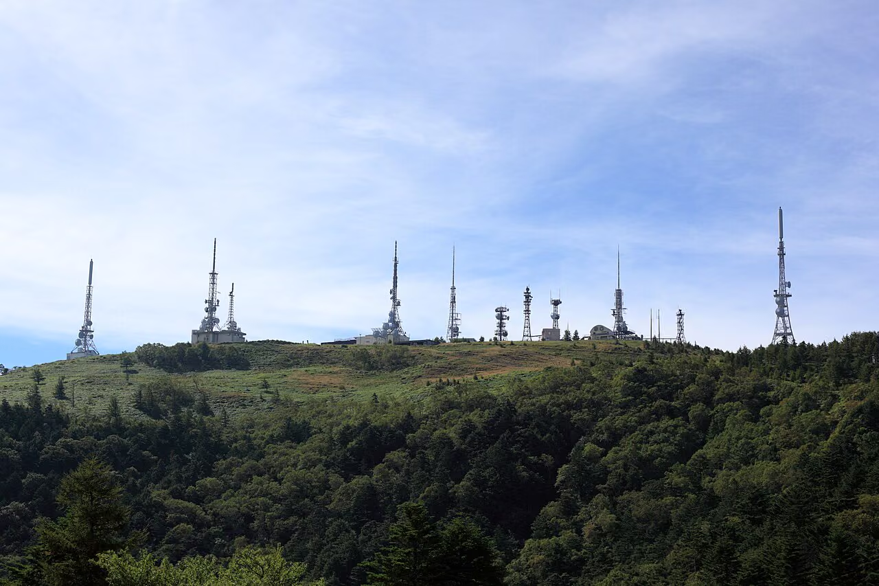
| Ogatou Summit (王ヶ頭) | 2,034 m | ~40–45 min (via pasture road or Shiozawa ridge path) |
| Ogahana Viewpoint (王ヶ鼻) | 2,008 m | ~20–25 min from Ogatou |
- Total Walking Time: ~2h 00m–3h 00m round trip (approx. 6–8 km depending on whether you loop via Ogahana and the Shiozawa ridge trail)
- Cumulative Elevation Gain: ~50–100 m
- Note from Matsumoto City Official Guide: Walking all the way across the plateau between Roadside Station Utsukushigahara Kogen (Open-Air Museum) and Utsukushigahara Nature Conservation Center via Utsukushi-no-To and Ogatou takes ~100–120 minutes one way (~70–90 minutes between the Nature Conservation Center and Utsukushi-no-To). If you want the shortest walk directly to Ogatou and Ogahana from the Matsumoto side, you can also park at the Utsukushigahara Nature Conservation Center (open until the late-November winter road closure).



Course 2: Mijo Pasture (三城牧場) Climb (~1,500 m → 2,034 m)
If a flat pasture stroll feels too short and you prefer a genuine mountain climb through larch and broadleaf forest before emerging onto the 2,000 m tableland, start at Mijo Pasture / Mijo Ikoi-no-Hiroba (~1,500 m) on the Matsumoto side.
- Route: Mijo Parking (~1,500 m) → (~60 min) → Eboshi-iwa Junction (~1,750 m) → (~50 min) → Plateau Rim (~1,950 m) → (~15 min) → Utsukushi-no-To → (~25 min) → Ogatou Summit (2,034 m) → Return to Mijo
- Walking Time & Gain: ~4h 00m–5h 00m round trip (approx. 10 km, ~500 m cumulative elevation gain)
- Road Access Note: Even during the Oct 19 – Dec 25, 2026 Yomogikoba Forest Road closure (which begins ~1 km above Mijo Ikoi-no-Hiroba), Matsumoto City confirms that vehicles can still drive up as far as the Mijo Ikoi-no-Hiroba area before winter snow closures begin.
Course 3: Utsukushigahara Open-Air Museum (美ヶ原高原美術館) & Plateau Walk
At the eastern end of the plateau (at the terminus of the Venus Line) sits the Utsukushigahara Open-Air Museum, opened in June 1981 as the sister museum of the Hakone Open-Air Museum, with more than 250–350 modern outdoor sculptures set across an alpine meadow overlooking the Japan Alps.
- 2026 Opening Period & Hours: Saturday, April 25 – Tuesday (Holiday), November 3, 2026 (open daily during season), 9:00–17:00 (last entry 16:30).
- Official Admission Fee (2026): Adults (junior high school & older): 1,000 yen | Children (elementary school): 500 yen (Cash or QR payments such as PayPay/d-barai/auPay/Merpay only; credit cards are not accepted).
- Parking: Utsukushigahara Daijo Parking Lot (800 spaces, free).
Road Access & Winter Closure Rules
1. By Car (Recommended)
- To the Eastern / Venus Line Side (Yamamotogoya Furusatokan & Open-Air Museum):
- From Tokyo, Nagoya, or Kansai (Osaka/Kyoto): Take the Chuo Expressway to Okaya IC (岡谷IC) → Route 142 (via Shin-Wada Tunnel, ~45 min) → turn left at Wada-shuku Honjin-iriguchi (和田宿本陣入口) onto Prefectural Route 178 / Venus Line (~30 min) to Nagawamachi Municipal Parking Lot (Yamamotogoya Furusatokan) or Roadside Station Utsukushigahara Kogen.
- Alternatively, during the green season (late April to mid-November), drive the scenic Venus Line north from Suwa IC via Kirigamine (Mt. Kurumayama, 1,925 m)—allowing you to combine two Nihon Hyakumeizan peaks (Utsukushigahara and Kirigamine) in a single day.
- To the Western / Matsumoto Side (Utsukushigahara Nature Conservation Center):
- From Nagano Expressway Matsumoto IC, drive via Asama Onsen and Lake Misuzuko along the Utsukushigahara Skyline (Forest Road Utsukushigahara Line) (~75 min from Matsumoto IC; note partial single-lane alternating traffic between Misuzuko and Takeshi Pass through November 30, 2026).
- Winter Road Closures (Mid/Late November – Mid/Late April):
- The Venus Line (Yashima Wetland to Ochiai Bridge), Azalea Line, Prefectural Route 67, and the Misuzuko → Nature Conservation Center road close for winter from mid/late November until mid/late April.
- According to Visit Matsumoto and Yamamotogoya Furusatokan, in winter only Prefectural Route 178 from Wada-shuku up to Nagawamachi Municipal Parking Lot (Yamamotogoya) remains open (strictly requiring 4WD/AWD vehicles with winter tires and chains; 2WD cars, normal tires, and EVs are not permitted in winter).
2. By Public Transit (Summer Seasonal Buses Only)
Direct buses from JR Matsumoto Station (to Utsukushigahara Nature Conservation Center) and from Ueda Station (to the Open-Air Museum) operate only on limited summer dates. Always check current seasonal bus schedules on the Alpico Group official website and Utsukushigahara Open-Air Museum news page.
Clothing, Weather & Plateau Safety Tips
- Thick Highland Fog & Disorientation: Utsukushigahara is famous for sudden, dense fog—especially in the afternoon—which is why the Utsukushi-no-To bell tower was originally built to guide lost travelers by sound. Keep a GPS map app running and carry a mobile power bank.
- Wind & Cold at 2,000 Meters: With no trees across the flat lava plateau to block the wind, even a midsummer breeze feels chilly, and spring/autumn temperatures drop close to freezing. Pack a windproof rain jacket and pants, a fleece or light down mid-layer, gloves, and sun protection (layering guide).
- Keep a Respectful Distance from Grazing Cattle: From June to October, cattle graze across the fenced pastures alongside the walking path. Walk quietly and never approach calves or startle the herd.
Official References
- Matsumoto City Official Website — Access Routes & 2026 Road Closure Information for Utsukushigahara Highland
- Matsumoto City Official Website — Forest Road Closure Status (Updated Oct 19, 2026)
- Visit Matsumoto (Official Matsumoto Tourism Guide) — Utsukushigahara Highland
- Utsukushigahara Open-Air Museum — Official Visitor Guide & 2026 Hours/Admission
- Utsukushigahara Open-Air Museum — Official English Guide
- Yamamotogoya Furusatokan — Driving Access & Road Closure Notices
- Alpico Group — Bus & Transit Information