

Photo: Uraomote yamaneko, Wikimedia Commons (CC BY-SA 3.0)

Mt. Akagi Hiking Guide: Kakumanbuchi, Mt. Jizo, and Mt. Kurobi Day Hikes, Plus Late-Autumn Roads and Bears (2026)
Mt. Akagi in Gunma is a cluster of peaks and lakes rather than one summit. Using Gunma Prefecture's course times, this guide compares the Kakumanbuchi marsh, Mt. Jizo, and the Mt. Kurobi–Mt. Koma loop, and covers late-autumn road closures, toilets, and bears.
Based on Gunma Prefecture and Snow Peak, checked October 24, 2026. Bus timetables are not listed here; check Kan-etsu Kotsu before you go.
Mt. Akagi is not a single summit. It is an area of peaks, including its highest point Mt. Kurobi (1,828 m), Mt. Koma, Mt. Jizo, and Mt. Chōshichirō, together with the lakes Ōnuma and Konuma and the Kakumanbuchi marsh. So once you decide to "climb Akagi", the next question is which route to walk.
Our suggestions for beginners:
- First hike or with family: walk around the Kakumanbuchi marsh (about 30 minutes for one lap), or around Lake Ōnuma
- Want the highest peak: the Mt. Kurobi – Mt. Koma loop (about 3 hours 30 minutes, Gunma Prefecture)


Main Routes Compared
The times below are Gunma Prefecture's guide times for hikes in Akagi Prefectural Park. Add time for breaks.
| Route | Time (Gunma) | Notes |
|---|---|---|
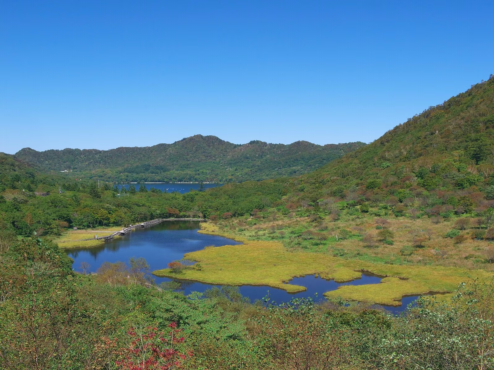
| Kakumanbuchi marsh | 1 lap, 30 min | Boardwalks; a barrier-free section from the visitor center entrance to the observation deck |
| Lake Ōnuma | 1 lap, 60 min | Partly on the road; some parts are impassable when the water is high |
| Kakumanbuchi – Mt. Chōshichirō | 3 h 20 min | Short climb to a summit with views of both lakes |
| Mt. Kurobi – Mt. Koma | 3 h 30 min | The highest peak; views to Mt. Hotaka (Jōshū), Mt. Sukai, and on clear days Mt. Fuji |
| Mt. Kuwagara – Mt. Suzu | 3 h | Out and back from the Shinzakadaira side |
| Gorin hiking course | 2 h 50 min | Ridge walk with little height gain; suited to families |
| Mt. Ara – Mt. Nabewari | 4 h 10 min | Views of the Kanto Plain from Mt. Nabewari |
If you think "Akagi is a Hyakumeizan, so it must be easy", Mt. Kurobi's steep climb will surprise you. Start with Kakumanbuchi or Lake Ōnuma, then move up to Mt. Kurobi once you are used to it.
Late October to Early Winter: What to Watch
- Road closures: Gunma Prefecture closes the Ōgo-Akagi road (Prefectural Road 16, Akagi Onsen entrance to Konuma, 9.1 km) from late December to early April, and the Numata-Akagi road (Prefectural Road 251) from early January to mid-March. For the exact 2026–27 dates, see Gunma's announcements. The Ōgo-Akagi road is also closed after 120 mm of continuous rain in a day (a caution warning at 80 mm).
- Toilets: as of Gunma's October 1, 2026 update, the Kakumanbuchi public toilet and the campground toilet are closed because of water-pipe damage. Check Gunma's toilet map for the ones still open.
- Visitor center: the Akagi Visitor Center now carries the name "Snow Peak Land Station Akagi". Snow Peak lists hours of 9:00–18:00 (9:00–17:00 from December to March), closed Wednesdays. Gunma lists the tourist information desk at 10:00–18:00 (10:00–17:00 December–March), closed Wednesdays.
- Bears: Gunma has published a map of 2026 bear sightings in Akagi Prefectural Park (updated October 19). It asks hikers not to go alone, to carry bells or a radio, and to carry bear spray. See also bear safety in Japan.
Route 1: Kakumanbuchi and Lake Ōnuma (Beginners and Families)
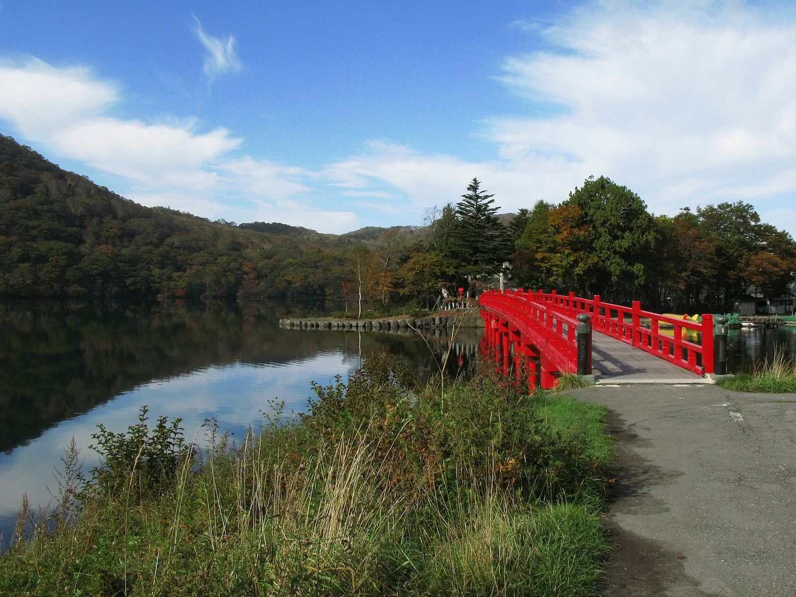
Kakumanbuchi, at 1,360 m southeast of Lake Ōnuma, is Akagi's only marsh, often called a "mini Oze" and selected by the Ministry of the Environment as an important wetland. Gunma completed a new boardwalk in autumn 2024 and removed the old one in spring 2025. One lap takes about 30 minutes. A lap of Lake Ōnuma takes about 60 minutes, with views of Mt. Koma, Mt. Kurobi, and Mt. Jizo across the water.
Leaves on boardwalks and rocks get slippery, so wear hiking boots rather than sneakers. Remember that the Kakumanbuchi toilet is currently closed.

Route 2: Mt. Jizo
Mt. Jizo offers wide views over Lake Konuma from near the summit. We could not confirm an official course time for it this time, so check the trekking map from the Maebashi tourism site before you go.


Route 3: Mt. Kurobi – Mt. Koma Loop (the Highest Peak)
Ōbora north trailhead → Neko-iwa → saddle → Mt. Kurobi (1,828 m) → saddle → Okurobi Ōkami → Hanamigahara campground junction → Mt. Koma (1,689 m) → Ōnuma lakeside road
Gunma Prefecture gives about 3 hours 30 minutes. It is the most demanding of the main routes here. Prepare for it as a real hike, not a stroll. If your knees are a concern, trekking poles help.

Getting There
- By bus: Kan-etsu Kotsu runs buses from Maebashi Station to the summit area. Check its timetable for current times and fares; in late autumn, plan to catch an afternoon bus rather than the last one, since days are short.
- By car: the main approach is Prefectural Road 4 from the Maebashi side, which is not part of the winter closures. Even so, expect snow and ice at this altitude and use winter tires from December.
- Konuma: large vehicles may not park at the Konuma parking lot, and group use of the Konuma bio-toilet is restricted (since April 26, 2024). This does not affect individual hikers.
Early Winter and Snow
In winter, the summit of Mt. Kurobi is covered with snow and rime. Walking on snow needs crampons and experience; the routes here assume snow-free conditions. Gunma asks hikers not to use butt sleds on trails, especially while wearing crampons, because of collision accidents.


What to Bring in Late Autumn
- Warm layers (fleece or light down) and rain gear that doubles as a windbreaker
- Gloves and a hat
- Headlamp, water, snacks, and a power bank
- Microspikes on days with ice
- A bear bell, and ideally bear spray
Summary
- Beginners: Kakumanbuchi (30 min) or Lake Ōnuma (60 min). For the highest peak: Mt. Kurobi – Mt. Koma (about 3 h 30 min)
- The Kakumanbuchi toilet is closed for now (Gunma, October 1)
- Roads 16 and 251 close in winter; Road 4 from Maebashi stays open, but use winter tires
- Bears have been sighted in the park in 2026; carry a bell and spray
See also: 22 Hyakumeizan day hikes from Tokyo