

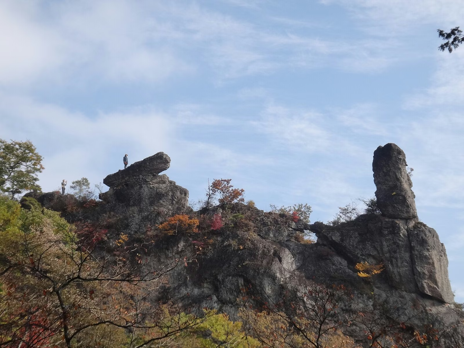
Photo: Yones, Wikimedia Commons (Public Domain) / Jagged rock crags of Mt. Myogi viewed from the Nakanotake Shrine side

Mt. Myogi Hiking Guide: Chukan-do Trail, Sekimon Rock Arches, Why Beginners Must Avoid the Upper Ridge & Access
A complete guide to hiking Mt. Myogi (1,104 m) in Gunma Prefecture, one of the Three Famous Mountains of Jomo. Explains the critical difference between the intermediate Chukan-do / Sekimon / Dai-no-ji trails and the expert-only upper rock ridge, plus parking at Michi-no-Eki Myogi and Nakanotake Shrine.
Rising across Tomioka City, Shimonita Town, and Annaka City in southwestern Gunma Prefecture, Mt. Myogi (妙義山, Myogisan) is celebrated alongside Mt. Akagi and Mt. Haruna as one of the Three Famous Mountains of Jomo (上毛三山, Jomo Sanzan) and one of the Three Most Scenic Rock Landscapes of Japan (日本三奇勝) alongside Yabakei and Kankakei.
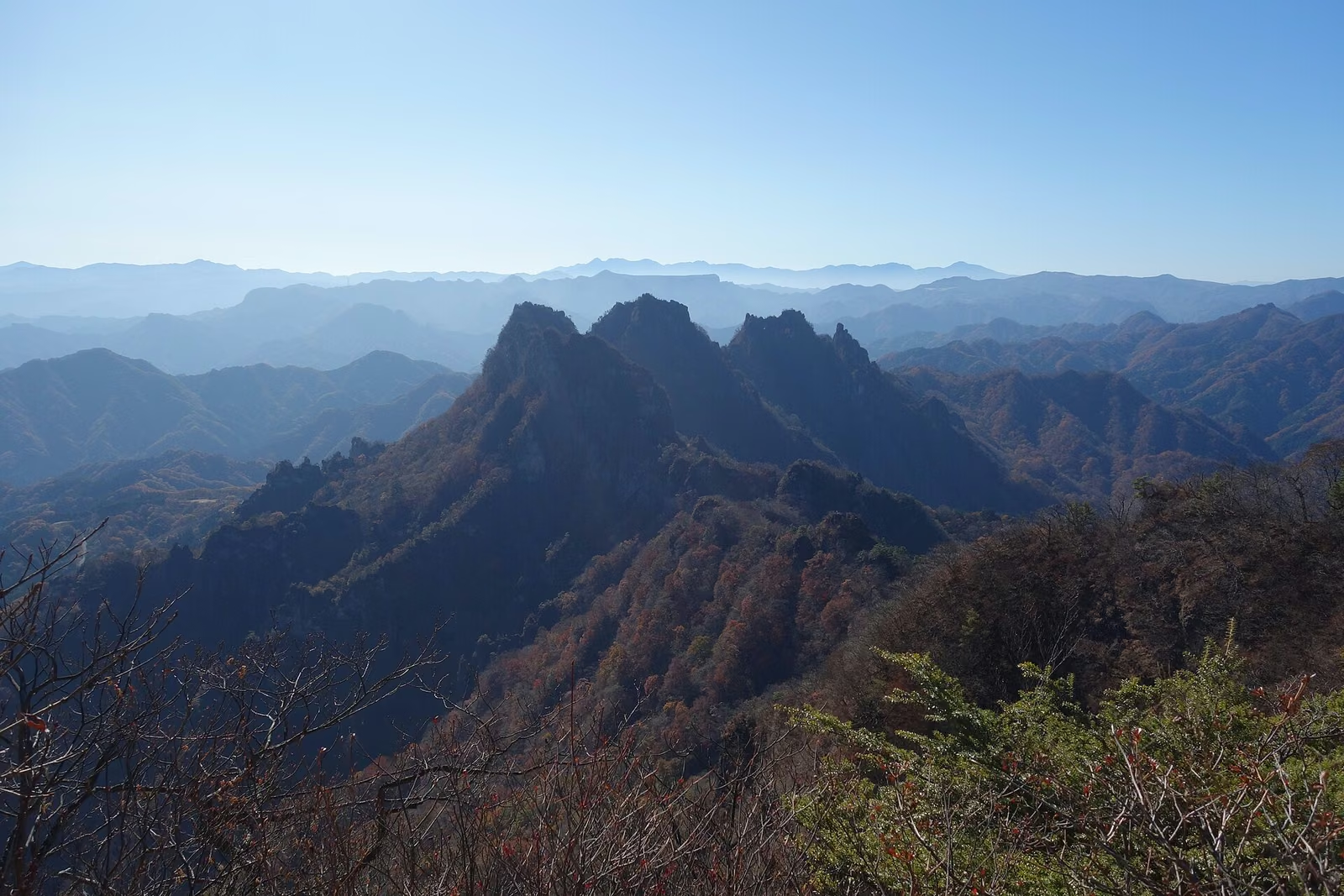
Rather than a single cone, Mt. Myogi is a jagged volcanic ridge split into Omote-Myogi (表妙義, Front Myogi)—comprising Hakuunzan (Soumadake, 1,103.8 m), Kondosan (Nakanodake, 1,094 m), and the closed peak of Kinkeisan (856 m)—and Ura-Myogi (裏妙義, Back Myogi), centered on谷急山 (Yakyusan, 1,162.1 m).
Because the mountain's highest point is just 1,104 meters, visitors who look only at the altitude sometimes mistake all of Mt. Myogi for a casual half-day hike. In reality, Gunma Prefecture's Mountain Grading System places the mid-mountain Chukan-do (中間道) and Sekimon Meguri (石門めぐり) at Technical Grade B–C, while ranking the upper ridge traverse of Hakuunzan and Kondosan at Technical Grade E (the highest possible technical difficulty in the prefecture, alongside the North Ridge of Mt. Tanigawa's Ichinokurasawa). Understanding which trail category you are stepping onto is the single most important part of planning a visit to Mt. Myogi.
The 3 Trail Categories on Mt. Myogi (Tomioka City Official Classification)
Tomioka City and Gunma Prefecture divide Mt. Myogi's trails into three strict categories:
| Category | Representative Trails | Gunma Prefecture Grade | Key Characteristics |
|---|---|---|---|
| 1. General Trail (一般登山道) | Kanto Fureai Trail "Chukan-do" (中間道) between Myogi Shrine and Nakanotake Shrine (excluding the Sekimon loop) | Physical 2 / Technical B | Traverses the wooded mid-slope below the cliffs; well-maintained footpath with viewing benches, though narrow and steep in places. |
| 2. Intermediate Trail (中級登山道) | Sekimon Meguri (石門めぐり) (First–Fourth Stone Gates, Kani-no-Yokobai, Tatebari) and the Dai-no-ji (大の字) viewpoint climb | Physical 2 / Technical C | Steep chain-assisted rock slabs, iron ladders, and narrow ledges requiring three-point contact, grippy footwear, and gloves. |
| 3. Expert Ridge Route (上級登山道) | Omote-Myogi Upper Ridge (Myogi Shrine → Dai-no-ji → Okunoin →見晴 → ビビリ岩 → 背ビレ岩 → Soumadake → 堀切 → 鷹戻し → Kondosan) and Ura-Myogi | Physical 6 / Technical E | Vertical chain pitches over 20–50 m drop-offs, knife-edge ridges, and complex route-finding; rope/harness skills and helmet required. |
Note: Kinkeisan (金鶏山) is permanently closed to entry due to rockfall and fatal accident risks.

Current Trail Closure Alert (Honkomi-zawa Bridge on Chukan-do)
According to official notices from Tomioka City, a bridge at Honkomi-zawa (本読み沢) between the Dai-ni Miharashi (第二見晴) viewpoint and the Azumaya (東屋) shelter on the Myogi Shrine side of the Chukan-do was damaged by a fallen tree and that section is closed until repairs are completed.
- What Remains Open:
- From the Nakanotake Shrine / Sekimon Trailhead side, you can hike the Sekimon Meguri loop, visit the Fourth Stone Gate (第四石門) and Taiho-iwa (大砲岩), and walk the Chukan-do up to the Azumaya shelter.
- From the Myogi Shrine side, you can climb to the Dai-no-ji (大の字) viewpoint and walk the Chukan-do as far as Dai-ichi Miharashi (第一見晴) and Dai-ni Miharashi (第二見晴).
- You cannot walk all the way through between Myogi Shrine and Nakanotake Shrine along the Chukan-do while the Honkomi-zawa bridge closure remains in effect. Always check Tomioka City's latest trail status page before departing.
Route 1: Chukan-do (中間道) — The Mid-Mountain Panorama Trail
When fully open, the Kanto Fureai Trail Chukan-do links Myogi Shrine at the eastern base with Nakanotake Shrine at the western base without climbing onto the jagged crest.
- Standard Time (Full One-Way Traverse when open): Approx. 2 hours 40 minutes (approx. 6.7 km) between Michi-no-Eki Myogi (Myogi Shrine) and Nakanotake Shrine.
- Highlights:
- Dai-ichi Miharashi (第一見晴) & Dai-ni Miharashi (第二見晴): Dramatic lookouts directly below the sheer rock walls of Hakuunzan.
- Fourth Stone Gate (第四石門 / Sekimon Hiroba): A spacious plaza beneath a huge natural rock arch framing Taiho-iwa ("Cannon Rock") and the distant Kanto Plain.


Route 2: Sekimon Meguri (石門めぐり) — Natural Stone Arches & Chain Passages
Starting from the Sekimon Trailhead (石門入口) along Prefectural Route 196 near Nakanotake Shrine, the Sekimon Meguri loop threads through four natural stone arches (Dai-ichi Sekimon through Dai-yon Sekimon).
- Difficulty: Intermediate (Gunma Grade: 2C)
- Chain Sections Along the Loop:
- Kani-no-Yokobai (かにの横ばい): A sideways traverse on a rock ledge using a fixed chain right at the First Stone Gate.
- Tsurube-sagari (つるべさがり): A steep chain-assisted descent on smooth conglomerate rock at the Second Stone Gate.
- Tatebari (たてばり): A long, steep chain climb between the Second and Fourth Stone Gates.
- Katate-kirikoshi (片手さがり): A short chain descent leading down toward the Nakanotake Shrine steps.
- How to Avoid the Steepest Chains on Sekimon: If you start directly from the Nakanotake Shrine parking lot, climb the shrine steps past Nakanotake Daikoku Shrine, and follow the Chukan-do east to the Fourth Stone Gate (Sekimon Hiroba) and back the same way, you can admire the Fourth Stone Gate and the viewpoint at the base of Taiho-iwa without passing through the narrow chain squeezes of the First and Second Stone Gates. (Note: climbing on top of Taiho-iwa itself or crossing Yurugi-iwa is exposed and optional—enjoy the view safely from the plaza if you are uncomfortable with heights.)
Route 3: The Dai-no-ji (大の字) Viewpoint from Myogi Shrine
Visible from the valley floor, the giant white character 「大」 (Dai) stands on a rock pinnacle at approx. 700 meters elevation above Myogi Shrine.
- Route: Michi-no-Eki Myogi → Myogi Shrine → Tsuji-no-o-do → Chain pitch below Dai-no-ji → Dai-no-ji (return via Tsuji-no-o-do and Chukan-do junction)
- Round-Trip Time: Approx. 2 hours to 2 hours 30 minutes
- Caution: The final approach to the Dai-no-ji pedestal involves climbing steep fixed chains and iron steps up an exposed rock outcrop. Turn back before the chains if the rock is wet or windy, and never continue past Dai-no-ji toward Okunoin (奥の院) unless you are an equipped expert party—Okunoin marks the entrance to the Grade E upper ridge.

Best Seasons to Visit
- Mid-April to May: Fresh green foliage and cherry blossoms around the base parks.
- Early to Mid-November (Peak Autumn Foliage): Because Mt. Myogi sits at a relatively low elevation (400–1,100 m), its autumn leaves peak in early to mid-November—later than high alpine peaks—framing the dark volcanic spires in crimson and gold.
- Winter: Mainly snow-free on the sunny southern Chukan-do, though shaded rock gullies can hold ice; avoid summer (July–August) when radiant heat on the low-elevation rock faces and hornets (suzumebachi) are at their peak.


Access and Parking
1. Eastern Base: Michi-no-Eki Myogi (Myogi Shrine Side)
- By Car: Approx. 5 minutes from Matsuidamyougi IC (松井田妙義IC) on the Joshin-etsu Expressway.
- Parking: Michi-no-Eki Myogi (道の駅みょうぎ / Myogi Bussan Center) offers free parking (145 standard cars, 12 large buses, 3 accessible spaces) with 24-hour restrooms and a tourist information counter right across from Myogi Shrine.
2. Western Base: Prefectural Nakanotake Parking Lot (Nakanotake Shrine / Sekimon Side)
- By Car: Approx. 15 minutes from Matsuidamyougi IC or Shimonita IC (下仁田IC) via Prefectural Route 196 (Myogi Momiji Line).
- Parking: The Prefectural Nakanotake Parking Lot (県立中之嶽駐車場) directly in front of Nakanotake Shrine is free and holds approx. 300 vehicles, with public restrooms at the lot.
3. By Train and Taxi / Community Bus
- JR Shin-etsu Main Line: Take a taxi from Matsuida Station (松井田駅) (approx. 10 min to Myogi Shrine) or Isobe Station (磯部駅) (approx. 15 min).
- Joshin Dentetsu Railway: From Takasaki Station, take the Joshin Line to Joshu-Tomioka Station (上州富岡駅) or Shimonita Station (下仁田駅). Tomioka City's demand-type Ai-タク (Ai-Taxi) runs on weekdays only and requires advance phone booking, so visitors arriving on weekends should plan on using a regular taxi from Matsuida, Isobe, or Shimonita Station.


Official References
- Gunma Prefecture: Mountain Grading Table (群馬県山のグレーディング)
- Tomioka City Tourism (Shiru-Kuru Tomioka): Mt. Myogi Climbing Guide & Map
- Tomioka City Official Website: Current Trail Closure Notice on Mt. Myogi Chukan-do
- Myogi Shrine Official Access Page
- Nakanotake Shrine Official Access Page
- Michi-no-Eki Myogi (Myogi Bussan Center) Official Website