

Photo: Σ64, Wikimedia Commons (CC BY 3.0)

Mt. Mitsutoge Hiking Guide: Mt. Fuji Views, Alpine Flowers, Omotesando vs. Ura-Mitsutoge Routes & Access
A complete English guide to hiking Mt. Mitsutoge (1,785 m) in Yamanashi Prefecture, one of the 200 Famous Japanese Mountains and a premier viewpoint for Mt. Fuji. Compares the classic Nishikatsura Omotesando climb from Mitsutoge Station and the short Ura-Mitsutoge route from Kawaguchiko.
Straddling the border of Nishikatsura Town, Fujikawaguchiko Town, and Tsuru City in Yamanashi Prefecture, Mt. Mitsutoge (三ツ峠山, Mitsutogeyama) is the collective name for three connected peaks along the Misaka range north of Mt. Fuji:
- Kaiunzan (開運山, 1,785 m): The highest point and main summit viewpoint.
- Osutakayama (御巣鷹山, 1,775 m): The northern peak topped by communication towers.
- Kinashiyama (木無山, 1,732 m): The southwestern shoulder overlooking Lake Kawaguchi and alpine flower conservation zones.
Selected among the 200 Famous Japanese Mountains (日本二百名山), the New 100 Famous Flower Mountains (新・花の百名山), and the 100 Famous Mountains of Yamanashi (山梨百名山), Mt. Mitsutoge is renowned equally for its head-on panorama of Mt. Fuji, the vertical volcanic conglomerate cliffs of Byobuiwa (屏風岩)—a historic cradle of Japanese rock climbing—and its rich subalpine flora from spring through the June–July rainy season (tsuyu) and autumn.


Mountain Overview
| Item | Details |
|---|---|
| Mountain Name | Mt. Mitsutoge (三ツ峠山 / Highest peak: Kaiunzan, 1,785 m) |
| Location | Nishikatsura Town, Fujikawaguchiko Town & Tsuru City, Yamanashi Prefecture |
| Official Course Times (Yamanashi Hiking 100) | Fujikawaguchiko Side (Mitsutoge Trailhead): Approx. 2 hr 45 min round trip (4.7 km) Nishikatsura Side (Ikoi-no-Mori Park): Approx. 4 hr 30 min round trip (6.3 km) |
| Difficulty | Beginner (Fujikawaguchiko side) to Intermediate (Nishikatsura Omotesando side, with ~1,100+ m of elevation gain from the valley) |
| Best Seasons | Year-round (April–May cherry blossoms & mitsuba-tsutsuji; June–July alpine wildflowers & yama-ajisai; late October–November autumn leaves & crisp Mt. Fuji views) |
Why Hike Mt. Mitsutoge?
1. Front-Row View of Mt. Fuji and the Southern Alps
From the open rocky terrace at Kaiunzan (1,785 m) and the ridge near the mountain huts below the summit, Mt. Fuji rises directly ahead across the Fuji Five Lakes basin—from its broad skirts to the summit crater—while the Southern Japan Alps (Akaishi Mountains), Yatsugatake, and the Okuchichibu range line the western and northern horizons. Even during the June–July rainy season (tsuyu), early morning ascents or breaks in the mist frequently reveal dramatic cloud seas (unkai) swirling around Mt. Fuji.


2. Byobuiwa Cliffs, Alpine Flora, and Historic Pilgrimage Statues
- Byobuiwa (屏風岩): Just below the summit ridge on the Nishikatsura side, sheer volcanic rock walls rise up to 80 meters high, where rock climbers often practice on multi-pitch routes while hikers walk the safe footpath along the base of the cliff.
- Wildflowers: Protected enclosures and cliff ledges around Kinashiyama and Byobuiwa support rare species such as atsumorisou (lady's-slipper orchid), iwakinbai, and woodland hydrangeas (yama-ajisai) in June and July.
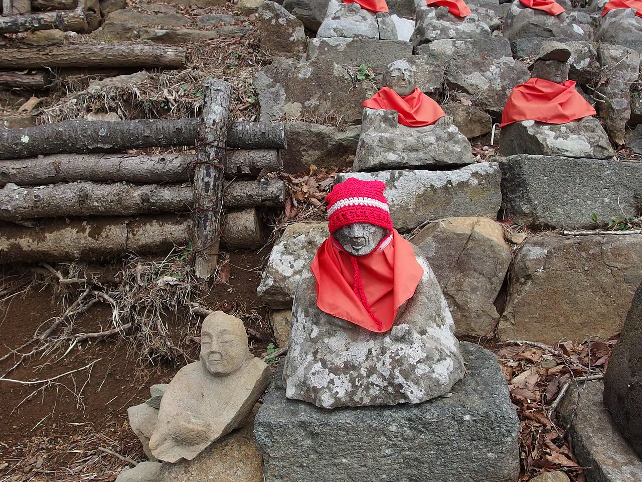
- Faith History: Along the traditional Nishikatsura Omotesando trail, hikers pass the engraved Daruma Stone (達磨石), the 88 Daishi Stone Statues (八十八大師), and the wooden gates surrounding old mountain ascetic sites.

Comparing the Two Main Routes (Plus Current Closure Alert)
Important Trail Closure Alert (Haha-no-Shirataki Section)
According to official notices from Nishikatsura Town and Fujikyu Bus, the lower section of the Kawaguchi trail between Haha-no-Shirataki Waterfall (母ノ白滝) and the Shirataki Rindo forest road junction has been closed to hikers since June 29, 2026 due to rockfall damage caused by the June 26, 2026 earthquake. Do not plan a descent from the summit ridge down to Haha-no-Shirataki and Kawaguchi Post Office until the municipality officially lifts this closure. Both main routes below (Ura-Mitsutoge from Mitsutoge Trailhead and Omotesando from Nishikatsura / Ikoi-no-Mori) remain open.
Route 1: Ura-Mitsutoge Course from Mitsutoge Trailhead (Fujikawaguchiko Side)
- Route: Mitsutoge Trailhead Parking / Bus Stop (approx. 1,250 m) → Gentle forest track → Mitsutoge Sanso / Shikirakuen Huts → Kaiunzan Summit (1,785 m) → Return the same way
- Time & Distance (Yamanashi Hiking 100): Approx. 2 hr 45 min round trip / 4.7 km
- Elevation Gain: Approx. 530 m
- Why Choose It: Starting high at the Mitsutoge Trailhead (三ツ峠登山口) on the northern shoulder above Kawaguchiko cuts the elevation gain in half compared to the valley routes. The path is a wide, steady track up to the huts below the summit, making it ideal for beginners, photographers aiming for sunrise or morning views of Mt. Fuji, and winter/early-spring hikers.


Route 2: Nishikatsura Omotesando (Daruma-ishi) Course
- Route: Ikoi-no-Mori Park Parking Lot (or 50 min walk from Fujikyu Railway Mitsutoge Station) → Daruma Stone (達磨石) → Momogatake Shelter → 88 Daishi Statues → Base of Byobuiwa Cliffs → Shikirakuen / Mitsutoge Sanso → Kaiunzan Summit (1,785 m) → Return via the same route (or traverse from Mitsutoge Trailhead to Mitsutoge Station)
- Time & Distance (Yamanashi Hiking 100): Approx. 4 hr 30 min from Ikoi-no-Mori Park (6.3 km); add approx. 50 minutes each way if walking from Mitsutoge Station (三つ峠駅)
- Why Choose It: This is the historic pilgrimage climb from the south-eastern foot of the mountain, passing waterfalls, stone monuments, and the dramatic base of the Byobuiwa climbing cliffs before popping out onto the summit ridge in front of Mt. Fuji.
Restrooms, Huts, and Seasonal Gear Tips
- Restrooms: Public restrooms are located at Mitsutoge Station, Ikoi-no-Mori Park, and the Mitsutoge Trailhead parking lot (note that trailhead toilets close in winter), as well as paid restrooms near the summit ridge huts (Shikirakuen / Mitsutoge Sanso). Carry ¥100 coins and a portable toilet bag.
- Clothing & Footwear: Even in June and July, the 1,785 m summit ridge is roughly 10–11 °C cooler than central Tokyo and exposed to wind off Mt. Fuji. Pack a waterproof/windproof rain shell, non-cotton base layers, and high-traction trekking shoes (especially for the damp soil and tree roots on the Nishikatsura descent).
Access and Parking
By Train and Bus
- To Mitsutoge Trailhead (Ura-Mitsutoge Course):
- Take the JR Chuo Line / Fujikyuko Line to Kawaguchiko Station (河口湖駅).
- From Kawaguchiko Station, board the Fujikyu Bus bound for Tenkachaya (天下茶屋行き) and get off at Mitsutoge Tozanguchi (三ツ峠登山口) (approx. 25 minutes). Because bus departures on the Tenkachaya line are limited (typically one morning bus), verify the seasonal timetable on the Fujikyu Bus website in advance or take a taxi from Kawaguchiko Station.
- To the Nishikatsura Side (Omotesando Course):
- Take the Fujikyuko Line (Fujisan Express / Local) from Otsuki Station to Mitsutoge Station (三つ峠駅), then walk approx. 50 minutes to Ikoi-no-Mori Park (憩いの森公園) (or take a short taxi ride to the Daruma-ishi trailhead).
By Car
- Mitsutoge Trailhead Parking Lot (Fujikawaguchiko side): Approx. 30 minutes from Kawaguchiko IC on the Chuo Expressway; free parking for approx. 30 cars right at the trailhead.
- Ikoi-no-Mori Park Parking Lot (Nishikatsura side): Approx. 30 minutes from Tsuru IC on the Chuo Expressway; free parking for approx. 25 cars.
Official References
- Yamanashi Hiking Course 100 Official Guide: Mt. Mitsutoge Course
- Nishikatsura Town Official Hiking & Trail Information (including Closure Notice)
- Fujikyu Bus: Mt. Mitsutoge Hiking Bus Information
- Fujikyu Bus: Notice on Partial Closure of the Mt. Mitsutoge Kawaguchi Trail (Haha-no-Shirataki Section)
- Fujikyu Railway (Fujisan View Express / Local Timetable & Fares)