

Photo: Batholith, Wikimedia Commons (Public domain)

Mt. Amagi Hiking Guide: Hydrangeas, Mossy Beech Forests, and the Amagi Kogen Loop on the Izu Peninsula
Plan a day hike on Mt. Amagi (Banzaburodake, 1,406 m) in Izu, Shizuoka Prefecture. Covers the classic Amagi Kogen loop over Banjirodake and Banzaburodake, endemic Amagi hydrangeas, mossy beech and Stewartia forests, land leech precautions, clothing, and bus access from Shuzenji Station.
Overview: A Moss-Covered Volcanic Ridge in the Heart of the Izu Peninsula
Mt. Amagi (Amagi-san) is not a single isolated peak, but a volcanic mountain range stretching across the center of the Izu Peninsula in Shizuoka Prefecture. Listed among the 100 Famous Japanese Mountains, its highest point is Mt. Banzaburo (Banzaburodake, 1,406 m), paired along a wooded ridge with Mt. Banjiro (Banjirodake, 1,299 m).
Because moist Pacific air flows directly up the slopes of the Izu Peninsula, Mt. Amagi receives abundant rainfall and supports one of the richest old-growth deciduous forests in the region—dominated by Japanese beech (buna), tall himeshara (Stewartia monadelpha) with smooth reddish-brown trunks, and thick carpets of moss. While clear autumn and winter days offer crisp views toward Mt. Fuji and Suruga Bay, early summer (mid-June to early July) transforms the ridge into a botanical corridor when endemic Amagi hydrangeas (Amagi-ajisai) and ko-ajisai (Hydrangea hirta) bloom beneath the canopy.
Quick Facts
| Item | Details |
|---|---|
| Highest Peak | Mt. Banzaburo (Banzaburodake, 1,406 m — highest peak on the Izu Peninsula) / Mt. Banjiro (Banjirodake, 1,299 m) |
| Location | Izu City, Ito City, and Higashi-Izu Town, Shizuoka Prefecture |
| Designations | 100 Famous Japanese Mountains (Nihon Hyakumeizan), Fuji-Hakone-Izu National Park |
| Difficulty | Lower-Intermediate (well-marked forest trail, but long distance and slippery roots/rocks) |
| Standard Loop Time | Approx. 5 to 6 hours including short breaks (Amagi Kogen Loop) |
| Main Trailhead | Amagi Kogen Hiker Parking Lot (approx. 1,050 m) |
| Public Transit | Izuhakone Railway to Shuzenji Station, or JR Ito Line / Izukyu Line to Ito Station, then Tokai Bus to Amagi Kogen |
| Restrooms | Available at the Amagi Kogen hiker parking lot trailhead (none along the ridge) |


Why Mt. Amagi Shines in Early Summer and Autumn
1. Endemic Amagi Hydrangeas and Ko-ajisai (Mid-June to Early July)
During Japan's early-summer rainy season (tsuyu), the ridge between Mt. Banjiro and Mt. Banzaburo comes alive with wildflowers:
- Amagi Hydrangea (Amagi-ajisai): A regional variety native to the Izu Peninsula, prized for its slender leaves and delicate white sterile florets. They cluster along the Uma-no-se ("Horseback") ridge and around the summit of Mt. Banzaburo from mid-June through early July.
- Ko-ajisai (Hydrangea hirta): Small, fragrant pale-purple blossoms that carpet the forest floor along the descent from Mt. Banzaburo toward the Karasawa junction and Yotsutsuji.
- Amagi Rhododendron (Amagi-shakunage): Earlier in late May and early June, pink blossoms of native rhododendrons open along the upper ridge.
2. Primeval Beech and Himeshara Forests Draped in Moss
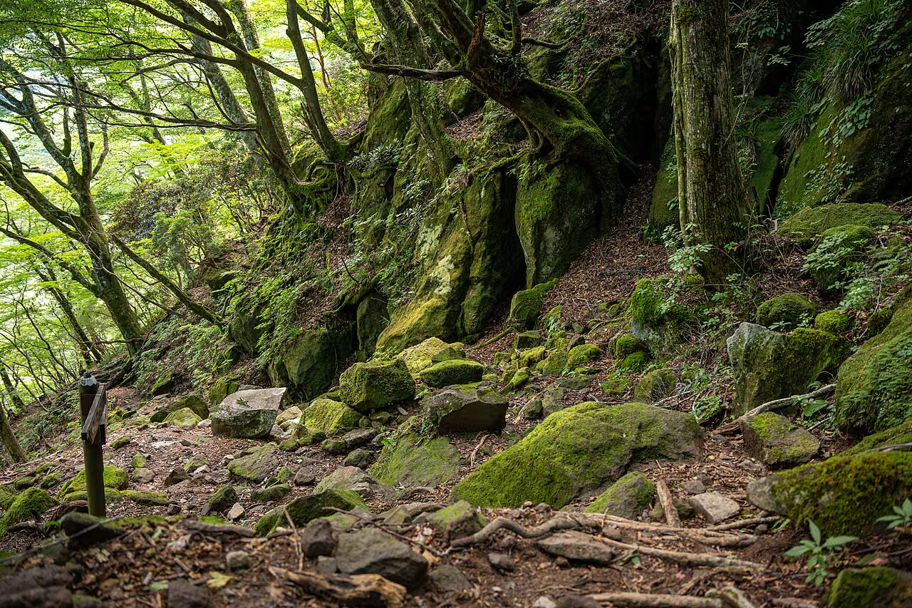
Even when mist rolls across the ridge and blocks distant views, the interior of Mt. Amagi's forest becomes more atmospheric in damp weather. Rain deepens the contrast between bright green moss on boulders and fallen logs and the wet, coppery bark of himeshara trees.
3. Forested Ridge Shelter
Because the Amagi Kogen loop stays almost entirely inside mature forest, hikers are less exposed to high winds than on bare alpine ridges. Even so, heavy rain quickly turns clay soil and tree roots slick, and stream crossings or steep steps require careful footing.

Key Precautions Before You Hike
1. Land Leeches (Yamabiru) Are Active from April Through November
The warm, humid forests of the Izu Peninsula are prime habitat for land leeches (yamabiru), especially on damp days between May and October.
- Wear long trousers, long sleeves, and ankle gaiters (spats) to seal the gap between your boots and pants.
- Apply a dedicated leech-repellent spray (such as salt- or DEET-based repellents sold at Japanese outdoor shops) around your boot soles, socks, and gaiters before stepping onto the trail.
- Avoid setting your backpack directly on wet leaf litter during breaks, and check your ankles periodically.
- If a leech attaches, do not rip it off forcefully; apply repellent or salt so it releases cleanly, then disinfect and cover the bite with a bandage.
If you want to avoid leeches entirely, plan your hike between late November and March, when cold temperatures keep them dormant and the leafless forest offers clearer views.
2. Slippery Roots, Clay, and Wooden Ladders
The loop between Mt. Banjiro and Mt. Banzaburo includes eroded root steps, volcanic rock, and several wooden ladders and bridges. Allow 10–20% extra walking time in wet conditions, wear high-traction hiking boots, and carry trekking poles for the descent from Mt. Banzaburo to the Karasawa junction.
3. Limited Bus Departures
Buses serving the Amagi Kogen trailhead run only a few times per day. Always check the current schedule on the Tokai Bus official website before your trip and aim to finish your hike at least one bus ahead of the final departure.
Classic Route: The Amagi Kogen Loop (Shakunage Course)
Amagi Kogen Hiker Parking Lot → Yotsutsuji Junction → Mt. Banjiro (1,299 m) → Uma-no-se Ridge → Mt. Banzaburo (1,406 m) → Karasawa Junction → Yotsutsuji Junction → Amagi Kogen Hiker Parking Lot
- Estimated Walking Time: Approx. 5 to 6 hours (including short breaks)
- Round-Trip Distance: Approx. 10 to 15 km depending on exact spur trails
- Cumulative Elevation Gain: Approx. 700 m
| Waypoint | Elevation | Segment Time |
|---|---|---|
| Amagi Kogen Hiker Parking Lot | ~1,050 m | Start |
| Yotsutsuji Junction | ~1,060 m | ~20 min |
| Mt. Banjiro (Banjirodake) | 1,299 m | ~1 hr 10 min |
| Uma-no-se ("Horseback") | ~1,200 m | ~20 min |
| Mt. Banzaburo (Banzaburodake) | 1,406 m | ~1 hr |
| Karasawa Junction | ~1,100 m | ~30 min |
| Yotsutsuji Junction | ~1,060 m | ~50 min |
| Amagi Kogen Hiker Parking Lot | ~1,050 m | ~20 min |
From the hiker parking lot, the trail descends briefly to Yotsutsuji, where the loop splits. Climbing clockwise via Mt. Banjiro (1,299 m) first tackles the steeper ascents while your legs are fresh. Beyond Mt. Banjiro, the trail dips to the saddle known as Uma-no-se and passes distinctive rock formations and himeshara groves before climbing to Mt. Banzaburo (1,406 m), the highest point on the Izu Peninsula.
Rather than backtracking over Mt. Banjiro, continue past the summit of Mt. Banzaburo and descend via the Karasawa Junction (Karasawa Bunki), which contours through quiet beech and ko-ajisai forest back to Yotsutsuji and the parking lot.


Clothing and Gear Checklist
At 1,400 meters, the ridge of Mt. Amagi is noticeably cooler than coastal towns on the Izu Peninsula, and rainy days in June or July often hover around 15°C.
- ** Clothing (Layering Guide):**
- Quick-dry long-sleeve base layer
- Light fleece or wind shirt for summit breaks
- Two-piece waterproof breathable rain suit
- Full-length stretch trekking pants tucked under gaiters
- Mid- or high-cut waterproof hiking boots with deep lugs
- Thin trekking gloves (useful on wet wooden ladders and tree roots)
- Essential Pack Items (Day-Hike Checklist):
- 1.0 to 1.5 L of water (there are no drinking water sources or staffed huts along the loop)
- Lunch and high-energy trail snacks
- Gaiters and leech repellent (April–November)
- Offline GPS map app and power bank
- Headlamp (dense forest canopy gets dark early on overcast afternoons)
- Spare socks and waterproof pack liner or dry bags
Access and Restrooms
By Public Transit
- Via Ito Station or Shuzenji Station: Take the JR Tokaido Shinkansen to Atami or Mishima, transfer to the JR Ito Line (to Ito Station) or the Izuhakone Railway Sunzu Line (to Shuzenji Station), and board a Tokai Bus bound for Amagi Kogen Golf Course (Amagi Kogen Golf-jo) right at the hiker trailhead. Because seasonal bus routes and operating days vary, verify the exact timetable on the Tokai Bus website before departure.
By Car
- From the Tomei Expressway (Numazu IC) or Shin-Tomei Expressway (Nagaizumi-Numazu IC), follow the Izu Jukan Expressway and Route 136 / Izu Skyline toward Amagi Kogen (approx. 1.5 to 2 hours from the interchange).
- Park only in the designated free Hiker Parking Lot (Haika Senyo Chushajo) near the golf course entrance—never in the private golf course guest lot.
Restrooms
- Public restrooms are located at the Amagi Kogen Hiker Parking Lot at the start of the trail. There are no public toilets along the hiking loop itself, so be sure to use the facility before setting out.