

Photo: 掬茶 via Wikimedia Commons (CC BY-SA 4.0)
10 Popular Spring Day Hikes Near Tokyo: Beginner-Friendly Mountains & Seasonal Trail Guide (2026)
A curated guide to 10 popular beginner-friendly spring day hikes around Tokyo and Kanto—from Mt. Takao, Mt. Tsukuba, and Mt. Mitake to Mt. Oyama, Mt. Kintoki, Mt. Jinba, and Chojagatake—comparing elevation, walking time, access, and seasonal highlights.
Why Low and Mid-Elevation Mountains Are Ideal for Spring Hiking
When the weather warms up in March, April, and May, many hikers start looking for their first trail of the season. However, in Japan's mountains, "spring on the calendar" and "spring on the summit" arrive at very different times. While cherry blossoms and fresh green leaves are in full bloom in the foothills below 1,000 meters, high alpine peaks above 2,000 meters remain buried under deep snow and require winter mountaineering equipment well into May.
For a comfortable, snow-free spring day hike, low and mid-elevation mountains around the Kanto region (roughly 300 m to 1,350 m) offer the best balance of:
- Seasonal Scenery: Plum blossoms, cherry blossoms, azaleas, fresh green foliage, and clear spring views of snow-capped Mt. Fuji.
- Flexible Logistics: Many popular peaks feature cable cars, ropeways, or well-served bus terminals that make it easy to adjust your route and descend early if needed.
- Gradual Fitness Progression: You can start with a 1.5–2 hour walk on a paved or well-graded trail and step up to a 4–5 hour ridge hike as your legs warm up for the main summer season.
Comparison of 10 Popular Spring Day Hikes Around Kanto
| # | Mountain | Area | Elevation | Standard Walking Time | Nearest Station / Access Hub | Key Spring Highlights |
|---|---|---|---|---|---|---|
| 1 | Mt. Takao (高尾山) | Tokyo (Hachioji) | 599 m | ~3–3.5 hrs | Takaosanguchi Sta. (Keio Line) | Cherry blossoms at Itchodaira, cable car/chairlift support, paved Trail 1 |
| 2 | Mt. Tsukuba (筑波山) | Ibaraki (Tsukuba) | 877 m | ~3.5–4 hrs | Tsukuba Sta. (TX) + Shuttle Bus | Twin peaks (Nantai & Nyotai), cable car & ropeway, Kanto Plain panorama |
| 3 | Mt. Mitake (御岳山) | Tokyo (Ome / Okutama) | 929 m | ~2.5–4 hrs | Mitake Sta. (JR Ome Line) + Bus | Musashi-Mitake Shrine, Rock Garden moss stream valley, cable car access |
| 4 | Mt. Oyama (大山) | Kanagawa (Isehara) | 1,252 m | ~4–4.5 hrs | Isehara Sta. (Odakyu Line) + Bus | Oyama Afuri Shrine, Sagami Bay & Mt. Fuji views, Oyama Cable Car |
| 5 | Mt. Kintoki (金時山) | Kanagawa / Shizuoka (Hakone) | 1,212 m | ~3–3.5 hrs | Kintoki-Jinja-Iriguchi / Otome Toge Bus Stops | Up-close views of snow-capped Mt. Fuji and Lake Ashi, summit teahouses |
| 6 | Mt. Jinba (陣馬山) | Tokyo / Kanagawa | 855 m | ~3.5–4 hrs | Fujino Sta. (JR Chuo Line) / Jinba Kogen Shita Bus Stop | Wide grassy 360-degree summit, white horse monument, Mt. Fuji views |
| 7 | Mt. Hiwada (日和田山) | Saitama (Hidaka) | 305 m | ~1.5–2 hrs | Koma Sta. (Seibu Ikebukuro Line, on foot) | Direct station walk-in, Kotohira Shrine viewpoint, short rocky scrambling practice |
| 8 | Mt. Bounore (Bonoore) (棒ノ折山) | Saitama / Tokyo (Hanno / Ome) | 969 m | ~4–4.5 hrs | Hanno Sta. (Seibu Line) + Bus to Sawarabi-no-Yu | Open grassy Gonpirao summit; use Takinodaira Ridge while Shirayazawa gorge is closed |
| 9 | Mt. Nokogiri (鋸山) | Chiba (Futtsu / Kyonan) | 329 m | ~3–3.5 hrs | Hamakanaya Sta. (JR Uchibo Line, on foot) | Dramatic Edo-period stone quarry walls, Nihon-ji Daibutsu, Tokyo Bay views |
| 10 | Mt. Chojagatake (長者ヶ岳) | Shizuoka / Yamanashi (Tanukiko) | 1,336 m | ~4–4.5 hrs | Fujinomiya Sta. (JR Minobu Line) + Bus to Lake Tanuki | Towering close-up view of Mt. Fuji across Lake Tanuki, quiet forest ridge |
Category 1: Ultra-Accessible Classics with Cable Car & Ropeway Support
If you are returning to hiking after the winter break or taking a friend on their very first mountain walk, start with one of these four mountains. All four have well-marked trails, restrooms, and mechanical transport options.
1. Mt. Takao (高尾山, 599 m) — Tokyo
Mt. Takao is the gold standard for a first spring hike. Located just an hour from Shinjuku on the Keio Line, it offers multiple numbered trails so you can tailor the walk to your exact fitness level.
- Best Spring Route: Take Trail 1 (Omotesando, paved) or ride the cable car/chairlift halfway up, visit Yakuo-in Temple and the 599 m summit, and continue 30 minutes further west along the gentle ridge to Itchodaira (一丁平)—famous for its "Takao Senbonzakura" cherry blossoms in mid-April.
- Planning Tip: Trail 1 has abundant restrooms and snack stalls, while Trail 6 (along a forest stream) and the Inariyama Trail offer a more natural earthen path. Because weekends in April and Golden Week draw huge crowds, aim to start hiking before 8:00 AM.
2. Mt. Tsukuba (筑波山, 877 m) — Ibaraki

As the lowest of Japan's 100 Famous Mountains (Nihon Hyakumeizan), Mt. Tsukuba lets you experience rocky scrambling, historic shrine forests, and sweeping views across the Kanto Plain in a single day trip via the Tsukuba Express (TX) and shuttle bus.
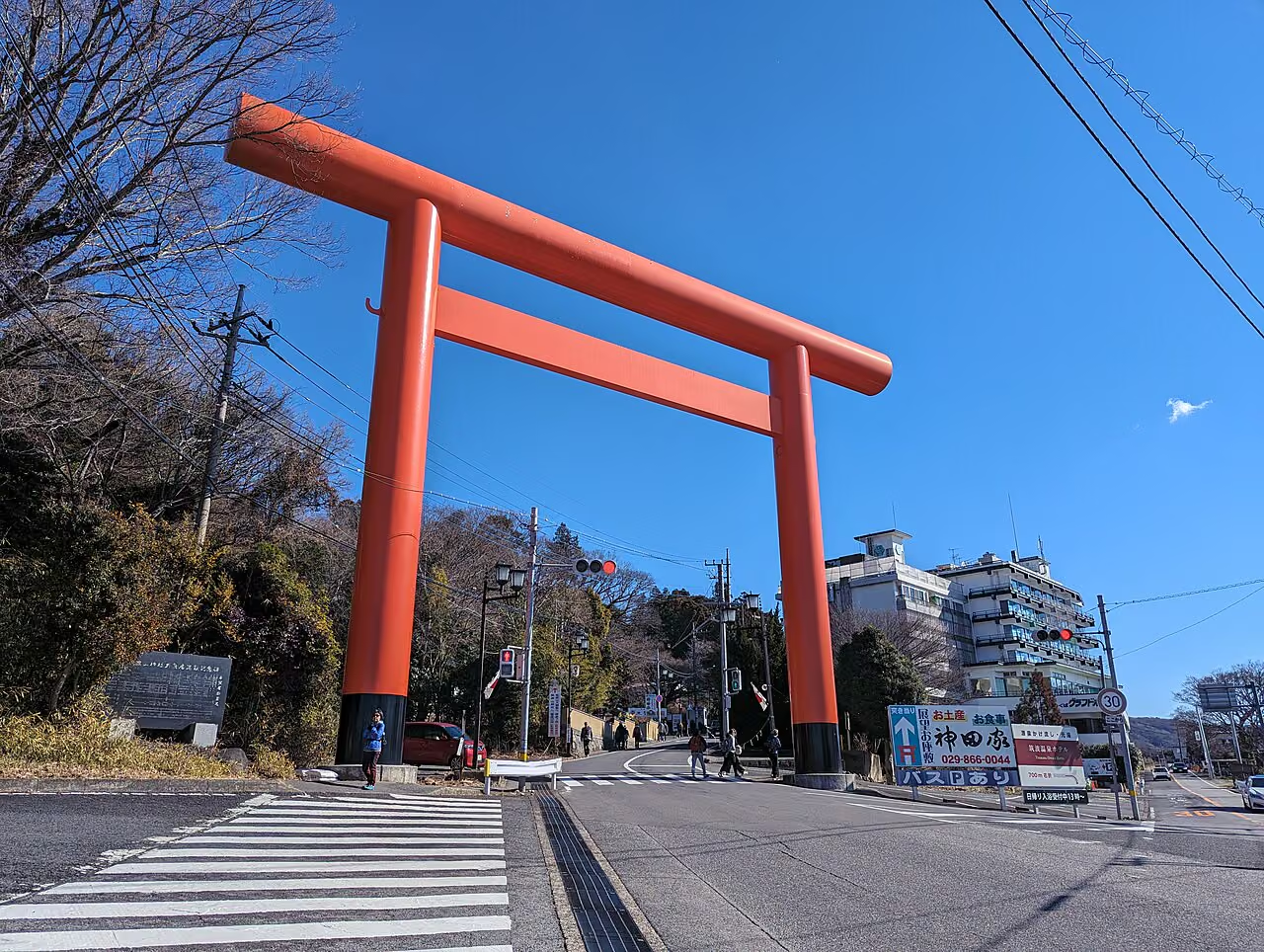
- Best Spring Route: Climb the Shirakumobashi Trail (白雲橋コース) or Otatsuishi Trail (おたつ石コース) through interesting rock formations to Mt. Nyotai (877 m), traverse the saddle (Miyukigahara) to Mt. Nantai (871 m), and either hike down the Miyukigahara Trail or take the Mt. Tsukuba Cable Car or Ropeway down (Tsukuba Kanko Railway Official Site).
- Planning Tip: The boulders near the summit of Mt. Nyotai are polished smooth and can be slippery after spring rain; wear grippy trekking shoes and take your time on the rock steps.
3. Mt. Mitake (御岳山, 929 m) — Tokyo (Okutama)
Located in Chichibu-Tama-Kai National Park, Mt. Mitake combines a historic mountain shrine village with one of Tokyo's most refreshing forest valley walks.
- Best Spring Route: Ride the Mitake Tozan Railway cable car from Takimoto Station to Mitakesan Station, visit Musashi-Mitake Shrine at the 929 m summit, and walk the Rock Garden (ロックガーデン) loop past Nanayo Falls (七代の滝) and Ayahiro Falls (綾広の滝), where moss-covered stones and clear stream water shine under fresh spring foliage.
- Planning Tip: Because the cable car covers the steepest lower elevation gain, the Rock Garden loop has gentle gradients and is ideal for hikers who prefer scenic forest walking over steep climbs.
4. Mt. Oyama (大山, 1,252 m) — Kanagawa (Tanzawa-Oyama)
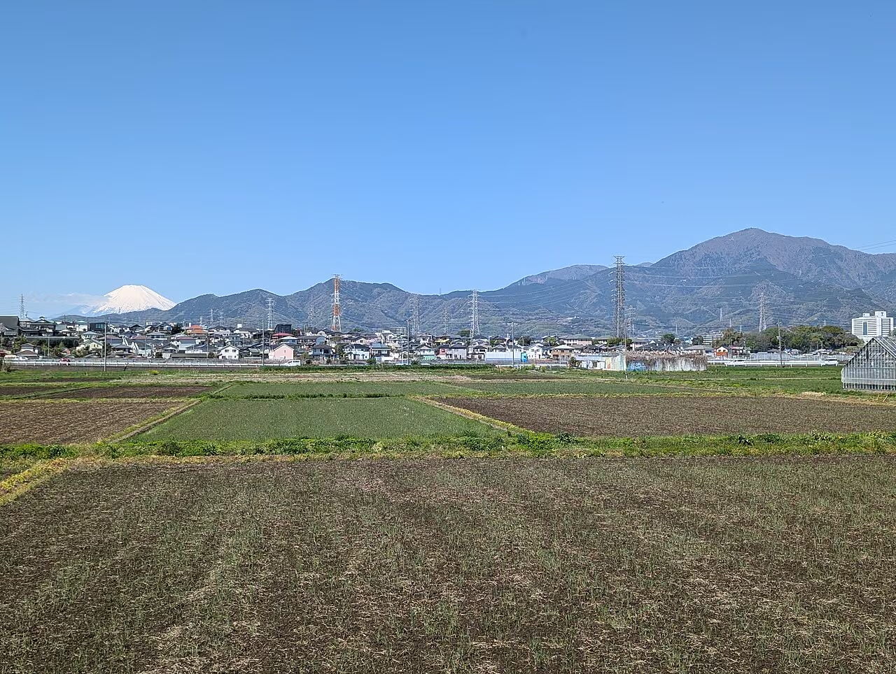
Rising to 1,252 meters on the eastern edge of Tanzawa, Mt. Oyama offers a more substantial mountain workout while still keeping the safety net of the Oyama Cable Car (Oyama Cable Car Timetable & Fares).
- Best Spring Route: Take the cable car to Afuri Shrine Shimosha (阿夫利神社下社), climb the stone steps and mountain trail through beech and cedar forest to the 1,252 m summit for views of Sagami Bay, Enoshima, and Mt. Fuji, and descend via the Miharashidai (見晴台) ridge back to Shimosha.
- Planning Tip: With over 550 meters of elevation gain even above the upper cable car station, Mt. Oyama is noticeably steeper on the knees than Mt. Takao or Mt. Mitake. Trekking poles are very helpful on the stone steps.
Category 2: Open Summits & Unbeatable Spring Views of Mt. Fuji
In spring, Mt. Fuji wears a deep coat of white snow on its upper cone while the surrounding ridges turn bright green. These three mountains offer some of the best open summit panoramas within day-trip reach of Tokyo.
5. Mt. Kintoki (金時山, 1,212 m) — Hakone (Kanagawa / Shizuoka)

Standing on the northern outer rim of the Hakone caldera, Mt. Kintoki delivers one of the most dramatic close-up views of Mt. Fuji, Lake Ashi, and the steaming volcanic valley of Owakudani—all in roughly 3 to 3.5 hours of round-trip hiking (Hakone Zenzan OfficialMt. Kintoki Guide).
- Best Spring Route: Start from Kintoki-Jinja-Iriguchi (金時神社入口) or Otome Toge (乙女峠) bus stop on the Hakone Tozan Bus from Hakone-Yumoto Station, climb to the 1,212 m summit, and descend to Sengokuhara for a post-hike hot spring soak.
- Planning Tip: Spring clouds tend to build around Mt. Fuji by midday, so catch an early bus from Odawara or Hakone-Yumoto to reach the summit before 10:30 AM.
6. Mt. Jinba (陣馬山, 855 m) — Tokyo / Kanagawa Border
If you love wide, grassy summits where you can spread out a picnic sheet under an open 360-degree sky, Mt. Jinba is hard to beat.
- Best Spring Route: Take the bus from JR Takao Station to Jinba Kogen Shita (陣馬高原下) and climb the New Highway Trail, or walk directly from JR Fujino Station (藤野駅) via the Ichinosawa (一ノ尾根) or Tochiyadani (栃谷尾根) trail to the iconic white horse monument at the 855 m summit.
- Planning Tip: While the full Jinba–Takao Traverse (~18.5 km, 6–7 hours) is a famous endurance route, climbing Mt. Jinba alone as a 3.5–4 hour loop is far more relaxing in spring and leaves plenty of time to enjoy summit views of Mt. Fuji, the Tanzawa mountains, and the Southern Alps.
7. Mt. Chojagatake (長者ヶ岳, 1,336 m) — Shizuoka / Yamanashi Border
Part of the Tenshi Mountain Range (Tenshi Sankai) west of Mt. Fuji, Mt. Chojagatake rises directly above Lake Tanuki (田貫湖) in Fujinomiya.
- Best Spring Route: Start from the Lake Tanuki North Campground trailhead, climb steadily through quiet forest to the 1,336 m summit where the entire western slope of Mt. Fuji fills the horizon above Lake Tanuki, and return the same way or continue 40 minutes along the ridge to neighboring Mt. Tenshigatake (天子ヶ岳).
- Planning Tip: In late April and May, azaleas (tsutsuji) bloom along the upper ridge. Because bus services from Fujinomiya Station to Lake Tanuki are infrequent, check the return bus timetable carefully if you are not driving.
Category 3: Short Adventures with Unique Terrain (Rock Ridges, Valleys & Quarries)
When you want a spring hike with a distinct personality—whether a train-to-trail low mountain, an Okumusashi ridge, or a coastal stone quarry—consider these three peaks.
8. Mt. Hiwada (日和田山, 305 m) — Saitama (Okumusashi)
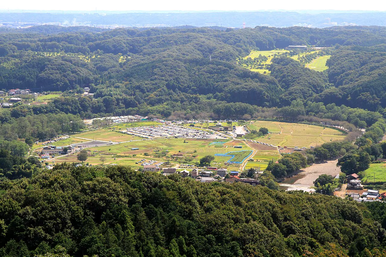
Despite standing only 305 meters tall, Mt. Hiwada packs a remarkable amount of variety into a 2-hour walk directly from Koma Station (高麗駅) on the Seibu Ikebukuro Line.
- Best Spring Route: Walk from Koma Station to the trailhead, choose between the gentle Onnazaka (女坂) path or the short, rocky Otokozaka (男坂) scramble up to the torii gate at Kotohira Shrine (which overlooks the horseshoe river bend of Kinchakuda), and continue to the 305 m summit. If you want a slightly longer walk, extend along the ridge to Monomiyama (物見山).
9. Mt. Bounore / Mt. Bonoore (棒ノ折山 / 棒ノ嶺, 969 m) — Saitama / Tokyo Border
Located between Hanno (Saitama) and Okutama (Tokyo), Mt. Bounore is beloved for its spacious, cherry-tree-lined grassy summit and its post-hike hot spring at Sawarabi-no-Yu (さわらびの湯).
- Important 2026 Trail Closure Notice: Historically, Mt. Bounore was famous for the Shirayazawa (白谷沢) stream gorge scramble. However, according to Saitama Prefecture's Hanno Construction Office (Official Suigen-no-Michi Trail Closure Notice), the Shirayazawa Gorge section is closed until further notice due to trail collapse and rockfall hazards. Hikers starting from Sawarabi-no-Yu must use the designated Takinodaira Ridge Course (滝ノ平尾根コース) for both ascent and descent, or traverse toward Kuroyama / Naguri.
10. Mt. Nokogiri (鋸山, 329 m) — Chiba (Boso Peninsula)
Because the southern Boso Peninsula warms up earlier than anywhere else in Kanto, Mt. Nokogiri is an outstanding choice from early March through May.
- Best Spring Route: Walk 10–15 minutes from JR Hamakanaya Station (浜金谷駅) (or arrive across Tokyo Bay on the Tokyo-Wan Ferry from Kurihama), hike up the Shyakuji Trail (車力道) once used to haul quarried stone, marvel at the vertical Edo-period quarry cliffs at the Laputa Wall (ラピュタの壁) viewpoint, and visit the Nihon-ji Temple (日本寺) precinct (
¥700adult admission; open 9:00–16:00) to see the cliff-top Jigoku-nozoki overhang and the 31-meter stone Great Buddha.
How to Choose Your Next Spring Hike
- First hike of the year or walking with beginners: Start with Mt. Takao, Mt. Mitake, or Mt. Hiwada.
- Stepping up to a 3.5–4.5 hour mountain walk with mechanical backup: Pick Mt. Tsukuba or Mt. Oyama.
- Chasing clear spring views of snow-capped Mt. Fuji: Head to Mt. Kintoki, Mt. Jinba, or Mt. Chojagatake on a crisp, high-pressure morning.
- Looking for coastal warmth and dramatic scenery: Take the train or ferry to Mt. Nokogiri in Chiba.
Even on mild spring days in the city, mountain ridges are windy and cool down rapidly in the afternoon. Always pack a windproof/waterproof shell, a warm fleece or light insulated jacket, a headlamp, and a mobile battery before heading out.
Related Guides on Yama-Nikki
- Beginner Day-Hike Packing Checklist: What to Bring for Low Mountains Like Mt. Takao
- 10 Common Beginner Hiking Mistakes in Japan and How to Avoid Them
- The 3 Essential Pieces of Hiking Gear: Boots, Backpack, and Rainwear
- 15 Recommended Golden Week Day Hikes in Kanto (2026 Guide)
- Mt. Daibosatsu Day Hike from Tokyo: Beginner Loop via Kaminichihara