
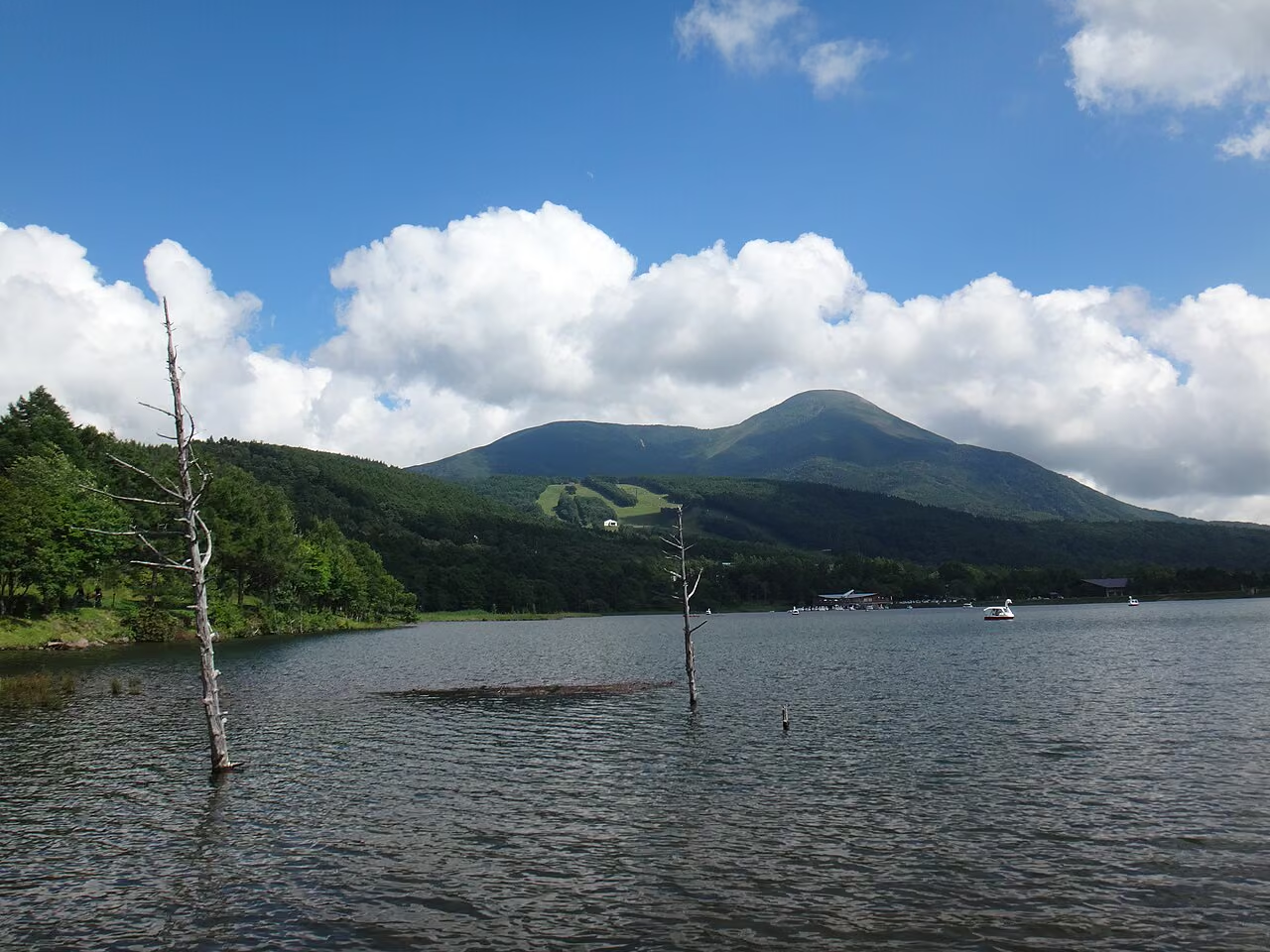
Photo: Koda6029 via Wikimedia Commons (CC BY-SA 4.0)
Mt. Tateshina Hiking Guide (2026): 7th Station, Oogawara Pass & Venus Line Routes, Mountain Huts & Access
Complete 2026 hiking guide to Mt. Tateshina (2,531 m, Suwa Fuji) at the northern tip of the Yatsugatake range in Nagano. Compare the 7th Station (Shogundaira), Oogawara Pass, and Tateshina Trailhead routes, boulder summit tips, mountain huts, parking, and access from Tokyo and Kansai.
Overview: "Suwa Fuji," the Conical 2,531 m Peak at the Northern Tip of Yatsugatake
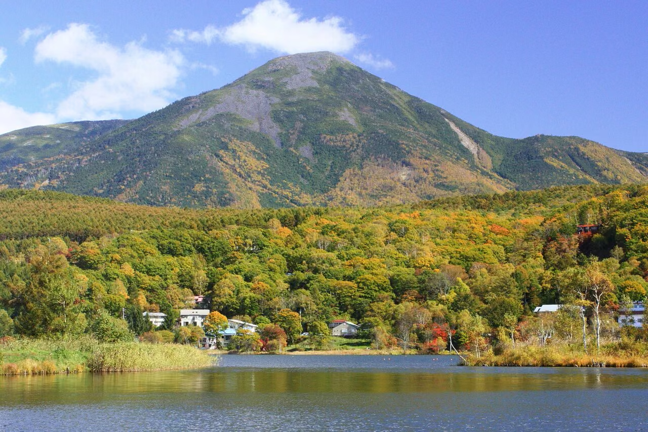
Mt. Tateshina (蓼科山, Tateshinayama, 2,531 m) stands at the northernmost end of the Yatsugatake mountain range on the border of Chino City and Tateshina Town in Nagano Prefecture. Celebrated as one of Japan's 100 Famous Mountains (Nihon Hyakumeizan), its graceful conical volcano silhouette has earned it the local nickname "Suwa Fuji" (諏訪富士).
Unlike the jagged southern peaks of Yatsugatake (such as Mt. Akadake), Mt. Tateshina sits surrounded by high plateaus—Shirakaba Lake, Megami Lake, and Oogawara Pass—allowing hikers to start from trailheads between 1,720 m and 2,093 m. While you can reach the 2,531 m summit in as little as 3.5 to 4.5 hours round-trip, the upper cone above 2,350 meters transforms into a steep field of massive volcanic boulders leading to a vast, flat rock-strewn crater rim with a 360-degree panorama of the Northern, Central, and Southern Alps, Mt. Asama, Kirigamine, and the Yatsugatake chain.
Comparison of the 3 Main Day-Hike Routes on Mt. Tateshina
According to the Nagano Trail Difficulty Grading List and official route guides from Tateshina Sancho Hutte and the Shinshu Tateshina Tourism Association, all three standard day-hike routes carry a Technical Grade of B due to the steep boulder scramble near the summit:
| Route Name | Trailhead Elevation | Round-Trip Time | Round-Trip Distance | Elevation Gain | Nagano Grade | Parking Capacity | Key Characteristics |
|---|---|---|---|---|---|---|---|
| 1. 7th Station Route (七合目登山口コース) | 1,900 m | ~3 hr 30 min (Up 2h / Down 1.5h) | ~4.7 km | ~630 m | 2B | ~100 cars (Free in 2026) | Most popular & shortest route. Gentle forest climb to Shogundaira (2,350 m), followed by a 40-min steep boulder climb to the summit. |
| 2. Oogawara Pass Route (大河原峠コース) | 2,093 m | ~4 hr 30 min (Up 2.5h / Down 2h) | ~6.4 km | ~550 m | 2B | ~30–40 cars (Free) | Highest starting elevation; traverses mossy subalpine forest over Mt. Maekake to Shogundaira before the final boulder cone. |
| 3. Tateshina Trailhead Route (蓼科山登山口/女神茶屋コース) | 1,720 m | ~4 hr 45 min (Up 3h / Down 1.75h) | ~5.5 km | ~810 m | 2B | ~30 cars (Free) | Starts along the Venus Line (Megami-chaya); climbs steeply and directly up the southern slope without passing Shogundaira. |
Important Distinction Between Trailheads: Hikers frequently confuse the 7th Station Trailhead (
七合目登山口, 1,900 m, ~100 parking spaces) near Gosensui Nature Park in Tateshina Town with the Tateshina Trailhead (蓼科山登山口/ 女神茶屋, 1,720 m, ~30 parking spaces) along the Venus Line in Chino City. Double-check which trailhead you are setting in your car navigation system before departing.
Detailed Route Breakdown
1. 7th Station Trailhead Route (七合目登山口〜将軍平〜山頂) — The Classic Shortest Ascent
Starting at the iconic wooden torii gate at the 7th Station Trailhead (1,900 m, Goyomatsu Entrance), this is the best choice for first-time visitors to Mt. Tateshina.
- 7th Station Trailhead (1,900 m) → Umakae-shi (馬返し) → Tengu-no-Roji (天狗の露地) → Shogundaira (将軍平, 2,350 m) (~1 hr 10 min): The trail begins as a gentle, well-graded path through larch and subalpine conifer forest to Umakae-shi, then gradually steepens over tree roots and rounded stones past Tengu-no-Roji to the four-way saddle of Shogundaira, where Tateshina Sanso stands.
- Shogundaira (2,350 m) → Tateshina Sancho Hutte (2,520 m) → Summit (2,531 m) (~40 min): Immediately above Tateshina Sanso, the trail pitch jumps sharply (averaging 35–40% gradient) up a wall of large andesite boulders. Follow the paint arrows and chains/ropes carefully using three points of contact to reach Tateshina Sancho Hutte on the shoulder and the massive summit plateau just beyond.
2. Oogawara Pass Route (大河原峠〜前掛山〜将軍平〜山頂) — Mossy Northern Yatsugatake Forest
Starting from Oogawara Pass (2,093 m) on the saddle between Mt. Tateshina and Mt. Futago, this route offers the quintessential mossy forest atmosphere of Northern Yatsugatake (Kita-Yatsugatake).
- You climb gently through fragrant shirabe (Veitch's fir) and kometsuga (hemlock) forest over the shoulder of Mt. Maekake (前掛山) and descend slightly into Shogundaira (2,350 m), where you join the 7th Station route for the final 40-minute boulder climb to the summit.
- Seasonal Road Note: The Tateshina Skyline road leading to Oogawara Pass is closed for winter from mid-November until late May / early June each year.
3. Tateshina Trailhead / Megami-Chaya Route (蓼科山登山口・女神茶屋コース)
Located directly on the Venus Line at 1,720 m (next to the Megami-chaya bus stop and restroom), this trail climbs straight up the southern flank of Mt. Tateshina. Because it gains 810 meters of elevation in roughly 2.7 km without a flat saddle break like Shogundaira, it feels physically tougher than the 7th Station route.
Summit Highlights & Safety Tips on the Boulder Field

The summit of Mt. Tateshina is not a narrow point—it is a vast, circular crater rim roughly 150 meters across covered entirely in flat and angular volcanic boulders, with Tateshina Shrine Okumiya (蓼科神社奥宮) enshrined at its center.
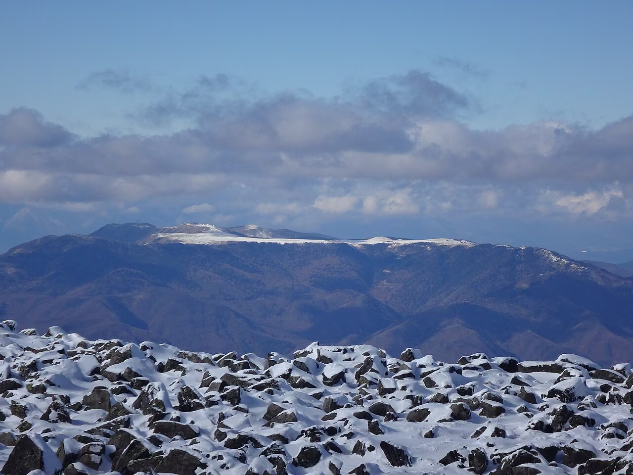
- Wear Grippy Gloves and Store Trekking Poles Above Shogundaira: On the boulder scramble between Shogundaira and the summit, trekking poles get in the way and can catch between rocks. Stow your poles on your backpack at Shogundaira and wear non-slip climbing gloves so you can use both hands safely on the rocks.
- Watch for Fog and Wind on the Wide Summit: Because the treeless boulder summit is wide and flat, heavy fog can make it surprisingly easy to lose your bearings toward the wrong descent trail (7th Station/Shogundaira vs. Venus Line vs. Tenshojigahara). Follow the painted arrows and cairns carefully.
Mountain Huts, Restrooms & Parking Information (2026 Verified)
| Facility / Location | 2026 Operating Period | Services & Restroom Notes | Official Source |
|---|---|---|---|
| Tateshina Sancho Hutte (蓼科山頂ヒュッテ) (2,520 m, just below summit) | Apr 25 – Oct 31, 2026 (Closed from Nov 1 for winter) | Lodging (reservation required), shop (from 9:00), light meals (10:00–14:00, L.O. 13:30) | Tateshina Sancho Hutte Official Calendar |
| Tateshina Sanso (蓼科山荘) (2,350 m, at Shogundaira) | Apr 25 – Oct 31, 2026 (Closed from Nov 1 for winter) | Lodging, café/badges, outdoor pay toilet (¥200 for non-guests; closed during winter off-season). No tent site at Shogundaira. | Tateshina Sanso Official Site |
| 7th Station Trailhead Parking (七合目登山口駐車場) (1,900 m) | Open spring–autumn | ~100 cars, free in 2026; seasonal restroom near trailhead (closed in winter). Note: Tateshina Town is considering a paid parking pilot for June–Nov 2027 due to weekend congestion. | Shinshu Tateshina Tourism Association Notice |
Access from Tokyo and Kansai (Osaka / Kyoto / Nagoya)
By Car
- From Tokyo: Chuo Expressway Suwa IC or Suwa-Minami IC → Venus Line / Shirakaba Lake → 7th Station Trailhead (~50–60 min from IC), or Joshin-Etsu Expressway Saku IC → Route 142 / 40 (~60 min).
- From Kansai / Nagoya: Meishin & Chuo Expressways via Komaki JCT and Okaya JCT to Suwa IC (~4 to 4.5 hours from Osaka/Kyoto; ~2.5 hours from Nagoya), making Mt. Tateshina one of the most accessible 2,500 m Hyakumeizan peaks for a weekend trip from western Japan.
By Public Transport (via JR Chino Station)
- Take the JR Chuo Line Limited Express Azusa from Shinjuku (or Shinano from Nagoya to Shiojiri + transfer) to JR Chino Station (茅野駅).
- From Chino Station, take an Alpico Kotsu Bus toward Shirakaba Lake / Kurumayama Kogen (or the seasonal Tateshina Kogen Round Bus / Tateshina Smile Kotsu + Shirakaba Resort Gondola when operating; see Tateshina Sancho Hutte Access Guide). Because bus and gondola connections to the 7th Station Trailhead are limited compared to driving, renting a car at Chino Station or Saku-daira Station is the most flexible option for early-morning starts.
Official References & Trail Resources
- Tateshina Sancho Hutte Official Site — Routes, Access & 2026 Operating Calendar
- Tateshina Sanso Official Site (Shogundaira)
- Shinshu Tateshina Tourism Association — Mt. Tateshina Trailheads & Parking Guide
- Shinshu Tateshina Tourism Association — 7th Station Parking Paid-Trial Study Notice (Sept 30, 2026)
- Alpico Kotsu Official Bus Timetables (Suwa / Chino / Tateshina Area)
- Nagano Prefecture 10-Prefecture Hyakumeizan Trail Grading List (PDF)
- Nagano Prefectural Police — Mountain Safety & Rescue Information