
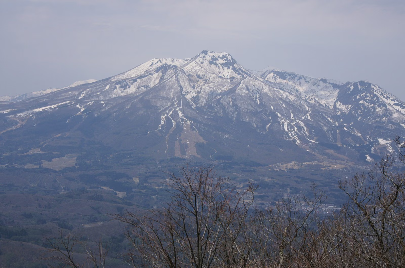
Photo: Σ64, Wikimedia Commons (CC BY-SA 4.0)
Mt. Myoko Hiking Guide: Tsubame Onsen Route, Chain Sections & Trailhead Comparison
Complete hiking guide to Mt. Myoko (2,454 m, 'Echigo Fuji'), one of Japan's 100 Famous Mountains in Myoko-Togakushi Renzan National Park. Compare the Tsubame Onsen, Sky Cable, and Sasagamine routes, Niigata Prefecture grading (5C / 4C / 5B), upper chain sections, and access.
Information checked October 24, 2026 against official notices from Myoko City, Myoko Tourism Management (Mt. Myoko Trail Guide), the Ministry of the Environment (Myoko-Togakushi Renzan National Park), Niigata Prefecture (Mountain Grading), and the Japan Meteorological Agency.
Rising 2,454 meters in southern Niigata Prefecture, Mt. Myoko (妙高山)—long revered as "Echigo Fuji" (越後富士)—is the centerpiece of Myoko-Togakushi Renzan National Park, one of the 100 Famous Mountains of Japan (Nihon Hyakumeizan), and one of the Kubiki Three Mountains (Kubiki Sanzan) alongside Mt. Hiuchiyama (2,462 m) and Mt. Niigata-Yakeyama (2,400 m).
Geologically, Mt. Myoko is an active stratovolcano with a steep central lava dome encircled by horseshoe-shaped outer caldera rim peaks (gairinzan)—Akakura-yama, Mitaharayama, and Kannayama. While neighboring Mt. Hiuchiyama offers gentle alpine boardwalks, Mt. Myoko rewards hikers with dynamic volcanic gorges, waterfalls, steep boulder scrambles, and a thrilling chain section (kusari-ba) leading to its twin summits.

Comparison of Mt. Myoko's 3 Main Climbing Routes
Hikers can approach Mt. Myoko from three primary trailheads, each with distinct terrain, time constraints, and Niigata Prefecture Mountain Grading scores:
| Route | Trailhead Elevation | Round-Trip Time | Distance | Cumulative Elevation Gain | Niigata Grading (Stamina / Tech) | Key Features & Cautions |
|---|---|---|---|---|---|---|
| 1. Tsubame Onsen Route (Classic Day Hike) | ~1,100 m | ~8–8.5 hr | ~11.5 km | ~1,400 m | 5 / C | No gondola time limit; passes waterfalls, hot springs, and the upper chain section (kusari-ba). |
| 2. Myoko Kogen Sky Cable Route | ~1,300 m (Summit Stn.) | ~7–7.5 hr | ~10.5 km | ~1,150 m | 4 / C | Shortest elevation gain, but strictly bound by first uphill (8:00 AM) and final downhill gondola times. |
| 3. Sasagamine Route (via Kurozawaike Hut) | ~1,300 m | ~9.5–10.5 hr | ~17.0 km | ~1,550 m | 5 / B | Avoids the eastern chain section; best as a 1-night, 2-day hike or traverse with Mt. Hiuchiyama. |
Route 1: Tsubame Onsen Route (燕温泉ルート — Classic Day Hike)
Starting from the historic hot-spring village of Tsubame Onsen (燕温泉), this is the most popular day-hike route up Mt. Myoko because you can start at dawn without waiting for a gondola.
Course Time Breakdown
- Ascent (~4 hours 30 minutes – 5 hours): Tsubame Onsen Trailhead (1,100 m) → (30 min) → Komyo Falls / Shomyo Falls View → (50 min) → Asagigahara (麻平) → (1 hr 20 min) → Tengu-do (天狗堂, 1,880 m; merges with Sky Cable trail) → (30 min) → Kosenji Pond / Wind Hole (光善寺池・風穴, 2,000 m) → (1 hr 20 min) → Chain Section (Kusari-ba) → Mt. Myoko South Peak (2,454 m) & North Peak (2,446 m)
- Descent (~3 hours 30 minutes): Mt. Myoko Summit → (1 hr 00 min) → Kosenji Pond → (20 min) → Tengu-do → (2 hr 10 min) → Tsubame Onsen Trailhead
Section-by-Section Highlights & Cautions
- Tsubame Onsen to Asagigahara (~1 hour 20 minutes): Walk through the hot-spring village past the open-air baths of Kogon-no-yu and Kawara-no-yu, overlooking the twin cascades of Komyo Falls and Shomyo Falls. The trail enters the valley along the Kitajigokudani stream before climbing wooden steps to the shaded beech forest clearing of Asagigahara.
- Volcanic Gas Caution: Stay strictly on the marked trail through the valley; off-trail geothermal vents emit hydrogen sulfide ($\text{H}_2\text{S}$).
- Munatsuki-hatcho to Tengu-do (~1 hour 20 minutes): From Asagigahara, the trail tackles Munatsuki-hatcho (胸突き八丁), a relentless, steep ridge climb over rocks and tree roots up to Tengu-do (1,880 m), where the trail from the Myoko Kogen Sky Cable joins.
- Kosenji Pond to the Chain Section & Summit (~1 hour 50 minutes): After passing a cool rock wind-hole (Kaza-ana) and the small alpine tarn of Kosenji Pond (光善寺池), the final 450 meters of elevation climb steep volcanic boulders and a steep chain section (kusari-ba) across exposed rock slabs.
- Gear: Wear a climbing helmet and grippy trekking gloves, keep three points of contact on the rock, and wait until the person ahead clears each chain anchor before climbing.
- South Peak (2,454 m) & North Peak (2,446 m): You arrive first at the South Peak (南峰, 2,454 m)—the highest point of Mt. Myoko, crowned by the stone shrine of Myoko Okami—and can walk ~10 minutes along the summit ridge to the North Peak (北峰, 2,446 m), where the first-class triangulation point overlooks Mt. Hiuchiyama and the Sea of Japan.

Route 2: Myoko Kogen Sky Cable Route (スカイケーブルルート)
Riding the Myoko Kogen Sky Cable gondola lifts you to ~1,300 meters in 11 minutes, saving ~250 meters of elevation gain compared with Tsubame Onsen.
- Course: Sky Cable Summit Station (~1,300 m) → Beech Forest Trail → Mitaharayama Traverse → Tengu-do (1,880 m) → Kosenji Pond → Chain Section → Mt. Myoko Summit → return to Sky Cable Summit Station.
- Strict Gondola Time Window: Because the first morning gondola typically departs at 8:00 AM and the final downhill gondola departs around 3:30 PM – 4:00 PM (depending on the season; green-season operations end in early November), hikers have only 7.5 to 8 hours to complete a 7 to 7.5-hour hike.
- Only choose the Sky Cable route if you are confident in your pace, and set a strict turnaround deadline at the summit (no later than 12:00 PM). If you miss the last gondola, you must walk down the ski resort service road to the base station (~1.5–2 additional hours).
Route 3: Sasagamine Route via Kurozawaike Hut (笹ヶ峰ルート)
Approaching from the west via Sasagamine Trailhead (1,300 m) avoids the steep eastern chain sections, making it rated Technical Difficulty B (rather than C), but the long distance (~17 km round trip) and the steep outer-rim climb and descent at Onozawa Pass (大倉乗越) and Nagasaka (長坂) make it physically demanding (Stamina 5).
- Course: Sasagamine Trailhead (1,300 m) → Twelve Switchbacks → Koyaike Junction → Kurozawaike Hut (黒沢池ヒュッテ, ~2,000 m) → Onozawa Pass → Nagasaka → Mt. Myoko North Peak & South Peak.
- Recommended 1-Night, 2-Day Traverse: Most hikers stay overnight at Kurozawaike Hut or Koyaike Hut (advance reservation mandatory) and climb both Mt. Hiuchiyama (2,462 m) and Mt. Myoko (2,454 m) on a two-day trip.

Access & Parking
Tsubame Onsen Trailhead (燕温泉登山口)
- By Car: ~25 minutes from Joshin-Etsu Expressway Myoko-Kogen IC (妙高高原IC) or Nakago IC (中郷IC). Park at the free Tsubame Onsen Hiker Parking Lot just before the entrance to the hot-spring village (public restrooms available; do not park inside the narrow inn streets).
- By Public Transit: Take the Echigo Tokimeki Railway (Myoko Haneuma Line) to Sekiyama Station (関山駅) or Myoko-Kogen Station (妙高高原駅), then board the Myoko City Municipal Bus (Suginosawa / Tsubame Onsen Line) to the Tsubame Onsen (燕温泉) terminus (~25–30 minutes).
Sasagamine Trailhead (笹ヶ峰登山口)
- By Car: ~30–40 minutes from Myoko-Kogen IC via Prefectural Route 39 (closes for winter from late October / early November through mid-June).
Reference Links
- Myoko Tourism Management — Mt. Myoko Trail Guide
- Myoko-Togakushi Renzan National Park — Mt. Myoko Climbing Route Map (PDF)
- Ministry of the Environment — Myoko-Togakushi Renzan National Park Climbing Map (PDF)
- Myoko City — Information on Climbing Mt. Hiuchiyama & Mt. Myoko
- Niigata Prefecture — Niigata Mountain Grading List
- Japan Meteorological Agency — Volcano Information Portal