
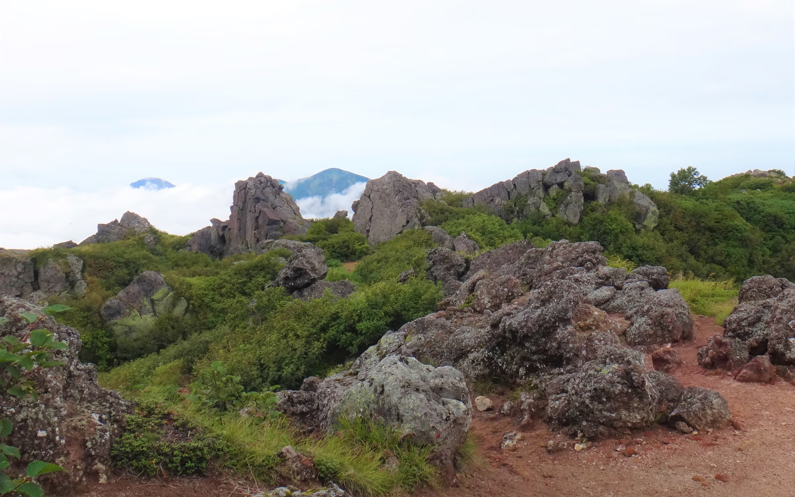
Photo: Taisyo, Wikimedia Commons (CC BY-SA 4.0)
Mt. Hiuchiyama Hiking Guide: Sasagamine Route, Koyaike Hut & Tengu-no-niwa Wetlands
Complete hiking guide to Mt. Hiuchiyama (2,462 m), the highest peak in Myoko-Togakushi Renzan National Park and one of Japan's 100 Famous Mountains. Covers the classic Sasagamine route via Twelve Switchbacks, Koyaike Hut, and Tengu-no-niwa alpine wetlands, plus Niigata Prefecture grading, hut reservations, and access.
Information checked October 24, 2026 against official notices from Myoko City, Myoko Tourism Management (Mt. Hiuchiyama Trail Guide and Koyaike Hut), the Ministry of the Environment (Myoko-Togakushi Renzan National Park), and Niigata Prefecture (Mountain Grading).
Standing at 2,462 meters in Myoko City, Niigata Prefecture, Mt. Hiuchiyama (火打山) is the highest peak in Myoko-Togakushi Renzan National Park and one of the 100 Famous Mountains of Japan (Nihon Hyakumeizan). Together with neighboring Mt. Myoko (妙高山, 2,454 m) and Mt. Niigata-Yakeyama (新潟焼山, 2,400 m), it forms the Kubiki Three Mountains (Kubiki Sanzan).
Unlike the rugged volcanic crags and chains of Mt. Myoko, Mt. Hiuchiyama is celebrated for its tranquil boardwalks winding through high-altitude marshes at Koyaike (高谷池) and Tengu-no-niwa (天狗の庭), its summer alpine flora, fiery late-September to early-October autumn meadow colors (kusa-momiji), and the northernmost habitat of the Japanese rock ptarmigan (raicho) in Japan.
Overview & Niigata Mountain Grading
| Item | Details |
|---|---|
| Mountain / Elevation | Mt. Hiuchiyama (火打山) / 2,462 m |
| Location | Myoko City, Niigata Prefecture (Myoko-Togakushi Renzan National Park) |
| Main Trailhead | Sasagamine Trailhead (笹ヶ峰登山口, ~1,300 m) |
| Standard Route | Sasagamine Trailhead → Kurosawa Bridge → Twelve Switchbacks → Fujimizaka → Koyaike Hut → Tengu-no-niwa → Mt. Hiuchiyama Summit (out-and-back) |
| Round-Trip Walking Time | ~8 hours 30 minutes – 9 hours (Ascent ~4 hr 50 min / Descent ~3 hr 40 min) |
| Round-Trip Distance | ~15.6 km |
| Cumulative Elevation Gain | ~1,200 m (net elevation difference ~1,160 m) |
| Niigata Mountain Grading | Physical Stamina: 4 (1–10 scale) / Technical Difficulty: B (A–E scale) |
| Climbing Season | Late June to mid/late October (snow remains on upper boardwalks until July; first snow typically arrives in mid-to-late October) |
Day Hike vs. Overnight Stay at Koyaike Hut
- Overnight Plan (Recommended for Most Hikers): Staying at Koyaike Hut (高谷池ヒュッテ) or Kurozawaike Hut (黒沢池ヒュッテ) breaks the 15.6 km hike into two comfortable days, lets you enjoy sunrise mist over the Koyaike marsh, or allows you to combine Mt. Hiuchiyama and Mt. Myoko on a 1-night, 2-day traverse.
- Day Hike from Sasagamine: Strong, experienced hikers can complete the round trip in a single day by starting from Sasagamine Trailhead around 5:00–5:30 AM, reaching Koyaike Hut by 8:00–8:30 AM, summiting by 10:00–10:30 AM, and returning to Sasagamine before 3:00 PM.
Section-by-Section Route Guide: Sasagamine Out-and-Back
Course Time Breakdown
- Ascent (~4 hours 50 minutes): Sasagamine Trailhead (1,300 m) → (50 min) → Kurosawa Bridge → (40 min) → Top of Twelve Switchbacks → (1 hr 30 min) → Koyaike Hut (2,100 m) → (30 min) → Tengu-no-niwa → (1 hr 20 min) → Mt. Hiuchiyama Summit (2,462 m)
- Descent (~3 hours 40 minutes): Mt. Hiuchiyama Summit → (1 hr 00 min) → Tengu-no-niwa → (30 min) → Koyaike Hut → (1 hr 30 min) → Kurosawa Bridge → (40 min) → Sasagamine Trailhead
1. Sasagamine Trailhead to Kurosawa Bridge (~50 minutes)
Pass through the wooden trailhead gate at Sasagamine (1,300 m), submit your climbing registration form, and walk along a wide, nearly flat wooden boardwalk through a cool primeval forest of beech (buna) and Japaneseasha (harunire) until you reach Kurosawa Bridge (黒沢橋) over the clear mountain stream.
- Caution: Wooden boardwalk planks are extremely slippery when wet with morning dew, rain, or frost—step flat on the boards and avoid placing weight on the edges.
2. Twelve Switchbacks (Juni-magari) to Fujimizaka (~2 hours 10 minutes)
Immediately after crossing Kurosawa Bridge, the trail begins climbing the Twelve Switchbacks (十二曲り)—a series of tight zigzags ascending a steep slope. Once above the switchbacks, the gradient eases briefly before climbing through conifer forest (shirabiso and kometsuga) and boulder steps up Fujimizaka (富士見坂). As the trees thin out near 2,000 meters, views open south toward Mt. Myoko and on clear days as far as Mt. Fuji.
3. Koyaike Hut & Tengu-no-niwa Wetlands (~30 minutes)
Crossing the ridge crest brings a sudden, dramatic reveal: the iconic triangular red roof of Koyaike Hut (高谷池ヒュッテ, 2,100 m) set beside the alpine ponds and meadows of Koyaike, with the gentle dome of Mt. Hiuchiyama rising ahead.
- Flush-style bio-toilets (100 yen environmental cooperation donation) and benches are available at Koyaike Hut.
- Beyond Koyaike, the boardwalk leads in 30 minutes to Tengu-no-niwa (天狗の庭), where calm marsh pools mirror the inverted silhouette of Mt. Hiuchiyama (Sakasa-Hiuchi). From July to August, hakusan-kozakura (primroses) and watasuge (cottongrass) bloom across the wetland; from late September to early October, the sedges turn brilliant gold and crimson.
4. Raicho-daira to Mt. Hiuchiyama Summit (~1 hour 20 minutes)
From Tengu-no-niwa, the trail climbs steeper rocky steps and wooden stairs through dwarf stone pine (haimatsu) past Raicho-daira (雷鳥平)—the northernmost habitat in Japan of the wild rock ptarmigan (raicho)—to the spacious Mt. Hiuchiyama Summit (2,462 m).
- The summit offers a 360-degree panorama of Mt. Niigata-Yakeyama and Mt. Myoko right beside you, the Northern Alps (Shirouma, Kashimayari, Tateyama, Yari, and Hotaka), Mt. Fuji, Sado Island, and the Sea of Japan.
Mountain Huts & Reservation Rules
Two mountain huts serve the upper plateau between Mt. Hiuchiyama and Mt. Myoko:
- Koyaike Hut (高谷池ヒュッテ, ~2,100 m)
- Location: At the junction of the Hiuchiyama trail and the Myoko traverse trail (~3 hours from Sasagamine Trailhead).
- Operating Season: Late June to mid/late October (check the official page for exact closing dates each autumn).
- Reservations: Advance reservation is mandatory for both hut lodging and the adjacent tent campsite via the Koyaike Hut Official Page.
- Water Supply: Koyaike Hut has no natural spring water; it relies on collected rainwater. Bring at least 2 to 2.5 liters of drinking water from the trailhead or purchase bottled drinks at the hut during staffed hours.
- Kurozawaike Hut (黒沢池ヒュッテ, ~2,000 m)
- Location: Situated beside Kurozawa Pond between Koyaike and Mt. Myoko, popular for hikers traversing both Mt. Hiuchiyama and Mt. Myoko over two days. Advance reservation is required.
Access, Parking & Autumn Road Closures
By Car
- Route: From the Joshin-Etsu Expressway Myoko-Kogen IC (妙高高原IC), take Prefectural Route 39 (Myoko-Kogen Park Line) for ~17 km (~30–40 minutes) to Sasagamine Trailhead Parking (笹ヶ峰駐車場).
- Parking & Facilities: Free parking (~200 spaces across the main trailhead lot and overflow lots near Sasagamine Campground), flushing public restrooms, and a trail register box. On autumn-foliage weekends in late September and October, the main lot often fills before 5:00 AM.
- Seasonal Winter Road Closure: Prefectural Route 39 between Suginosawa and Sasagamine closes to all vehicles for winter from late October / early November through mid-June (exact closure dates depend on autumn snowfall). Check Myoko City's Official Climbing Information before visiting in late October.
By Public Transit
- Take the Echigo Tokimeki Railway (Myoko Haneuma Line) or Shinano Railway (Kita-Shinano Line) to Myoko-Kogen Station (妙高高原駅).
- From Myoko-Kogen Station, ride the seasonal Sasagamine Direct Bus (笹ヶ峰直行バス) to the Sasagamine (笹ヶ峰) terminus (~50 minutes; operates during the summer and autumn hiking season—confirm current schedules and operating dates with Myoko Tourism Management before traveling).
Safety & Late-Autumn Precautions
- Early Snow & Frosted Boardwalks in October: At 2,100–2,462 meters, frost coats the wooden boardwalks at Koyaike and Tengu-no-niwa from early October, and the first snowfall typically arrives in mid-to-late October. Bring chain spikes (microspikes), waterproof gloves, and a warm insulated jacket in autumn.
- Lingering Snowfields in June–July: Heavy Sea of Japan snowfall leaves snowfields between the Twelve Switchbacks and Koyaike Hut well into early July, obscuring trail markers in fog.
- Bear Awareness: Asian black bears inhabit the Sasagamine beech forests; carry a bear bell or bear spray and check recent sightings at the trailhead notice board.
Reference Links
- Myoko Tourism Management — Mt. Hiuchiyama Trail Guide
- Myoko Tourism Management — Koyaike Hut Official Page & Reservations
- Myoko-Togakushi Renzan National Park Official Site — Mt. Hiuchiyama
- Ministry of the Environment — Myoko-Togakushi Renzan National Park Climbing Map (PDF)
- Myoko City — Information on Climbing Mt. Hiuchiyama & Mt. Myoko
- Niigata Prefecture — Niigata Mountain Grading List