
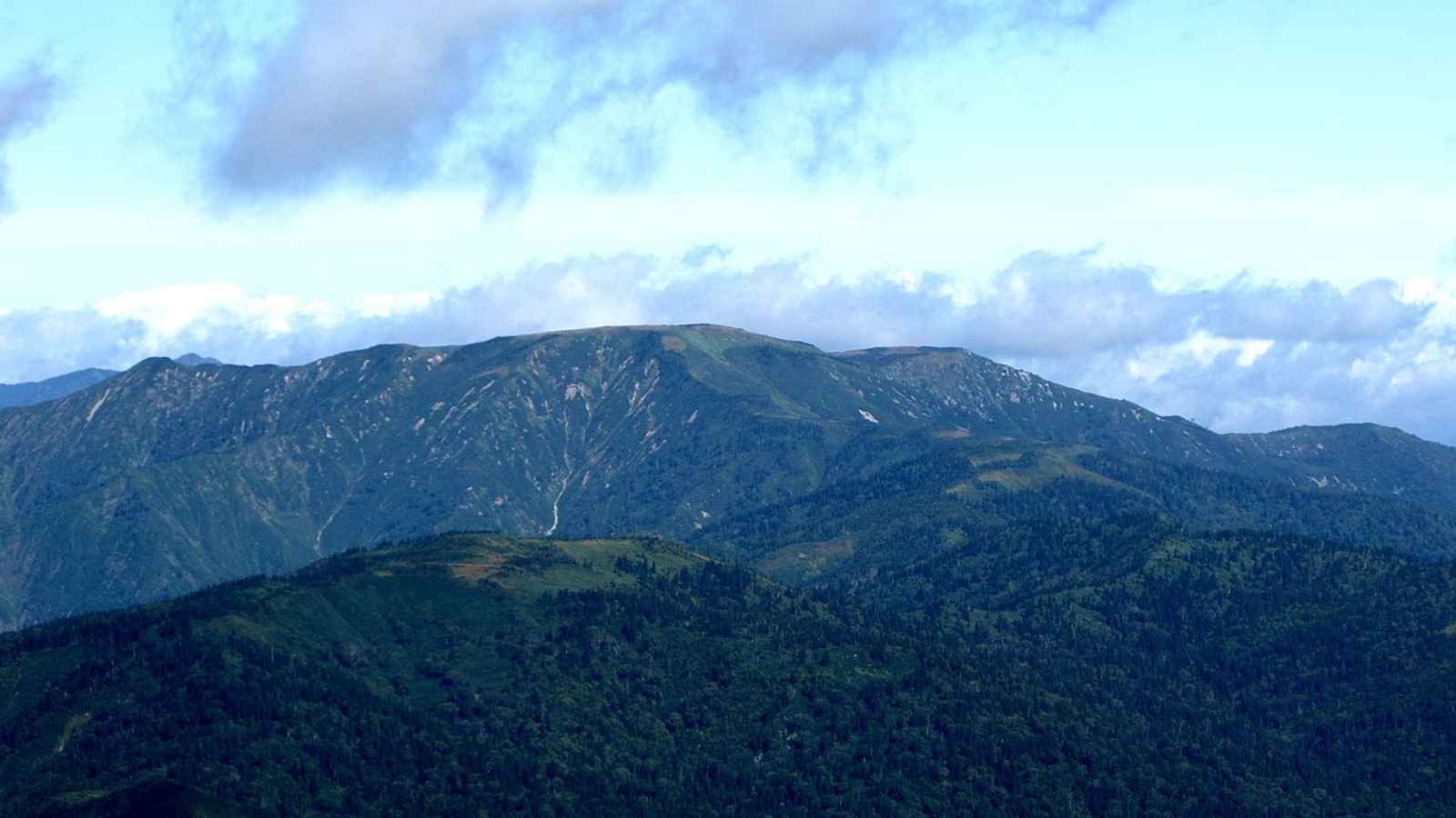
Photo: Qwert1234, Wikimedia Commons (CC BY-SA 4.0)

Mt. Hiragatake Hiking Guide: A 22.6 km Day Hike from Takanosu, Niigata Grading 5/D and the Route 352 Winter Closure
Mt. Hiragatake (2,141 m), one of Japan's 100 Famous Mountains, has no huts, no shelter and no camping, so it is a very long day hike from the Takanosu trailhead. Niigata grades it 5/D (22.6 km, 11.8 h). Official times, toilets and water, and the Route 352 winter closure from November 4, 2026.
This guide is based on information from Niigata Prefecture, Uonuma City and local tourism associations, checked October 24, 2026. Route 352 to the trailhead closes for winter from 9:00 on November 4, 2026. Check road information before you go.
Mt. Hiragatake stands on the border of Uonuma City in Niigata and Minakami Town in Gunma. The Uonuma City Tourism Association gives its height as 2,141 m (Niigata's grading list and Niigata Kankō Navi give 2,140 m). It is one of Japan's 100 Famous Mountains. The broad, flat summit plateau has marshes dotted with ponds and a strange egg-shaped rock, Tamago-ishi.
It is also one of the hardest day hikes in the region. Niigata Prefecture's mountain grading rates the round trip from the Takanosu car park at fitness level 5 and technical difficulty D: 22.6 km, 11.8 hours of course time and 1.82 km of total ascent. There are no huts, no emergency shelter, and camping is prohibited, so it has to be walked as one long day.


Key facts
| Item | Details |
|---|---|
| Elevation | 2,141 m (2,140 m in Niigata's grading list and Niigata Kankō Navi) |
| Location | Border of Uonuma City (Niigata) and Minakami Town (Gunma) |
| Main trailhead | Takanosu (846 m) |
| Niigata grading | Fitness 5, difficulty D (11.8 h, 22.6 km, 1.82 km ascent) |
| Season | July to November (Niigata Kankō Navi); the road closes on November 4, 2026 |
| Huts | None; no emergency shelter, camping prohibited |
Course times from Takanosu
The usual route is out and back from the Takanosu trailhead. Official figures differ by source:
| Source | Up | Down / round trip |
|---|---|---|
| Uonuma City Tourism Association | about 6 h 30 min | down about 4 h |
| Oze Hinoemata Onsen Tourism Association | – | about 12 h 30 min, 21 km round trip |
| Niigata Prefecture grading | – | 11.8 h, 22.6 km round trip |
The Oze Hinoemata association adds that the summit is about 1,300 m above the trailhead, but with the ups and downs of the ridge the total ascent is about 1,900 m. Allowing for breaks, photos and a detour to Tamago-ishi, plan on 12 hours or more.
The Uonuma City Tourism Association advises:
- Take plenty of food; the route is long.
- If you go as a day hike, start early in the morning.
- After about 20 minutes on a forest road, the trail follows a narrow ridge for about an hour. Take care.
The other trail, from the Nakanomata forest road, is not an option for most hikers: private vehicles are not allowed on that road.
Highlights
The summit area is a wide marsh with scattered ponds. The Oze Hinoemata association notes that the view from the summit itself is limited by trees, and recommends walking around Tamago-ishi and the marsh if you have the time and energy. In July, because snow lingers, spring and summer flowers bloom together: Primula cuneifolia, cotton grass and Narthecium asiaticum in the marsh, and rhododendrons, Glaucidium palmatum and Maianthemum in the forest.


Access and road information
By car
Niigata Kankō Navi gives about 40 minutes from "Uonuma IC" on the Kan-Etsu Expressway to Ginzandaira via the Okutadami Silver Line, then about 1 hour from Ginzandaira to Takanosu. From the Tokyo area, staying nearby the night before is safer.
- Parking: about 30 cars according to the Uonuma City Tourism Association, 20 cars according to Niigata Kankō Navi. Arrive early on busy days.
- Toilets: a temporary toilet (tip system) beside the car park, usually available from late June. The Oze Hinoemata association says there are no other toilets on the route; carry a portable toilet.
- Water: a source between the summit and Tamago-ishi (Hiragatake-zawa), but it can dry up. Carry plenty to drink.


Route 352 winter closure (2026)
Niigata Prefecture's Uonuma office (updated October 22, 2026) announces that Route 352 closes for winter from 9:00 on Wednesday, November 4, 2026, on two sections: Komanoyu entrance to Ginzandaira (Ishidaki Bridge), and Ginzandaira (boat landing) to the prefectural border (Kinsen Bridge). The road to Takanosu is in the second section, so the trailhead cannot be reached by car from November 4. The closure is normally lifted in late June.
Road enquiries: Uonuma Regional Development Bureau, maintenance section, 025-792-1304.
By public transport and boat
Niigata Kankō Navi lists a bus from Urasa Station (Jōetsu Shinkansen) to Okutadami Dam (75 min), a scheduled boat (40 min) and a 60-minute walk to the trailhead. We could not confirm operating days or times, and with this approach a round trip to the summit in one day is unrealistic.
Climbing plan
Uonuma City asks hikers to submit a climbing plan in advance. Niigata Prefectural Police recommend submitting it online or through an app.
What to bring
- Quick-drying base layer, a long-sleeved layer and a light warm layer.
- Rain jacket and trousers, hat and gloves.
- Hiking boots that support you over a long day.
- Plenty of water, snacks and lunch.
- Headlamp and spare batteries.
- A map app plus a backup map, and a power bank.
- First-aid kit, sunscreen, insect repellent and a portable toilet.
Planning tips
- Do not start late. Plan to set off at first light.
- Take care on the narrow ridge in the first part of the route.
- Carry extra water; the water source can dry up.
- Turn back early if the weather, your energy or the time is against you. There is no shelter.
- Include the drive home in your plan. Mountain roads after a 12-hour day are tiring; consider staying nearby before and after.
References
- Uonuma City Tourism Association: Mt. Hiragatake (Japanese)
- Niigata Prefecture: mountain grading (Japanese)
- Oze Hinoemata Onsen Tourism Association: Mt. Hiragatake (Japanese)
- Niigata Prefecture Uonuma office: Route 352 winter closure (Japanese)
- Niigata Kankō Navi: Mt. Hiragatake and Takanosu trailhead (Japanese)
- Uonuma City: 2026 mountain opening days (Japanese)