

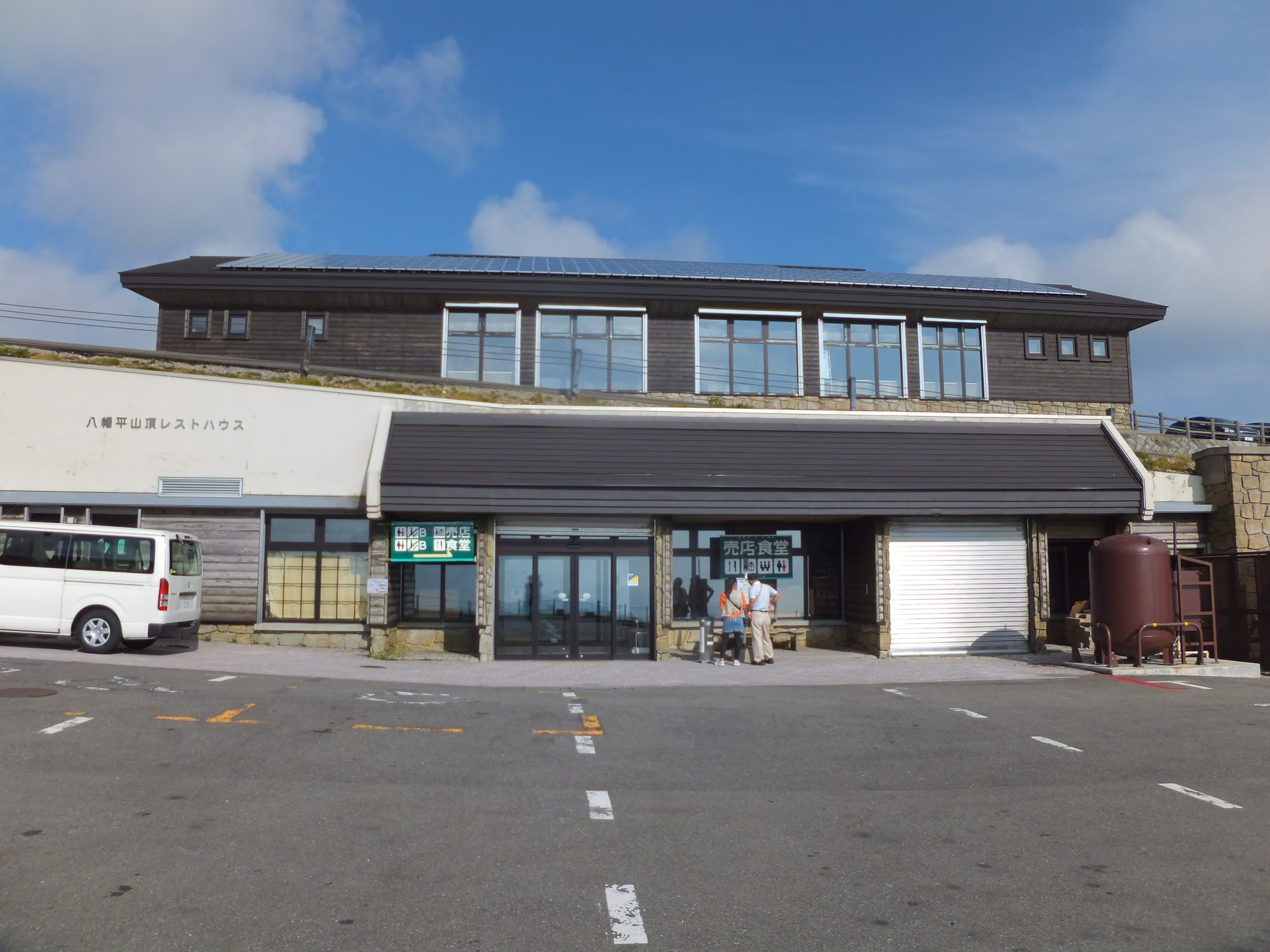
Photo: MaedaAkihiko via Wikimedia Commons (CC BY-SA 4.0)
Mt. Hachimantai Hiking Guide (2026): Dragon Eye (Kagaminuma), Mikaeri Pass Loop, Chausudake Traverse & Aspite Line Access
Complete 2026 hiking guide to Mt. Hachimantai (1,613 m, Hyakumeizan) on the Iwate–Akita border—covering the 1-hour Mikaeri Pass summit loop, the seasonal Kagaminuma 'Dragon Eye' snowmelt phenomenon, Kuroyachi and Chausudake extensions, parking fees, and Aspite Line winter closures.
Overview: The Easiest 100 Famous Mountain Walk Across a 1,600 m Volcanic Plateau
Straddling the border of Iwate and Akita Prefectures inside Towada-Hachimantai National Park, Mt. Hachimantai (八幡平, 1,613 m) is an expansive shield-like volcanic plateau dotted with emerald crater lakes, high-altitude marshes, and fragrant Maries' fir (Aomori todomatsu) forests (JMA Active Volcano Profile: Hachimantai PDF).
Because the scenic Hachimantai Aspite Line and Jukai Line highways climb directly to Mikaeri Pass (見返峠, ~1,540 m), the elevation difference to the 1,613 m summit is only about 70 meters. On paved stone paths and wooden boardwalks, even beginners can complete the classic summit loop past Kagaminuma ("Dragon Eye"), the summit observation deck, and Hachimannuma Marsh in 1 to 1.5 hours—making Mt. Hachimantai one of the most accessible peaks in Japan's 100 Famous Mountains (Nihon Hyakumeizan).
Seasonal Highlights: From the "Dragon Eye" to Alpine Flowers and Early Autumn Foliage
1. Mid-May to Mid-June: The "Hachimantai Dragon Eye" at Kagaminuma Pond

Every spring from mid-May to mid-June, snowmelt water pools in a ring around a central snow dome floating on Kagaminuma (鏡沼), creating the famous "Hachimantai Dragon Eye" (八幡平ドラゴンアイ) (Hachimantai City Tourism Association).
- Important Spring Trail Condition: During the Dragon Eye season (May to mid-June), the stone paths and wooden boardwalks around Kagaminuma and the summit remain buried under packed residual snow (残雪). Waterproof mid-cut hiking boots (plus light traction cleats/chain spikes on icy mornings) are strongly recommended instead of mesh sneakers.
2. Late June to August: Alpine Wildflowers at Hachimannuma & Kuroyachi Marshes

Once the snow melts in late June, the boardwalks around Hachimannuma (八幡沼), Gamanuma (ガマ沼), and Kuroyachi Wetland (黒谷地湿原) burst into bloom with chinaguruma (avens), nikkisuge (daylilies), mizubasho (skunk cabbage), and watasuge (cottongrass) (Visit Hachimantai Hiking Guide).
3. Late September to Mid-October: Golden Grasses (Kusamomiji) and Autumn Leaves
Because the plateau sits above 1,500 meters, autumn colors arrive early—typically peaking from late September to early October on the summit marshes and descending along the Aspite Line through mid-October before the first snowfall arrives in mid-to-late October.
Comparison of the 3 Recommended Hiking Courses
All three courses start from the Hachimantai Summit Rest House / Mikaeri Pass (見返峠, ~1,540 m) (Ministry of the Environment National Park Course Guide):
| Course Name | Distance | Walking Time | Elevation Gain | Difficulty | Best For |
|---|---|---|---|---|---|
| 1. Classic Summit &Hachimannuma Loop (山頂・八幡沼周回コース) | ~3.3–3.8 km | ~1 hr 15 min – 1 hr 40 min | ~90 m | Beginner | First-time visitors; covers Kagaminuma (Dragon Eye), the 1,613 m summit, Gamanuma, Hachimannuma, and Gentamori |
| 2. Short Summit & Gamanuma Walk (山頂・ガマ沼往復コース) | ~2.2 km | ~50–60 min | ~75 m | Beginner | Quick sightseeing walk when short on time or during windy weather |
| 3. Kuroyachi Wetland & Mt. Chausu Traverse (源太森・黒谷地湿原・茶臼岳縦走コース) | ~7.5 km (one-way to Chausuguchi) | ~3 hr 20 min – 3 hr 40 min | ~220 m | Beginner–Intermediate | Hikers wanting quiet boardwalk wetlands and a panoramic rocky summit at Mt. Chausu (茶臼岳, 1,578 m) |
Step-by-Step Guide to the Classic Summit & Hachimannuma Loop

- Mikaeri Pass Parking (~1,540 m) → Kagaminuma (鏡沼) → Meganenuma (メガネ沼) (~15–20 min): Start beside the Hachimantai Summit Rest House and climb a gentle stone-paved path through subalpine fir trees. Within 15 minutes you reach the viewing rim above Kagaminuma (where the Dragon Eye appears in late May–early June) and the twin crater ponds of Meganenuma.
- Meganenuma → Mt. Hachimantai Summit (1,613.3 m) (~10 min): A flat boardwalk leads to the 1,613.3 m summit, which is crowned by a raised wooden observation deck reconstructed in 2014 (Natural Parks Foundation Hachimantai Branch).
- Summit → Gamanuma (ガマ沼) → Ryoufu-no-Ma (陵雲荘 / 八幡沼展望台) (~15 min): Just past the summit, the trail opens onto the Gamamuma viewpoint—famous for its "two-tone" mineral-rich blue-green waters and direct views of Mt. Iwate (岩手山, 2,038 m) on clear days. Just below stands Ryounso (陵雲荘), an unmanned brick-and-timber emergency shelter beside the shore of Hachimannuma (Japan's second-largest crater-chain marsh).
- Hachimannuma Boardwalk → Gentamori (源太森, 1,595 m) → Mikaeri Pass (~35–45 min): Follow the boardwalk along the northern shore of Hachimannuma and climb a short staircase to Gentamori (1,595 m)—widely considered the best panoramic viewpoint on the entire plateau. From Gentamori, you can either loop back to Mikaeri Pass via the outer boardwalk or continue east toward Kuroyachi Wetland and Mt. Chausu (茶臼岳, 1,578 m).
Access, Parking Fees & Aspite Line Road Closures (2026 Verified)

| Item | 2026 Verified Official Details | Source |
|---|---|---|
| Mikaeri Pass Parking Fee (見返峠駐車場) | Standard Cars: ¥500 / Motorcycles: ¥200 / Microbuses: ¥1,000 / Large Buses: ¥2,000 (collected during the green season from Mid-April to early November for park maintenance) | Natural Parks Foundation — Hachimantai Branch |
| Aspite Line & Jukai Line Opening / Nighttime & Winter Closures | Reopens each spring in mid-April ("Snow Corridor" season). In late April and from mid-October until early November, night gates close from 17:00 to 8:30 the next morning whenever road-surface freezing occurs. Full winter closure runs from early November to mid-April. | Akita Prefecture Official Road Regulation Notice & Hachimantai Visitor Center |
| Public Bus from JR Morioka Station | Take the Iwate Kenpoku Bus (岩手県北バス) seasonal Hachimantai Nature Go (八幡平自然散策バス) or regular bus from Morioka Station (East Exit Boarding #3) to Hachimantai Chojo (八幡平頂上) (~1 hr 45 min – 2 hr). | Iwate Kenpoku Bus Official Hachimantai Route Page & Timetable Info |
Essential Safety Notes Before You Go
- Wind Protection Is Mandatory Even in Summer: Because Mikaeri Pass and the summit marsh sit on an exposed 1,600-meter ridge with no tall trees to block the wind, a sunny 25°C day in Morioka can quickly turn into a windy, fog-shrouded 8–12°C walk on the plateau. Always carry a windproof/waterproof shell.
- Bear Habitat Awareness: Towada-Hachimantai National Park is prime Asiatic black bear (tsukinowaguma) habitat. Even on the busy boardwalk loop—and especially on the quieter Kuroyachi and Chausudake trails—carry a bear bell or bear spray and check recent sightings posted at the Hachimantai Summit Rest House or Hachimantai Visitor Center (at Onuma).