

Mt. Chokai Hiking Guide: Comparing Hokodate, Fukura, Yunodai, and Yashima Routes on Dewa Fuji
Complete guide to climbing Mt. Chokai (2,236m), the independent volcano on the Akita–Yamagata border rising straight from the Sea of Japan. Compares the 4 major trailheads (Hokodate, Odaira/Fukura, Yunodai/Takinokoya, and Haraikawa/Yashima), course times, hut closures, and snowfield hazards.
Rising 2,236 m directly from the coast of the Sea of Japan on the border of Akita and Yamagata Prefectures, Mt. Chokai (Chokai-san, often called "Dewa Fuji") is one of Japan's 100 Famous Mountains (Nihon Hyakumeizan). Because its foot sweeps all the way down to the shoreline just 16 km away, no other peak in Tohoku matches its sense of vertical scale—or its exposure to moisture-laden winds off the Sea of Japan.
The summit area has a dramatic double structure: the outer crater rim peaking at Shichikosan (2,230 m) and the jagged lava dome of Shinzan (2,236 m), which pushed up inside the crater during the 1801 (Kyowa 1) eruption. Climbing the final boulder pile of Shinzan requires three-point rock scrambling, while the mid-mountain slopes hold massive perennial snowfields (sekkei), alpine meadows around Lake Chokai (Chokai-ko), and autumn colors that sweep down from late September through October.
Because Mt. Chokai straddles two prefectures and four municipalities, nine distinct trails radiate up its flanks. This guide compares the four most popular trailheads—Hokodate (Kisakata), Odaira (Fukura), Yunodai (Takinokoya), and Haraikawa (Yashima)—along with 2026 mountain hut and road closure dates, active trail detours, and safety essentials.
Mt. Chokai at a Glance
| Item | Details |
|---|---|
| Elevation | Shinzan: 2,236 m (GSI triangulation point: Shichikosan, 2,229.9 m) |
| Location | Nikaho City & Yurihonjo City (Akita Pref.) / Yuza Town & Sakata City (Yamagata Pref.) |
| Volcanic Alert Level | JMA Volcanic Alert Level 1 (Active volcano; check latest JMA bulletins before climbing) |
| Main Trailheads | Hokodate (1,160 m), Odaira / Fukura (1,080 m), Yunodai / Takinokoya (1,200 m), Haraikawa / Yashima (1,200 m) |
| Round-Trip Walking Time | 7.5 to 10 hours excluding breaks (allow 10 to 12 hours including rests for Hokodate or Odaira) |
| Elevation Gain | Approx. 1,100–1,250 m (including drop and re-ascent around the outer crater rim / Lake Chokai) |
| Best Season | Late June – early October (Summer alpine flowers: July–August; Autumn foliage: late September – mid-October) |
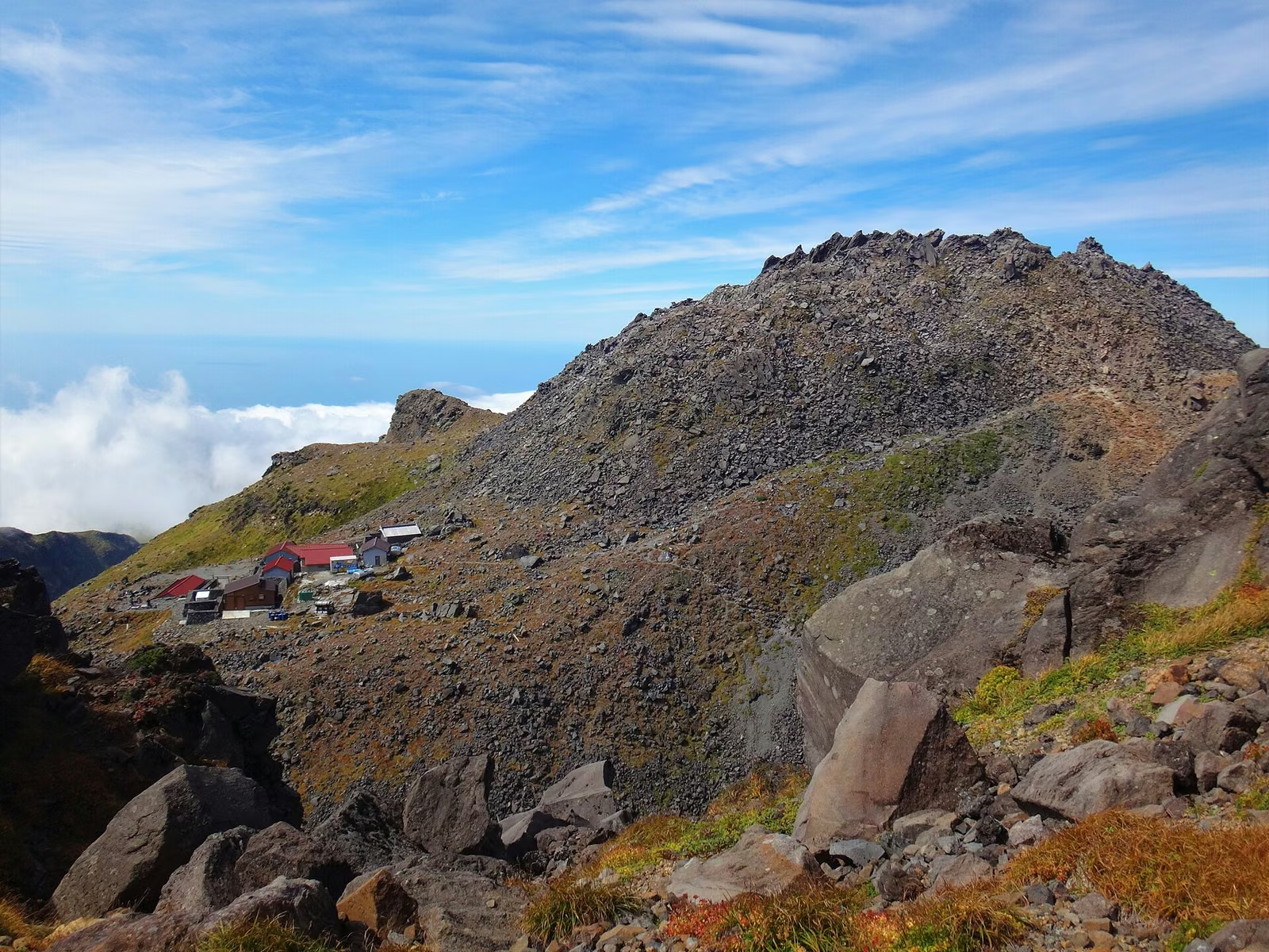 Looking across from Shichikosan (2,230 m) on the outer crater rim to the rugged lava dome of Shinzan (2,236 m). Photo: Wikimedia Commons (Koda6029, CC BY-SA 4.0)

Comparing the 4 Main Routes
| Route (Trailhead) | Side | Starting Elev. | Round-Trip Walking Time (excl. breaks) | Round-Trip Distance | Key Features & Best For |
|---|---|---|---|---|---|
| 1. Hokodate (Kisakata) | Akita (Nikaho) | 1,160 m | 9 hr 05 min (Up 5h05m / Down 4h00m) | ~15.5 km | Most popular route; gradual ridge walk past Lake Chokai (Ohama); 300-car parking lot |
| 2. Odaira (Fukura) | Yamagata (Yuza) | 1,080 m | 9 hr 45 min (Up 5h35m / Down 4h10m) | 14.5 km | Yamagata Grading Physical 5 / Technical C; joins Hokodate trail at Ohama |
| 3. Yunodai (Takinokoya) | Yamagata (Yuza/Sakata) | 1,200 m | 9 hr 10 min (Up 4h55m / Down 4h15m) | 10.6 km | Yamagata Grading Physical 3 / Technical C; shortest distance on Yamagata side; steep snowfields & Azami-zaka |
| 4. Haraikawa (Yashima) | Akita (Yurihonjo) | 1,200 m | 7 hr – 8 hr (incl. short breaks) | ~8.8 km (to Shichikosan) | Shortest route to the outer rim (4.4 km one way); ideal for late-season hikes after Chokai Blue Line closes |
1. Hokodate Route (Kisakata-guchi, Akita Side)
Starting near the top of the Chokai Blue Line scenic toll-free road at 1,160 m, the Hokodate Route is the single most popular trail on Mt. Chokai. The trailhead has free parking for roughly 300 cars, the Hokodate Visitor Center, Inakura Sanso, and Hokodate Sanso.
- Course Breakdown (Nikaho City Tourism Association standard times, excluding breaks):
- Hokodate Trailhead (1,160 m) → Sainokawara (1,540 m): 1 hr 20 min up / 1 hr 00 min down
- Sainokawara → Ohama Hut / Lake Chokai (1,700 m): 40 min up / 30 min down
- Ohama Hut → Shimekake (1,800 m): 1 hr 00 min up / 50 min down
- Shimekake → Omuro / Summit Hut (2,150 m): 1 hr 40 min up / 1 hr 20 min down
- Omuro → Shinzan Summit (2,236 m): 25 min up / 20 min down
- Total Walking Time: 5 hr 05 min up / 4 hr 00 min down (9 hr 05 min pure walking; Nikaho City advises budgeting 11 to 12 hours total including rest stops and congestion on the Shinzan boulders).
After climbing gently to Ohama (1,700 m), the view opens over the crater basin of Lake Chokai (Chokai-ko) and the ocean below. From Ohama, however, the trail drops toward Shimekake before climbing Senjadani (the inner valley route) or the Outer Crater Rim (Gairinzan), making the return climb back to Ohama feel longer than expected.
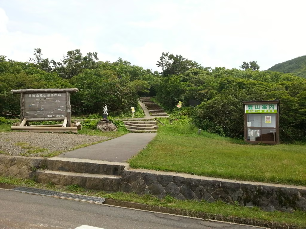 The Hokodate trailhead (1,160 m) on the Chokai Blue Line, the busiest starting point on Mt. Chokai. Photo: Wikimedia Commons (Douglas Paul Perkins, CC BY 3.0)

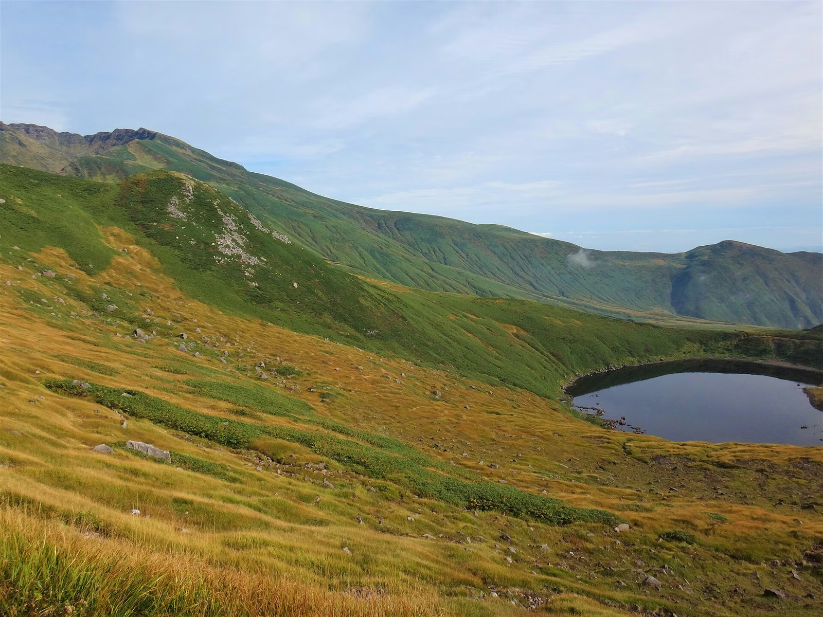 Lake Chokai (Chokai-ko) framed by autumn foliage below Ohama (1,700 m). Photo: Wikimedia Commons (Koda6029, CC BY-SA 4.0)

2. Odaira Route (Fukura-guchi, Yamagata Side)
Located 2.5 km down the Yamagata side of the Chokai Blue Line from Hokodate, the Odaira Trailhead (1,080 m) climbs through forest past Miharashidai (1,340 m) and the snow-fed valley of Kawarashuku (1,580 m) to join the Hokodate trail at Ohama (1,700 m).
- Course Breakdown (Yuza-Chokai Tourism Association times):
- Odaira Trailhead (1,080 m) → Miharashidai (1,340 m): 50 min up / 30 min down
- Miharashidai → Kawarashuku (1,580 m): 1 hr 10 min up / 50 min down
- Kawarashuku → Ohama (1,700 m): 30 min up / 20 min down
- Ohama → Shinzan Summit (2,236 m): 3 hr 05 min up / 2 hr 30 min down
- Total Walking Time: 5 hr 35 min up / 4 hr 10 min down (9 hr 45 min excluding breaks; Yamagata Mountain Grading: Physical 5 / Technical C, 14.5 km round trip).
- 2026 Facility Note: Odaira Sanso at the trailhead has been closed during the 2026 season due to electrical equipment repairs.
3. Yunodai Route (Takinokoya Trailhead, Yamagata Side)
Accessed via the Yunodai Highland Road on the southern flank of the mountain, the Yunodai Route starts at the Takinokoya Parking Lot (1,200 m, approx. 70 spaces) and is the shortest route to the summit on the Yamagata side.
- Course Breakdown (Yuza-Chokai Tourism Association times):
- Takinokoya Parking Lot (1,200 m) → Takinokoya Hut (1,280 m): 20 min up / 15 min down
- Takinokoya Hut → Kawarashuku (1,550 m): 1 hr 00 min up / 50 min down
- Kawarashuku → Azami-zaka (1,860 m): 1 hr 50 min up / 1 hr 35 min down
- Azami-zaka → Fushiogamidake (2,135 m): 40 min up / 35 min down
- Fushiogamidake → Outer Rim Junction (2,196 m): 25 min up / 25 min down
- Outer Rim Junction → Omuro (2,150 m): 15 min up / 15 min down
- Omuro → Shinzan Summit (2,236 m): 25 min up / 20 min down
- Total Walking Time: 4 hr 55 min up / 4 hr 15 min down (9 hr 10 min excluding breaks; Yamagata Mountain Grading: Physical 3 / Technical C, 10.6 km round trip).
Key Hazards on the Yunodai Route
- Large & Small Snowfields (Daisekkei / Shosekkei, 1,400–1,600 m): Between Takinokoya and Kawarashuku, hikers cross steep perennial snowfields well into summer (and hard-frozen snow bridges in autumn). Light crampons (6-point or 10-point) and poles are frequently required into July and August. (Note: the old Kawarashuku Hut at 1,550 m has collapsed and cannot be used for shelter.)
- Azami-zaka (1,860 m): A fierce, eroded volcanic gravel and boulder climb up to the outer crater rim at Fushiogamidake.
- Route-Finding Error When Descending the Outer Rim: On the descent from the outer crater rim, hikers heading for Yunodai and hikers heading for Hokodate/Odaira often accidentally follow each other down the wrong fork at Fushiogamidake / Azami-zaka, ending up tens of kilometers away from their parked car in dark forest. Check every junction sign carefully in fog.
4. Haraikawa Route (Yashima-guchi, Akita Side)
Approaching from the northeast (Yurihonjo City), the Haraikawa Trailhead (1,200 m, approx. 100 parking spaces) offers the shortest distance to the outer crater rim at Shichikosan (4.4 km one way, just over 1,000 m of elevation gain).
- Standard Time: 4 hr to 4 hr 30 min up / 3 hr to 3 hr 30 min down (including short rests). From Shichikosan, descending into the inner crater to scramble up Shinzan adds roughly 45–60 minutes round trip.
- 2026 Haraikawa Sanso Status: Located right at the trailhead, Haraikawa Sanso is open April 24 – October 31, 2026 (overnight fee 2,200 JPY when the caretaker is present; the caretaker's final staffed night in 2026 was October 3, and part of the building remains open year-round as an unstaffed shelter).
 Wooden boardwalk winding through the open slopes of Mt. Chokai toward the upper volcano. Photo: Wikimedia Commons (Douglas Perkins, CC BY 4.0)

Active Trail Closures and Detours (2026 Season)
According to the Yuza-Chokai Tourism Association, two trail sections on the upper mountain remain closed due to rockfall and cliff collapse:
- Gyojadake – Omuro Hut Shortcut (Closed): On the outer crater rim between Gyojadake and Fushiogamidake, the direct shortcut dropping to the summit Omuro area is closed due to rock wall collapse. Stay on the main outer crater rim trail (Gairinzan) past Fushiogamidake.
- Shimekake Old Trail (Closed): Near Shimekake (between Ohama and Senjadani on the Hokodate/Odaira route), the old trail is closed due to rockfall hazard. Use the newly constructed boardwalk detour.
2026 Hut, Toilet, and Road Closure Dates
Because Mt. Chokai faces the cold northwesterlies of the Sea of Japan, mountain huts and toilets close much earlier in autumn than in the Japanese Alps:
- Summit Omuro Hut & Ohama Hut (Akita Side): Closed for the 2026 season on September 2, 2026.
- Summit Toilet & Ohama Toilet: In 2026, the Summit Toilet closed on September 11 and the Ohama Toilet closed on September 29. Anyone climbing in October must carry a portable toilet kit (keitai toire) and use the trailhead restrooms before starting.
- Takinokoya Hut (Yunodai Route): Staffed from June 22 to October 12, 2026 (part of the building remains unlocked off-season as an emergency shelter).
- Hokodate Sanso (Hokodate Trailhead): Open early May to late October (overnight fee 2,200 JPY; reservations not accepted).
- Chokai Blue Line (Prefectural Road 210, Hokodate & Odaira Access):
- Closes for winter from early November to late April every year. Even before full winter closure (typically from late October), overnight gate closures (17:00 to 08:00) take effect due to road icing. Always check the latest road notices from Nikaho City and Yamagata Prefecture before driving up in late October.
- Shared Taxi / Bus ("Chokai Blue Liner"):
- The reservation-based Chokai Blue Liner connecting Michi-no-Eki Kisakata (Nemunooka) / JR Kisakata Station with Hokodate Trailhead (3,000 JPY one way when shared by 2+ passengers) operates on weekends and holidays from June through the second week of October (ended for the 2026 season in mid-October). Outside that window, use a taxi from JR Kisakata Station or JR Yuza Station.
 Mt. Chokai in mid-October, when early snow caps the upper lava dome while autumn foliage colors the mid-slopes. Photo: Wikimedia Commons (8-Forest, CC BY-SA 3.0)

References and Official Links
- Geospatial Information Authority of Japan (GSI): Elevation of Major Mountains in Japan
- Japan Meteorological Agency (JMA): Volcanic Activity Information for Mt. Chokai
- Nikaho City Official Guide: Mt. Chokai Climbing Routes & Course Times (Hokodate)
- Nikaho City: 2026 Closing Dates for Summit Hut, Ohama Hut, and Mountain Toilets
- Nikaho City: Chokai Blue Line Road Closure Information
- Yuza-Chokai Tourism Association: Mt. Chokai Trail Routes (Odaira & Yunodai)
- Yuza-Chokai Tourism Association: Latest Mt. Chokai Trail Notices & Detours
- Yamagata Prefecture: Yamagata Mountain Grading List (PDF)
- Yurihonjo City: Haraikawa Sanso (Yashima Trailhead) Facility Information
- Kisakata Godo Taxi: Chokai Blue Liner Shared Bus Information