

Photo: Alpsdake, Wikimedia Commons (Public Domain)

Mt. Arashima Hiking Guide: The Kadohara Trail, Mochigakabe Steps & Autumn Beech Forest on Fukui's Hyakumeizan
A complete English guide to hiking Mt. Arashima (1,523 m) in Ono City, Fukui Prefecture—the only 100 Famous Japanese Mountain in Fukui. Covers the Kadohara Trail, the steep Mochigakabe section, autumn beech foliage, and access from JR Etsumi-Hoku Line Kadohara Station.
Rising to 1,523 meters in Ono City, Fukui Prefecture, Mt. Arashima (荒島岳, Arashimadake) is the only peak in Fukui Prefecture selected among the Nihon Hyakumeizan (100 Famous Japanese Mountains), compiled by writer and mountaineer Kyuya Fukada. Often called Ono Fuji for the balanced silhouette it presents above the Ono Basin, Mt. Arashima is also one of the closest 100 Famous Mountains to the Kansai and Chukyo metropolitan regions.
Despite its modest elevation below 1,600 meters, the standard Kadohara Course (カドハラコース) begins near 350 meters above sea level on the floor of the former Kadohara Ski Area. Climbing to the summit therefore involves roughly 1,170 meters of cumulative elevation gain, mature beech (buna) forests, and the steep rope-and-chain pitch known as Mochigakabe (もちがかべ)—making it a substantially more demanding day hike than its altitude alone suggests.
Mountain Overview
| Item | Details |
|---|---|
| Mountain Name | Mt. Arashima (荒島岳 / Arashimadake) |
| Elevation | 1,523.5 m (First-Order Triangulation Station) |
| Location | Ono City, Fukui Prefecture |
| Main Trailhead | Kadohara Course (approx. 350 m elevation, base of the former Kadohara Ski Area) |
| Standard Round-Trip Time | Approx. 6 hr 5 min (Ascent: approx. 3 hr 35 min / Descent: approx. 2 hr 30 min; breaks excluded) |
| Cumulative Elevation Gain | Approx. 1,170 m |
| Difficulty | Intermediate (sustained steep climb and steep fixed-chain/rope sections on Mochigakabe) |
| Best Season | Late April to early November (fresh green beech canopy in May–June; autumn foliage in mid-October to early November) |


Why Hike Mt. Arashima?
1. Mature Beech Forest ("Totoro's Trees") and Autumn Color
Above the former ski slopes of the Kadohara Course, the trail enters a dense, mature forest of Japanese beech (Fagus crenata), locally nicknamed Totoro no Ki (Totoro's Trees) for its mossy trunks and overarching canopy.
- Late May to June: Newly unfurled beech leaves filter the sunlight, keeping the forest floor cool and shaded after the exposed climb up the old ski slope.
- Mid-October to early November: The beech forest turns shades of gold and amber, while maples and rowans along the upper ridge above Shokugatake turn bright red.
2. 360-Degree Summit Panorama Over Mt. Haku and the Northern Alps
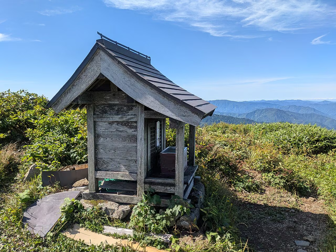
The summit of Mt. Arashima is completely open above the treeline and houses the small shrine of Arashima Jinja alongside a compass viewing plaque. On clear days, the 360-degree view encompasses:
- North: The massif of Mt. Haku (白山, 2,702 m) rising across the border of Fukui, Ishikawa, and Gifu.
- East: Mt. Norikura, Mt. Ontake, and the Northern Japan Alps (Hida Mountains).
- West: The Ono Basin below, often blanketed in a morning sea of clouds (unkai) in autumn.

Trail Routes on Mt. Arashima
Ono City introduces four main routes on Mt. Arashima:
| Route | Round-Trip Time (Ono City Guide) | Key Characteristics |
|---|---|---|
| Kadohara Course (カドハラコース) | Approx. 6 hr 5 min (Up 3 hr 35 min / Down 2 hr 30 min) | The most popular and best-maintained route, with spacious parking, restrooms, and a washing station at the trailhead. |
| Shimoyama Course (下山コース) | Approx. 5 hr 50 min | A steeper, quieter ridge route starting near越美北線 Shimoyama Station. |
| Nakade Course (中出コース) | Approx. 6 hr 25 min | Joins the Kadohara route at Shokugatake via Kosho-daira. |
| Sakadani Course (阪谷コース) | Long route via Mt.Koarashima | Least frequented; better suited to experienced hikers looking for a quiet traverse. |
For most visitors, the Kadohara Course is the standard choice due to its clear signage, trailhead facilities, and direct access from Route 158.
Step-by-Step Guide: The Kadohara Course
Route Summary: Kadohara Parking Lot → Former Ski Slope → Beech Forest ("Totoro's Trees") → 白山ベンチ (Hakusan Bench) → Shokugatake (シャクナゲ平 / 1,206 m) → Mochigakabe (もちがかべ) → Mae-Arashima → Mt. Arashima Summit (1,523 m) → Return via the same route.
1. Kadohara Trailhead to the Top of the Former Ski Slope (Approx. 50 min)
From the parking lot at the base of the former Kadohara Ski Area, pass the trail register box and begin climbing up the grassy service track and concrete steps alongside the old ski run. There is virtually no shade on this opening section, so in late spring, summer, and early autumn it can feel warm right from the start. Pace yourself steadily and look back for expanding views of the Ono Basin.
2. Beech Forest to Shokugatake / Shakunage-daira (Approx. 1 hr 35 min)
At the top of the old ski lift area, the trail steps into the cool beech forest. The path climbs over tree roots and wooden steps through Totoro no Ki, passing the Hakusan Bench (白山ベンチ) viewpoint where Mt. Haku appears framed through the trees.
Continuing up the ridge, you reach Shokugatake (小荒島岳方面分岐 / シャクナゲ平, 1,206 m), a broad junction where the Nakade Course merges from the right. This flat clearing offers open views and is the ideal place for a rest and snack before tackling the steepest part of the mountain.
3. Shokugatake Through Mochigakabe to the Summit (Approx. 1 hr 10 min)
From Shokugatake, the trail actually drops briefly into a saddle before confronting Mochigakabe (もちがかべ)—a steep, rocky wall where high steps, exposed roots, and fixed ropes/chains climb sharply up the ridge.
- Ascending Mochigakabe: Keep three points of contact, test rocks and roots for stability before weighting them, and leave space between hikers so dislodged pebbles do not hit anyone below.
- Descending Mochigakabe: Because you must climb back up into Shokugatake after descending Mochigakabe on the return leg, save energy and knee strength for the afternoon descent.
Above Mochigakabe, the forest gives way to low sasa bamboo and alpine shrubs along the open ridge through Mae-Arashima (前荒島) and Naka-Arashima (中荒島), leading directly to the 1,523.5 m summit.


Facilities, Restrooms, and Water
- No Mountain Huts or Toilets on the Trail: There are no staffed huts, no vending machines, and no restrooms anywhere above the trailhead.
- Trailhead Restrooms: Restrooms and boot-washing taps are available at the Kadohara Trailhead parking area. Bring a portable toilet bag (keitai toire) for emergencies during the 6-hour round trip.
- Drinking Water: Although a small seep (Todoro-no-mizu) exists along the mid-mountain trail, it is untreated and can run dry in late summer and autumn. Carry at least 1.5 to 2.0 liters of water per person from the start.
Access and Parking
By Car (Recommended)
- Route: From the Chubu Jukan Expressway Kadohara IC (勝原IC) or Arashima IC (荒島IC), follow National Route 158 to the Kadohara Trailhead (just minutes from Kadohara IC).
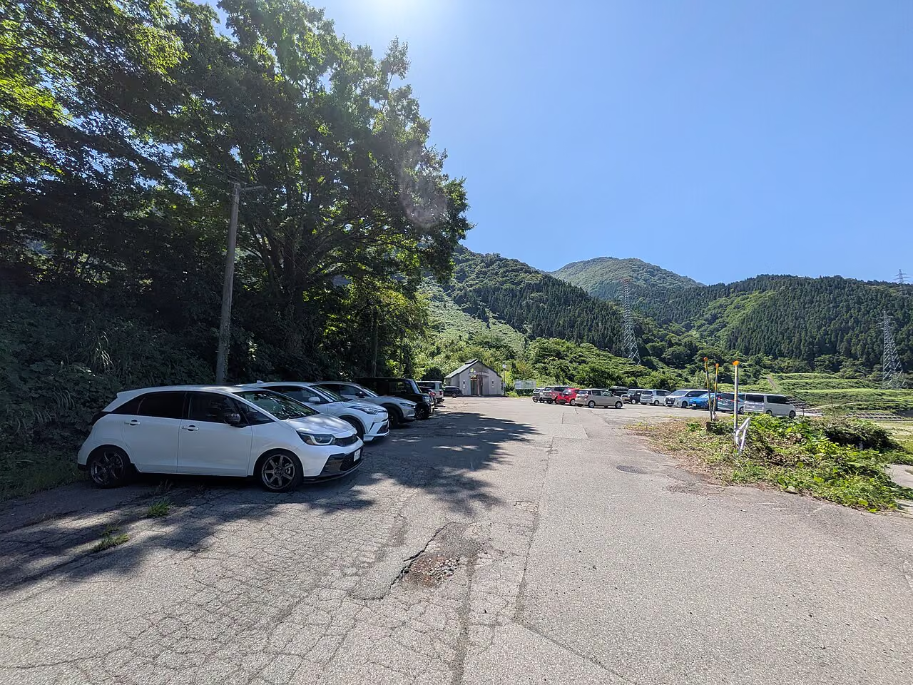
- Parking: Large free parking areas are available at the former Kadohara Ski Area base. Even during the May Golden Week holidays and October autumn foliage season, the lot can accommodate a large number of vehicles.

By Train (JR Etsumi-Hoku Line / Kuzuryu Line)
- Nearest Station: Kadohara Station (勝原駅) on the JR Etsumi-Hoku Line (from Fukui Station via Echizen-Ono Station).
- Walk to Trailhead: Approx. 20–25 minutes on foot uphill from Kadohara Station to the Kadohara Trailhead.
- Important Timetable Warning: The JR Etsumi-Hoku Line beyond Echizen-Ono runs only about 4 to 5 trains per day. Always check the exact departure times on JR West's official planner before attempting a rail-based day hike, or arrange a taxi from Echizen-Ono Station.