
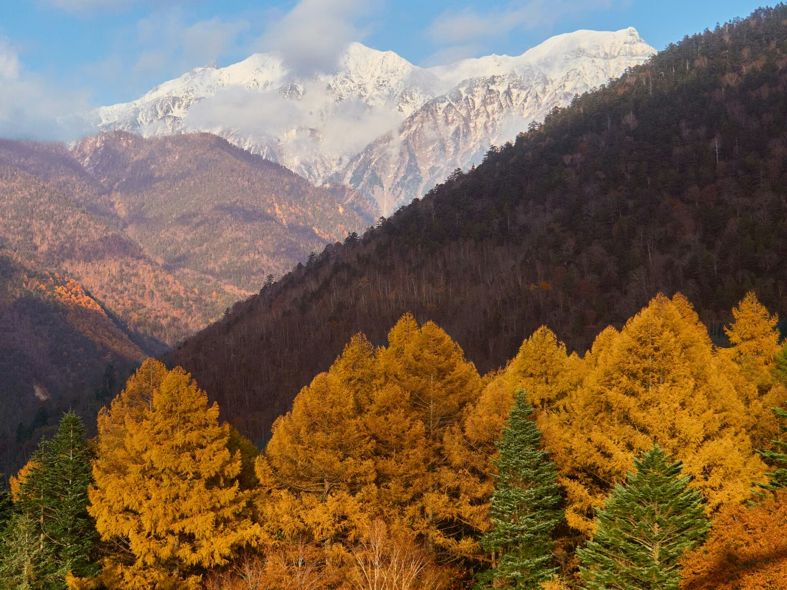
Photo: lumoplank, Wikimedia Commons (CC0)
When 'First Snowcap' News Breaks in Japan: How to Read Late-Autumn Mountain Weather, Snow Depth & Climbing Indexes
When autumn news reports the first snowcap (hatsu-kansetsu) on Japanese mountains, high ridges are already entering winter conditions. Learn what changed in the Japan Meteorological Agency's 2026 first-snowcap rules, how to calculate summit wind chill, and why a 'Level A' climbing index does not mean snow-free trails.
Information checked October 24, 2026 against official publications from the Japan Meteorological Agency (July 31, 2026 Press Release on First Snowcap Observations, Snow Depth Portal, and Forecast Terminology), Nagano Prefecture (Autumn Mountain Safety Guidelines), and Tenki-to-Kurasu.
Every autumn from late September through November, news headlines in Japan announce the "first snowcap" (hatsu-kansetsu, 初冠雪) on peaks from Daisetsuzan and the Northern Alps to Mt. Fuji. While plains and valleys are still enjoying mild autumn sunshine and colorful leaves, mountains above 1,500 to 2,000 meters can shift overnight into winter blizzards, glazed ice, and sub-zero wind chill.
This guide explains how the Japan Meteorological Agency (JMA) determines hatsu-kansetsu—including the major rule change introduced in autumn 2026—how to calculate real summit temperatures and wind chill from lowland forecasts, and how to use weather portals like Tenki-to-Kurasu (Tenkura) without being caught off guard by early snow.
1. What "First Snowcap (Hatsu-kansetsu)" Actually Means—and What Changed in Autumn 2026
Why Hikers Cannot Wait for the Official "First Snowcap" Announcement
Historically, the Japan Meteorological Agency defined first snowcap (hatsu-kansetsu) as the first day after the summer's highest temperature when snow or white solid precipitation (graupel, hail) whitening all or part of a mountain near its summit is visually observed from a JMA weather office down in the valley or plain (JMA Observation Method PDF).
Because traditional observation depended on visibility from the weather station:
- If clouds shrouded the mountain during and after a snowfall, hatsu-kansetsu could not be recorded until the clouds cleared—or if the snow melted before the clouds lifted, it was not recorded at all.
- If snow accumulated only on the far side of the ridge invisible from the weather office, no announcement was made even while hikers on the trail were walking through snow.
The Autumn 2026 Rule Change: 44 Mountains Switched to "Analyzed Snow Depth"
On July 31, 2026, the Japan Meteorological Agency announced a major modernization starting in the 2026 autumn–winter season (JMA Press Release, July 31, 2026):
- 44 mountains nationwide transitioned from human visual observation to automated determination using Analyzed Snow Depth (Kaiseki Sekisetsushin, 解析積雪深)—which combines radar, AMeDAS precipitation/temperature data, and snow-melt modeling to detect snow accumulation even when clouds hide the mountain.
- 20 mountains remain visually observed from local weather stations, including Mt. Fuji (Kofu), Mt. Iwate (Morioka), Mt. Chokai (Akita), Mt. Gassan (Yamagata), Mt. Azuma (Fukushima), Mt. Asama (Nagano), Mt. Tanigawa (Maebashi), Mt. Tateyama (Toyama), Mt. Hakusan (Kanazawa), Mt. Ibuki (Gifu), Mt. Daisen (Yonago), and Mt. Aso (Kumamoto).
Even on the 44 mountains using Analyzed Snow Depth, hikers must stay cautious: JMA's Analyzed Snow Depth uses a 5 km horizontal grid, which means thin snow dustings, rime ice (muhyo), frozen puddles, and glazed rock slabs (verglas) on narrow summit ridges can create hazardous winter footing before the 5 km grid registers an official snowcap.
2. How to Calculate Summit Temperature and Wind Chill from Lowland Forecasts
As highlighted in Nagano Prefecture's Autumn Mountain Safety Guidelines (PDF), two simple rules convert a lowland weather forecast into ridge-top reality:
- Elevation Rule: $-0.6^\circ\text{C}$ per 100 m of elevation
- Air temperature drops by roughly $0.6^\circ\text{C}$ for every 100 meters gained ($6^\circ\text{C}$ per 1,000 m; $12^\circ\text{C}$ per 2,000 m; $18^\circ\text{C}$ per 3,000 m).
- Wind Chill Rule: $-1^\circ\text{C}$ per 1 m/s of wind speed
- Once you step above the treeline onto an exposed ridge, every 1 m/s of wind lowers perceived temperature by roughly $1^\circ\text{C}$.
Quick Summit Perceived-Temperature Reference (When Lowland = 15°C)
| Elevation | Still-Air Temperature (0 m/s Wind) | Moderate Breeze (5 m/s Wind) | Strong Ridge Wind (10 m/s Wind) | Gale-Force Ridge Wind (15 m/s Wind) |
|---|---|---|---|---|
| 0 m (Lowland City) | 15°C | 10°C | 5°C | 0°C |
| 1,000 m (Low Mountain) | 9°C | 4°C | -1°C | -6°C |
| 1,500 m (Mid-Mountain) | 6°C | 1°C | -4°C | -9°C |
| 2,000 m (Subalpine Peak) | 3°C | -2°C | -7°C | -12°C |
| 2,500 m (Alpine Ridge) | 0°C | -5°C | -10°C | -15°C |
| 3,000 m (High Alpine Peak) | -3°C | -8°C | -13°C | -18°C |
When a lowland city forecast says "High of 15°C, light rain," a 2,000 m summit is already near $3^\circ\text{C}$—cold enough for sleet or wet snow—and a 10 m/s ridge wind pushes the perceived temperature down to $-7^\circ\text{C}$.
3. Four Forecast Phrases That Warn of Early Mountain Snow
Even if a general television or smartphone weather forecast does not mention snow, watch for these four official meteorological phrases (JMA Pressure Pattern Terminology, JMA Temperature Terminology, JMA Wind Terminology):
- "Winter-Type Pressure Pattern (Fuyugata no kiatsu haichi / 西高東低)"
- With high pressure over Eurasia and low pressure east of Japan, cold northwest winds blow across the Sea of Japan, dumping snow on peaks along the Sea of Japan coast and central mountain spine (Tohoku,越後, Myoko, Hakuba, Tateyama, Yatsugatake, Tanigawa, and Hakusan) even while the Pacific side (Tokyo) is sunny.
- "Cold Air Mass (Kanki, 寒気) Moving In Overhead"
- When upper-air temperatures drop to $-6^\circ\text{C}$ at 850 hPa (~1,500 m) or $0^\circ\text{C}$ at 700 hPa (~3,000 m), any precipitation in the mountains falls as snow rather than rain.
- "After a Low-Pressure System and Cold Front Pass"
- The most dangerous pattern for late-autumn hypothermia accidents: a hike starts in mild, cloudy morning air ahead of a front, rain wets clothing as the front passes at midday, and then northwest gales and plunging temperatures freeze everything into a blizzard by afternoon.
- "Season's Strongest Cold Snap (Konki ichiban no hiekomi)"
- Clear skies overnight trigger strong radiational cooling. Wooden boardwalks across marshes, wet tree roots, and shaded rock slabs freeze solid into black ice by dawn.
4. How to Use Tenki-to-Kurasu (Tenkura) and JMA Snow Maps Correctly

Many hikers in Japan check Tenki-to-Kurasu (Tenkura), which displays a Climbing Index (登山指数) of A, B, or C for each mountain:
- A: Suitable weather for climbing
- B: Strong wind or rain—exercise caution
- C: Severe wind or rain—unsuitable for climbing
Crucial Warning: "Index A" Does NOT Mean "No Snow on the Ground"
As explicitly stated on Tenki-to-Kurasu, the A/B/C Climbing Index is calculated solely from forecast wind speed and precipitation. It does not account for existing snow accumulation, icy trails, or cold temperatures.
On a crisp, sunny morning the day after a cold front passes, wind and precipitation drop to zero, so the index turns "A"—even when the upper trail is covered in 15 cm of fresh snow and glazed ice! Always verify all three of the following before choosing a mountain in late autumn:
- Numeric Wind Speed & Temperature by Altitude on Tenkura: Scroll past the A/B/C badge to read the 3-hour table for the summit, 1,500 m / 3,000 m, and trailhead. If wind reaches 10–15 m/s or summit temperatures drop near or below $0^\circ\text{C}$, expect winter conditions.
- JMA Current Snow Depth Map (JMA Snow Portal): Switch the JMA map layer to "Current Snow Depth (Genzaichi no Sekisetsushin)" to see whether snow has accumulated on the surrounding mountain grid over the past 24–72 hours.
- Mountain Hut & Visitor Center Updates: Check the official website or social media of mountain huts and local visitor centers for real-time trail photos (whether rocks are glazed with verglas and whether chain spikes or 6- to 12-point crampons are required).
5. How to Switch Destinations When Early Snow Hits High Peaks

If you do not carry winter traction gear (chain spikes or crampons), winter insulation, and experience walking on icy rock, use this three-step rule to adjust your late-autumn hike:
- Lower Your Target Elevation by 500 to 1,000 Meters: Dropping from a 2,500 m peak to a 1,200–1,500 m mountain raises the temperature by $6^\circ\text{C}$ to $8^\circ\text{C}$ and typically moves you below the snow line right into the peak autumn-foliage zone.
- Shift from the Sea of Japan / Crest Side to the Pacific Side: During a weak winter-type pressure pattern, mountains along the Niigata/Nagano/Gunma border may be in snow clouds while peaks further south and east (such as Okutama, Tanzawa, Chichibu, Otsuki, or Izu/Hakone) enjoy dry sunshine.
- Pack Minimum Late-Autumn Emergency Gear Even on Lower Mountains: Even on 1,000–1,500 m hikes in October and November, always pack a rain shell (windproof outer layer), fleece or down mid-layer, warm gloves, knit cap, headlamp (sunset arrives around 4:30–5:00 PM), and a vacuum-insulated thermos with a hot drink.
Reference Links
- Nagano Prefecture — Autumn Mountain Safety Leaflet (R8 PDF)
- Japan Meteorological Agency — Method of First Snowcap Observation (PDF)
- Japan Meteorological Agency — Press Release: Use of Analyzed Snow Depth for First Snowcap Observations from Autumn 2026 (July 31, 2026)
- Japan Meteorological Agency — First Snowcap Normals & Observation Data Table
- Japan Meteorological Agency — Snowfall & Current Snow Depth Portal
- Japan Meteorological Agency — Forecast Terminology: Temperature & Humidity
- Japan Meteorological Agency — Forecast Terminology: Wind
- Japan Meteorological Agency — Forecast Terminology: Pressure Patterns
- Tenki-to-Kurasu (Tenkura) — Mountain Weather & Climbing Index Portal